The Appian Way on Foot and by Bike: a Day Trip from the Centre of Rome
A Roman road from the walls of Rome to open country, mile by mile: what you pass and on which side, where to hire a bike, the catacombs, the weekend car ban, and where to turn back.
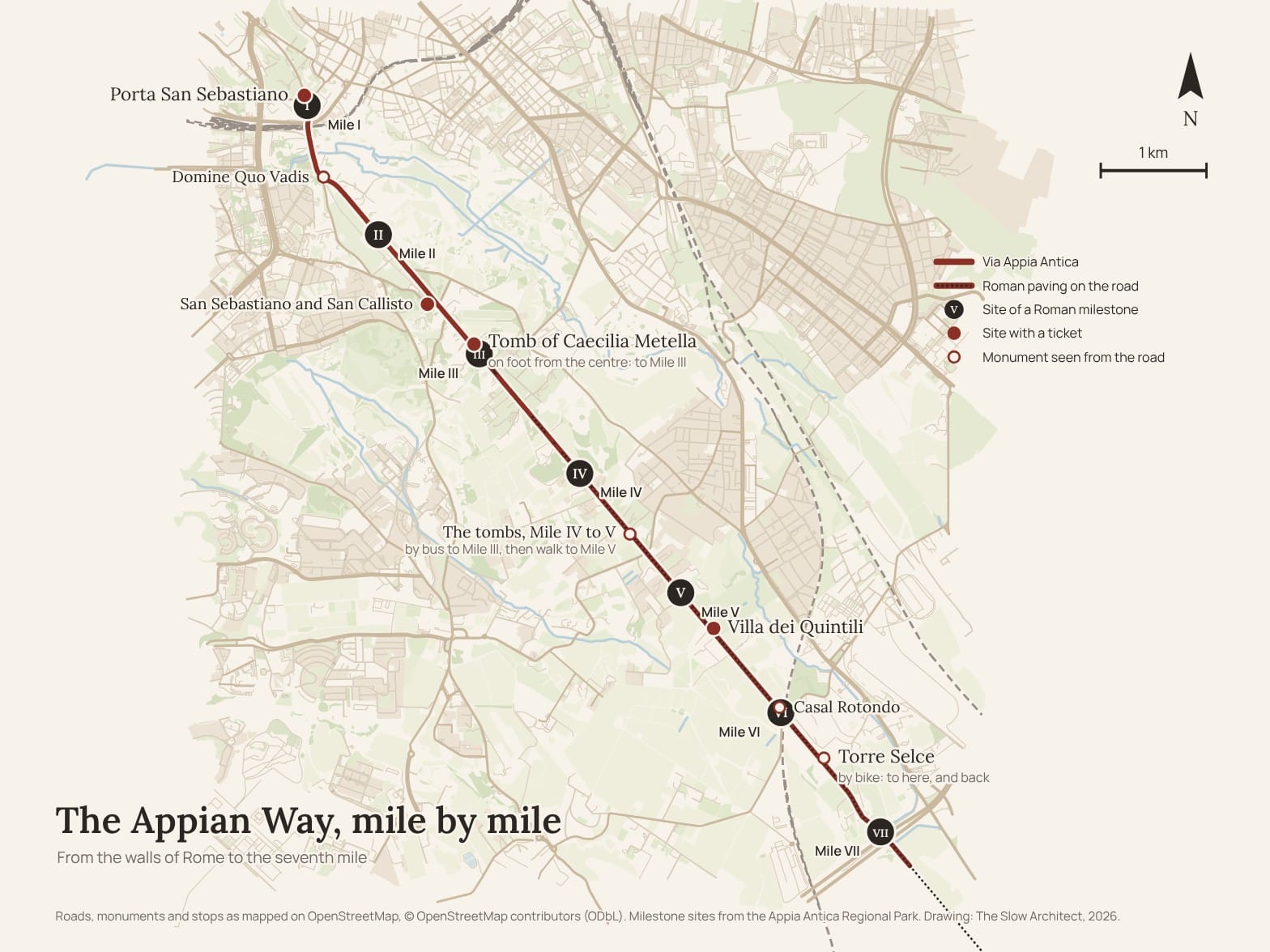
A Roman road from the city walls to open country, mile by mile: what you pass and on which side, how far from the gate, where to hire a bike, and where to turn back.
Is the Appian Way worth it? The short answers
Is it worth it? Yes. On the Appian Way you walk on a Roman road from the walls of the city out into the countryside, and public transport gets you there.
On foot? Half a day, from Porta San Sebastiano to the Tomb of Caecilia Metella at the third mile, about three kilometres.
By bike? A whole day, out to the Villa dei Quintili, Casal Rotondo and the Torre Selce, between the sixth and the seventh mile, where the road grows quieter.
When? On a Saturday or a Sunday, when the first stretch is closed to cars. Avoid Mondays, the days after rain, and summer.
What does it cost? The road costs nothing. The two sites worth a ticket are the Tomb of Caecilia Metella and the Villa dei Quintili: 12 euros for both with the Park Ticket.
There are two ways to do it, and two kinds of people. Some want a walk through green country that starts from the centre of Rome; others want to hire a bike and ride a long way. This guide follows both, plus a third for those short of time: take public transport to Caecilia Metella, walk for an hour on the old stones, and come back. But the heart of the guide is the road itself, mile by mile: what you pass, on which side, and how far from the gate. The park is big, and without a few fixed points you get lost.
My own memories here are distant. I came to Caecilia Metella and the villas in 2010, on the day the photographs in the two essays were taken, and what I remember best is the road itself: the layers of the Appian Way and the lava flow it runs on. Most of what is inside the sites I have forgotten, and I have never hired a bike on the Appian Way. So the practical information comes from the official websites, checked in October 2026, and I say so every time a piece of advice is not mine.
When to go
On a Saturday or a Sunday. Since 19 September 2026 the stretch from Via delle Mura Latine, just outside Porta San Sebastiano, to Via Appia Pignatelli has been closed to unauthorised cars from 7am to 7pm, all year except August. For now it is a trial, with local police at the entry points. Before, the ban held only on Sundays, and many Romans use the road that way: on foot, on bikes, for the morning run. People who live near the park go in the evening too, to run. Don't expect an empty road.
The right season is spring or autumn. Winter works too, because Rome is mild apart from a few really cold weeks; just make sure it hasn't rained recently, because wet stones are slippery and the joints between them fill with water. I would avoid summer: beyond Caecilia Metella there is little shade, and the park is no place to escape the heat.
Monday is the wrong day: Caecilia Metella, the Villa dei Quintili, the Villa of Maxentius, the Museum of the Walls and the Catacombs of San Sebastiano are all closed. On Wednesdays the Catacombs of San Callisto close, and with them the private road I describe further on, the one that avoids the traffic. On the first Sunday of the month the state sites are free, and you can tell. From November to February the Park's sites close at 4.30pm, so in winter, start early.
How to read the road: the miles
The Romans measured the Appian Way in miles, and set up a column at every mile along the road. A Roman mile is just under a kilometre and a half, 1,478 metres according to the Park: about twenty minutes on foot, five or six by bike. The miles were counted from Porta Capena, near the Circus Maximus, so the first mile falls just beyond Porta San Sebastiano, and Caecilia Metella is at the third. The original milestones are no longer on the road, and two of them stand on the balustrade of the Capitol, but the places are known, and this guide uses them as boundary stones: each stretch from one mile to the next has its own map.
Left and right, here, are always for someone walking south, away from Rome. Distances are measured from Porta San Sebastiano.
The three ways to do the day, in miles. On foot from the centre you walk to the third mile, Caecilia Metella, and come back by bus. By public transport you start at the third mile, walk an hour south to the fifth, and walk back. By bike you ride to somewhere between the sixth and the seventh, the Torre Selce, and ride back.
Getting there, and Appian Way bike rental
On foot from the centre, you start at the Colosseum or the Circus Maximus and walk south, along Viale delle Terme di Caracalla and Via di Porta San Sebastiano, to the gate. It is a couple of kilometres on ordinary streets, with cars, and they are not the reason for the trip: if you'd rather skip them, take the 118 bus from Circo Massimo metro station. To start straight from Caecilia Metella, take metro line A to Arco di Travertino and then the 660 bus, or the 118 from the centre.
The bike. The easiest place to hire one is the Regional Park's Centro Servizi, at Via Appia Antica 58/60, on the right just before the fork at Domine Quo Vadis, run since 2014 by EcoBike. It opens every day in the morning and closes between 5pm and 7pm depending on the season; on weekdays it closes for lunch, and you must collect the bike at least an hour, or an hour and a half, before closing (the website says both). Prices: a city bike costs 4 euros an hour, 16 at most for the day; a mountain bike 5 and 20; an electric bike 8 and 32; an electric mountain bike 10 and 40. Helmet, lock and map are included. From March to October it is worth booking online at least the day before, paying a minimum of a few hours; without a booking you hire on the spot, if there are bikes, and pay on your return for the time used.
Which bike. On the paving a city bike is a bad idea, because thin tyres get caught in the joints, and the hire centre itself recommends a mountain bike or an electric one, precisely because of the surface. I would recommend the electric mountain bike, which suits everybody, even those who aren't fit.
A rule few people expect: on the stretches of Roman paving, you push the bike. The hire rules ask for it, and so does common sense, because those stones are what is being protected. The stretches are short, but they are there, and the bike ride becomes a bike ride with a few walks in it. From the hire centre to the Torre Selce and back is about fifteen kilometres.
Appian Way bike tours: on your own or with a guide? On your own, if you are walking: there is one road, and this guide tells you what to look at, mile by mile. A tour is worth it if you want an e-bike and someone to take you out to the aqueducts without thinking about the route. The Park's Centro Servizi runs shared e-bike tours from €40, three and a half hours, as well as tours on foot and by electric golf cart, booked by email. The Archaeological Park runs guided visits with its own staff every month, at the Tomb of Caecilia Metella among others. At weekends, book ahead.
Mile by mile
From the gate to the second mile: the stretch to get through quickly (0–1.6 km)
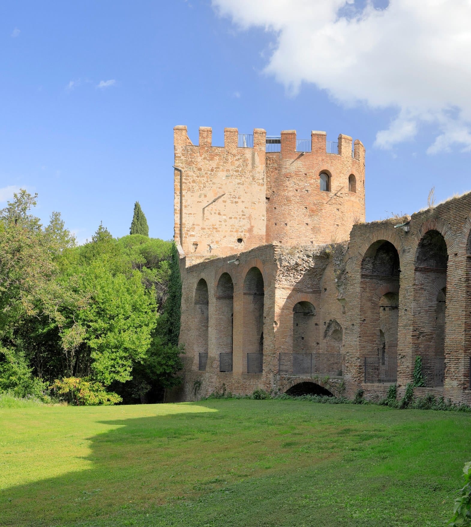
At Porta San Sebastiano it is worth going into the Museum of the Walls. It is free, opens Tuesday to Sunday from 10am to 4pm, and you walk along the walkway on top of the walls with the road starting below your feet. No more than twenty people are allowed inside at once, and the free ticket is collected on the spot; check the notices on the museum's website the day before.
Out through the gate, about a hundred metres on, a copy of the first milestone is set into a modern wall. The original stands on the balustrade of the Capitol. It is the first boundary stone of the day, and the easiest to miss: look at the wall.
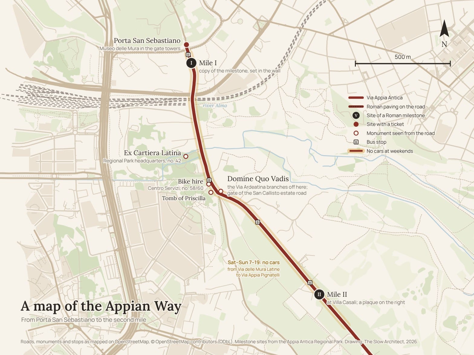
Then come the worst kilometres. As far as the fork at Domine Quo Vadis you can't see the ancient roadway: it is a narrow street between the walls of private villas, with no pavements, and on weekdays cars and buses use it. On Saturdays and Sundays it is another matter. After half a kilometre, on the right, is the Ex Cartiera Latina, a former paper mill at number 42, now the Regional Park's headquarters, and the road crosses the Almo, the little river now called the Marrana della Caffarella.
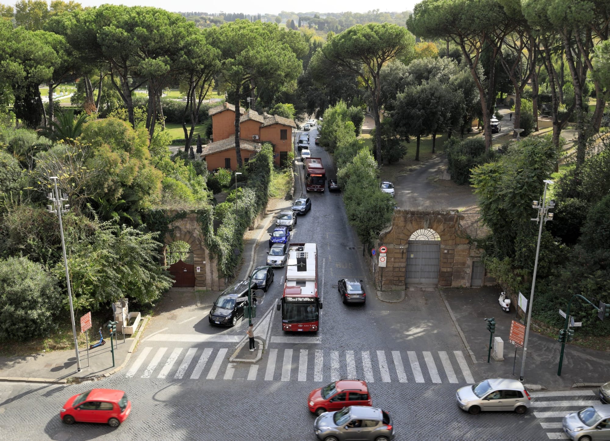
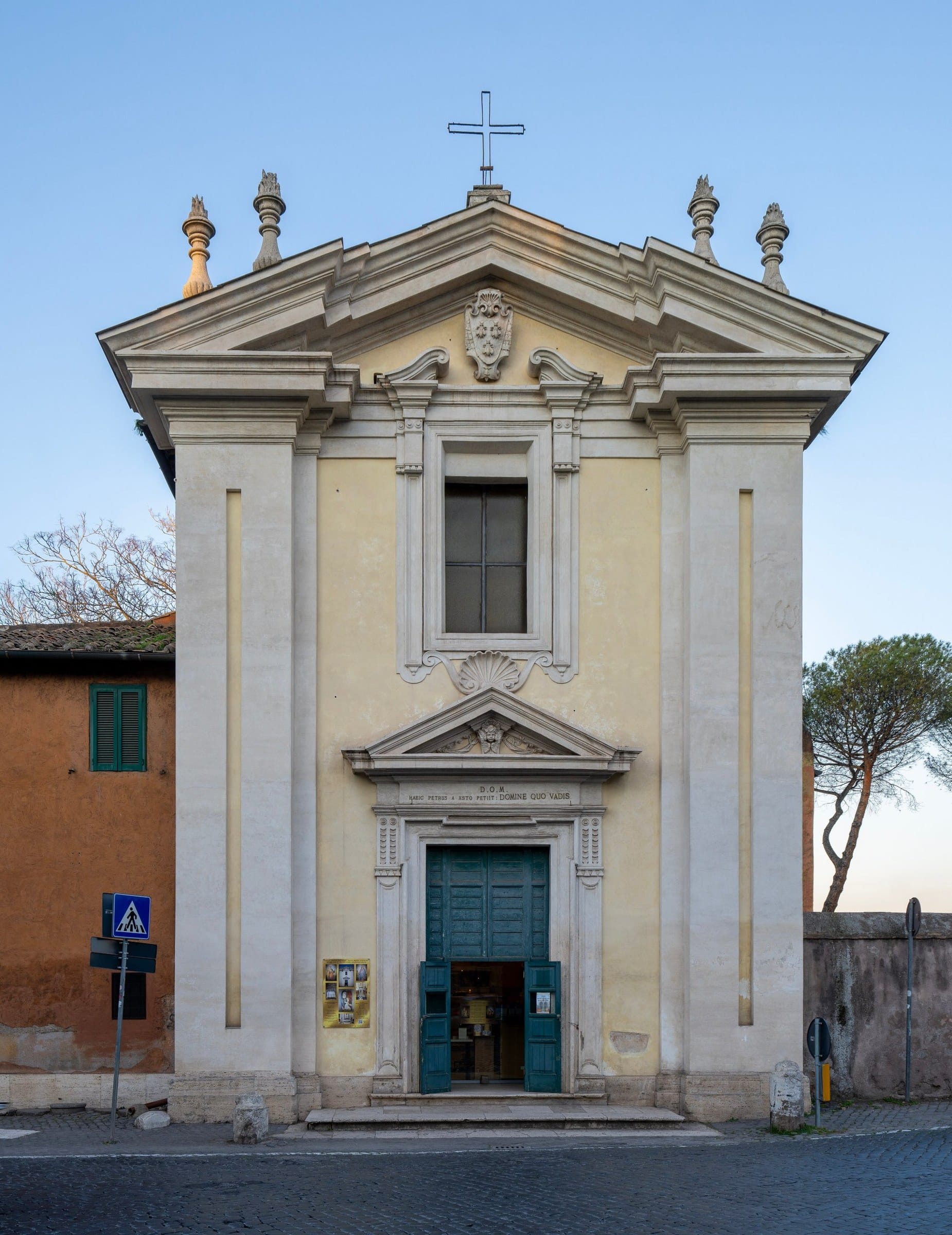
Eight hundred metres from the gate you reach the fork. On the left is Santa Maria in Palmis, the church known as Domine Quo Vadis, where the Via Ardeatina branches off the Appian Way; on the right, opposite, the Tomb of Priscilla with its medieval tower. Here there is a short cut that the Park's Centro Servizi points out in its FAQ. In the middle of the fork a private road climbs behind a gate: it belongs to the estate of the Catacombs of San Callisto, and it is open to walkers and cyclists every day from 9am to 6.45pm, except Wednesdays and some holidays. You go through olive trees and cypresses, with no cars, and after about a kilometre and a half you come back out on the Appian Way, just before the stretch where only residents may drive. The gates close automatically, so don't leave it to the last minute.
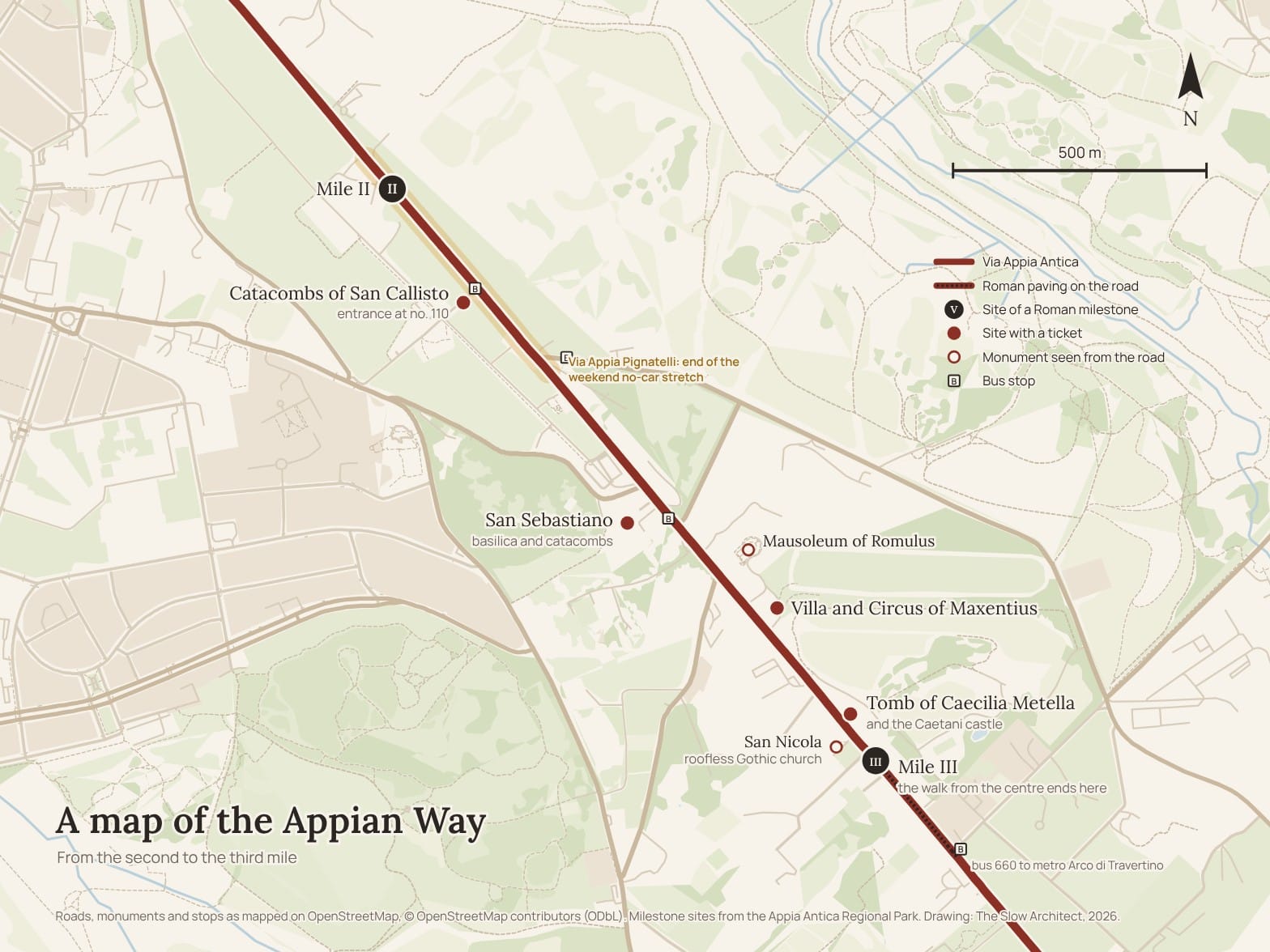
From the second to the third mile: catacombs, Maxentius and Caecilia Metella (1.6–3.1 km)
The second mile falls about 1.6 kilometres from the gate, by Villa Casali; the milestone is gone, and a plaque on the right recalls it.
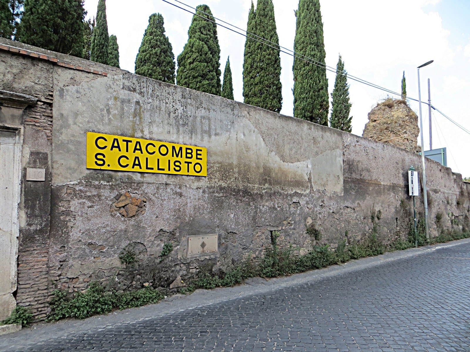
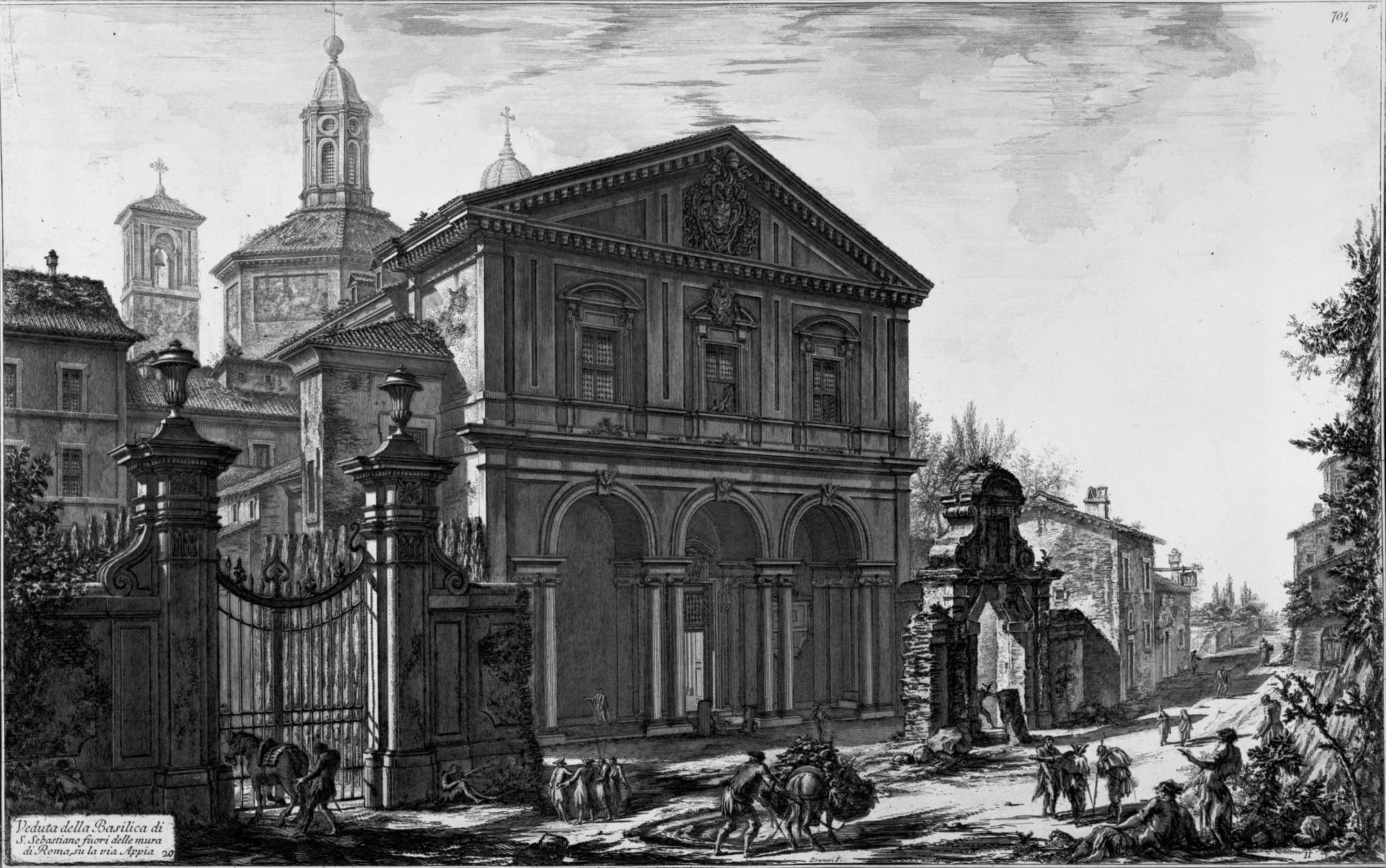
On the right, about 1.8 kilometres from the gate, at number 110, is the Appian Way entrance to the Catacombs of San Callisto. Five hundred metres further, also on the right, is the basilica of San Sebastiano, with its catacombs underneath. I deal with the catacombs further on: all you need to know here is that a visit costs you an hour.
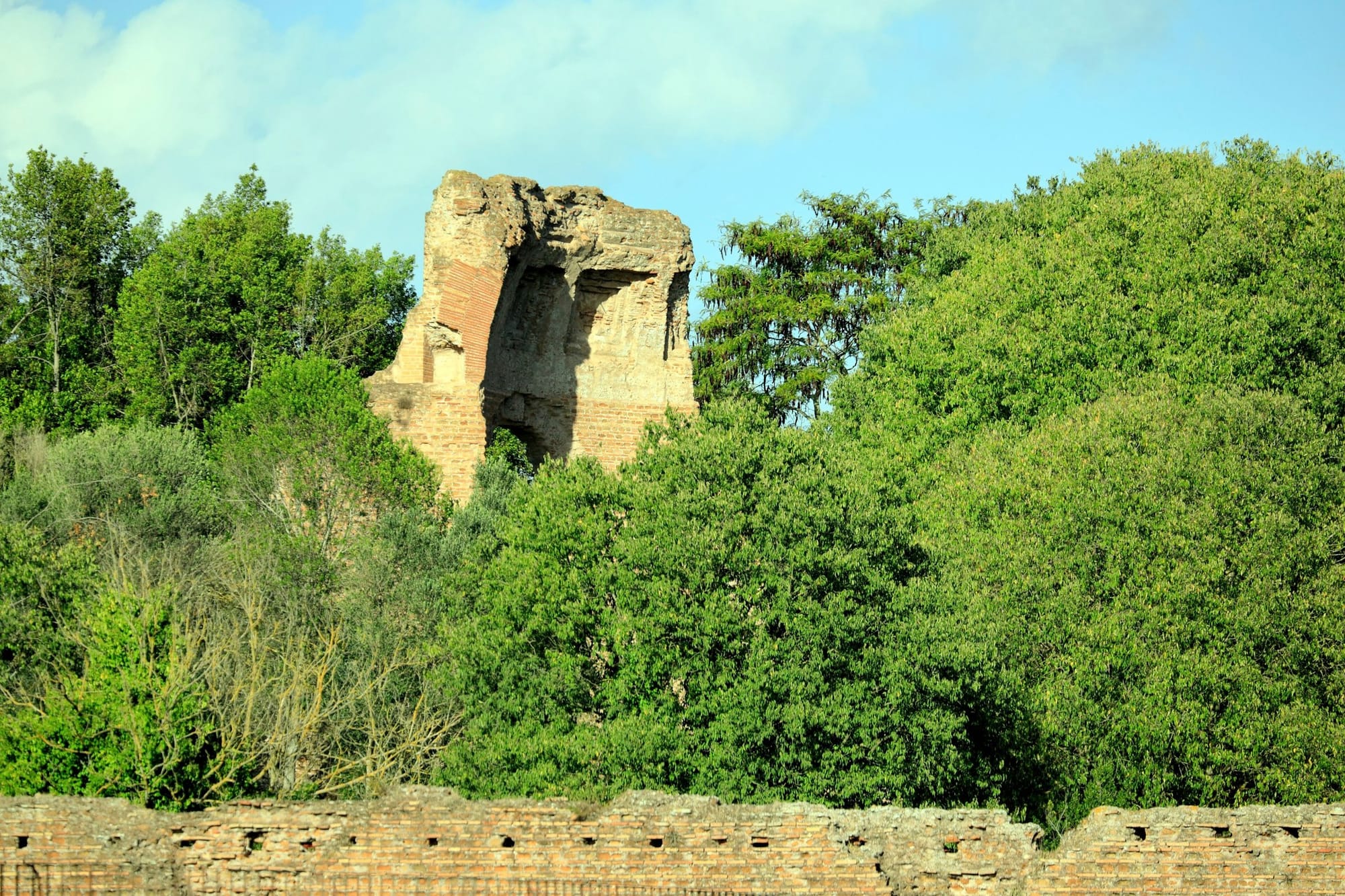
Straight after, on the left, is the complex of Maxentius: the mausoleum believed to be that of his son Romulus, the circus, and the remains of the palace. The villa costs 7.50 euros and from October to May opens Tuesday to Sunday, from 10am to 4pm. It is worth half an hour if the circus interests you; if the day is short, look at it from the road and keep going.
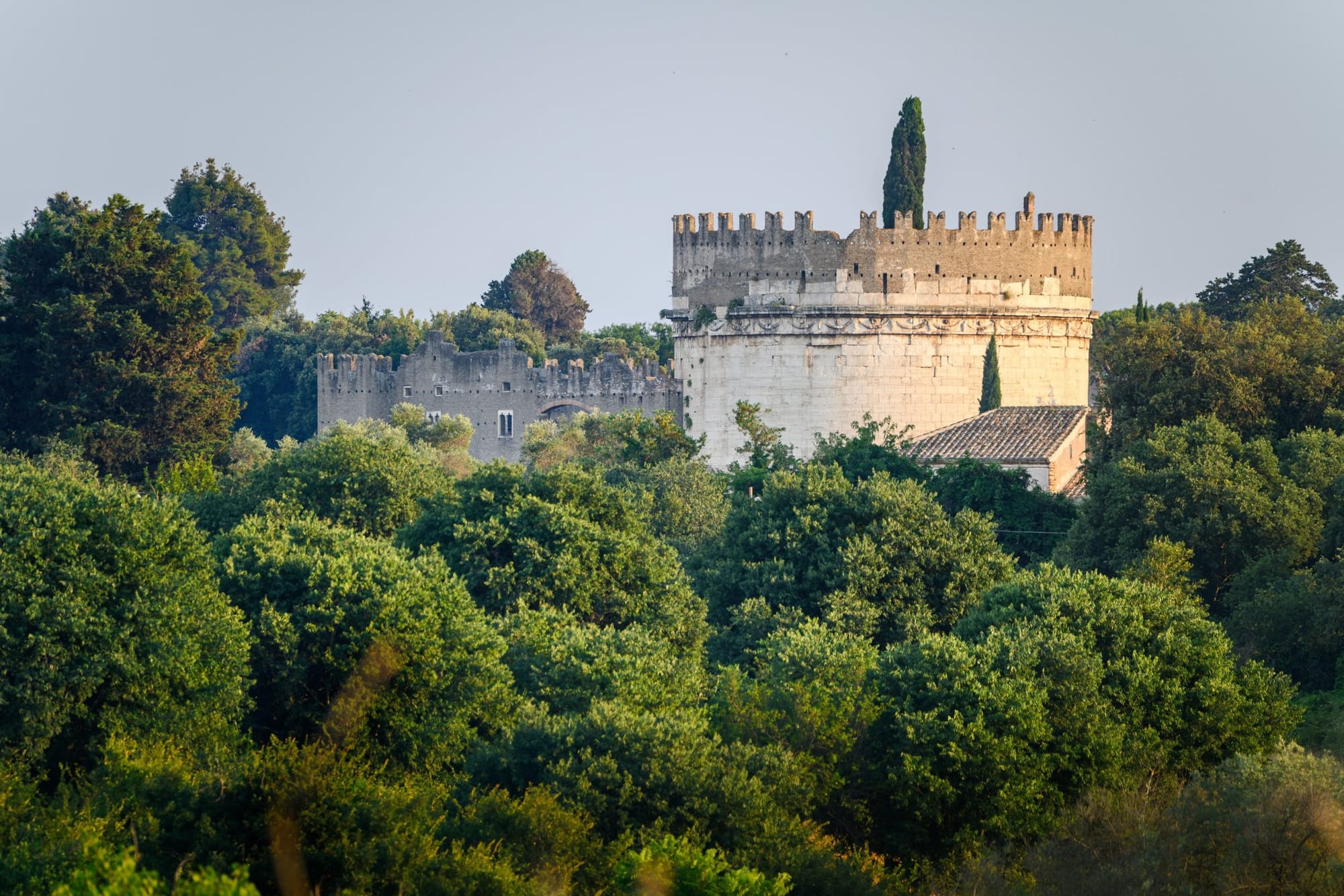
A little further, uphill, on the left, is the Tomb of Caecilia Metella, about three kilometres from the gate. It is the place I remember best, and the essay on the Appian Way as a volcano explains why: the tomb stands on the front of a lava flow from the Alban Hills, and the road runs on top of that flow. Inside you see the burial chamber and, in the Caetani castle attached to the tomb, the collection of pieces found along the road. The ticket costs 8 euros; it used to include Capo di Bove, a little further on, but that has been closed for works since 22 June 2026, with no reopening date yet. Opposite, on the right, is San Nicola, a Gothic church of the early fourteenth century, left without a roof; eighty metres further on stood the third milestone.
If you walked from the centre, this is where you stop. Go back on the 660 to Arco di Travertino metro station, or on the 118 from Via Appia Pignatelli. If your legs still have it in them, walk on for an hour on the paving and then turn round: that is the next stretch.
From the third to the fourth mile: where the paving begins (3.1–4.5 km)
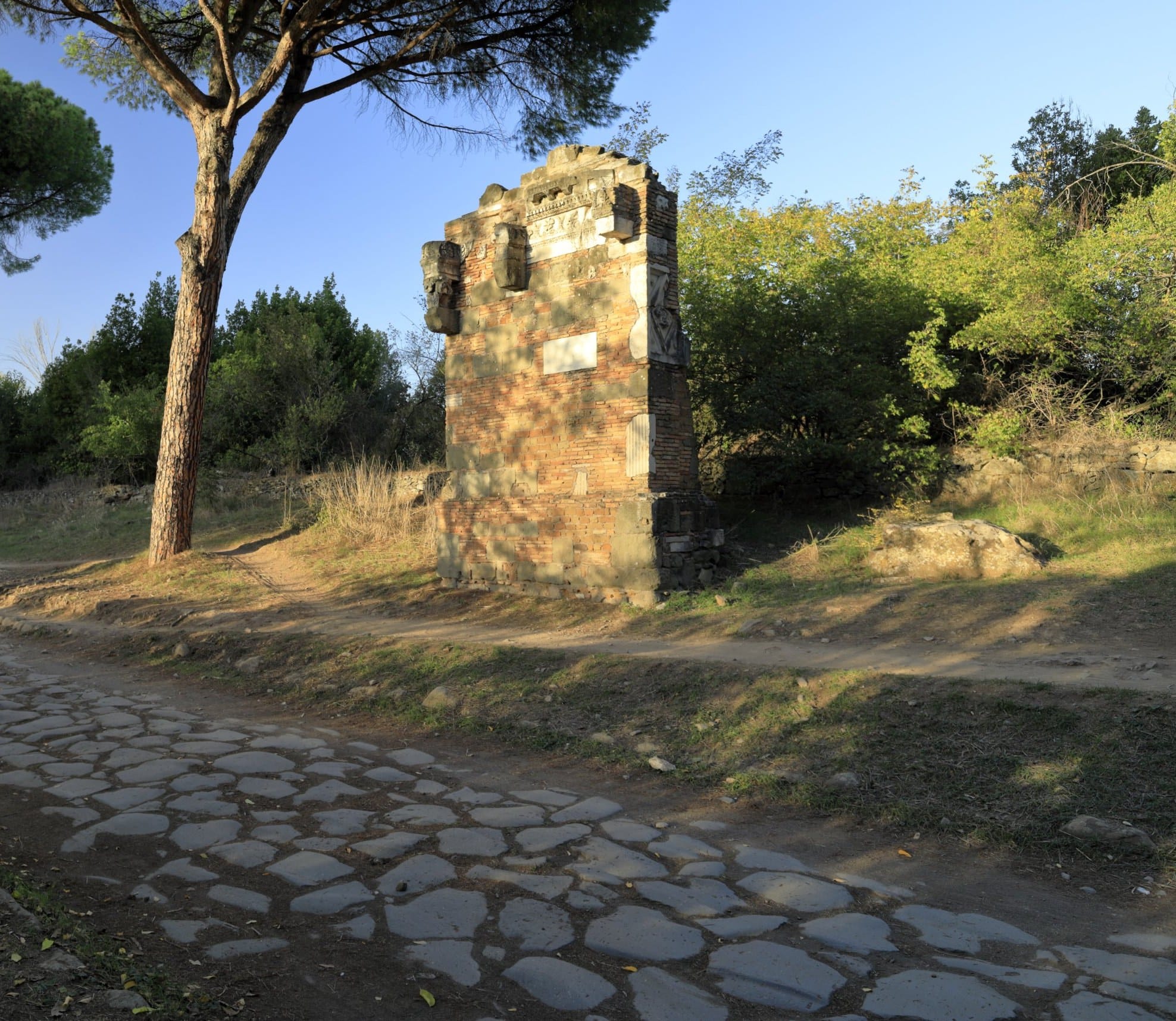
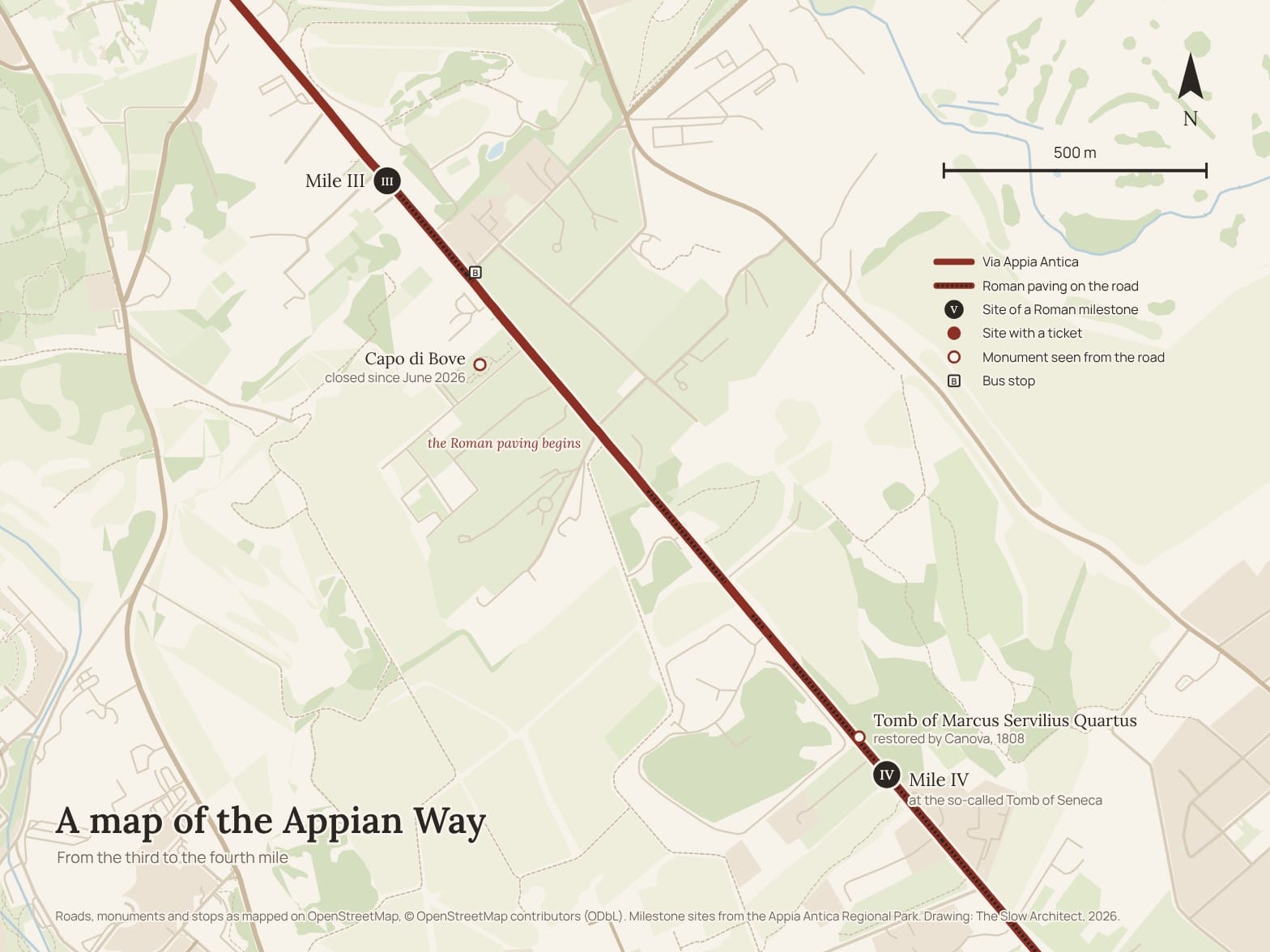
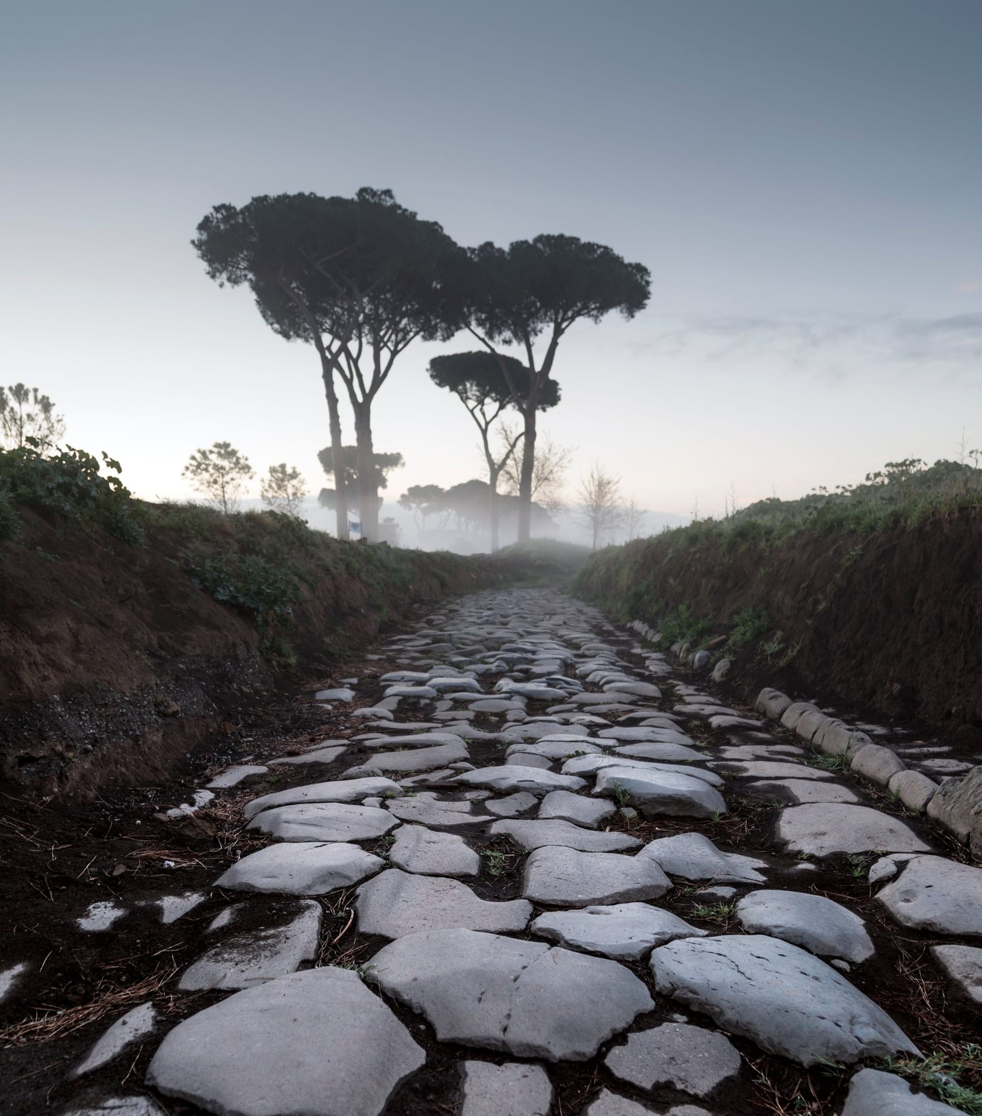
Soon after Caecilia Metella, from number 195, the road becomes public property, and after Capo di Bove the Appian Way changes: the private villas fall behind and the road becomes the one in the old prints, straight, between pines and cypresses, with tombs on both sides. The Roman paving surfaces here and there, and in many places it has been relaid with smaller, modern stones; where the real thing survives, you walk on the same stones worn down by the carts.
Set into walls along the road are fragments of tombs, inscriptions and reliefs found on the spot: the essay on who made the Appian Way we see tells you who put them there, and why. The first monument treated this way is the Tomb of Marcus Servilius Quartus, on the left, four and a half kilometres from the gate. A few steps further, also on the left, is the brick pillar known as the Tomb of Seneca: there, or just before it, stood the fourth milestone.
From the fourth to the fifth mile: the stretch of tombs (4.5–6.0 km)
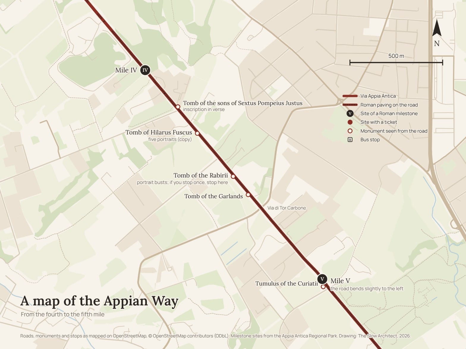
This is the densest stretch: for a kilometre and a half the tombs follow one another, mostly on the right, and the Park numbers about twenty of them. There is no need to stop at every one. I point out three, the ones where there is really something to look at, and all three are on the right.
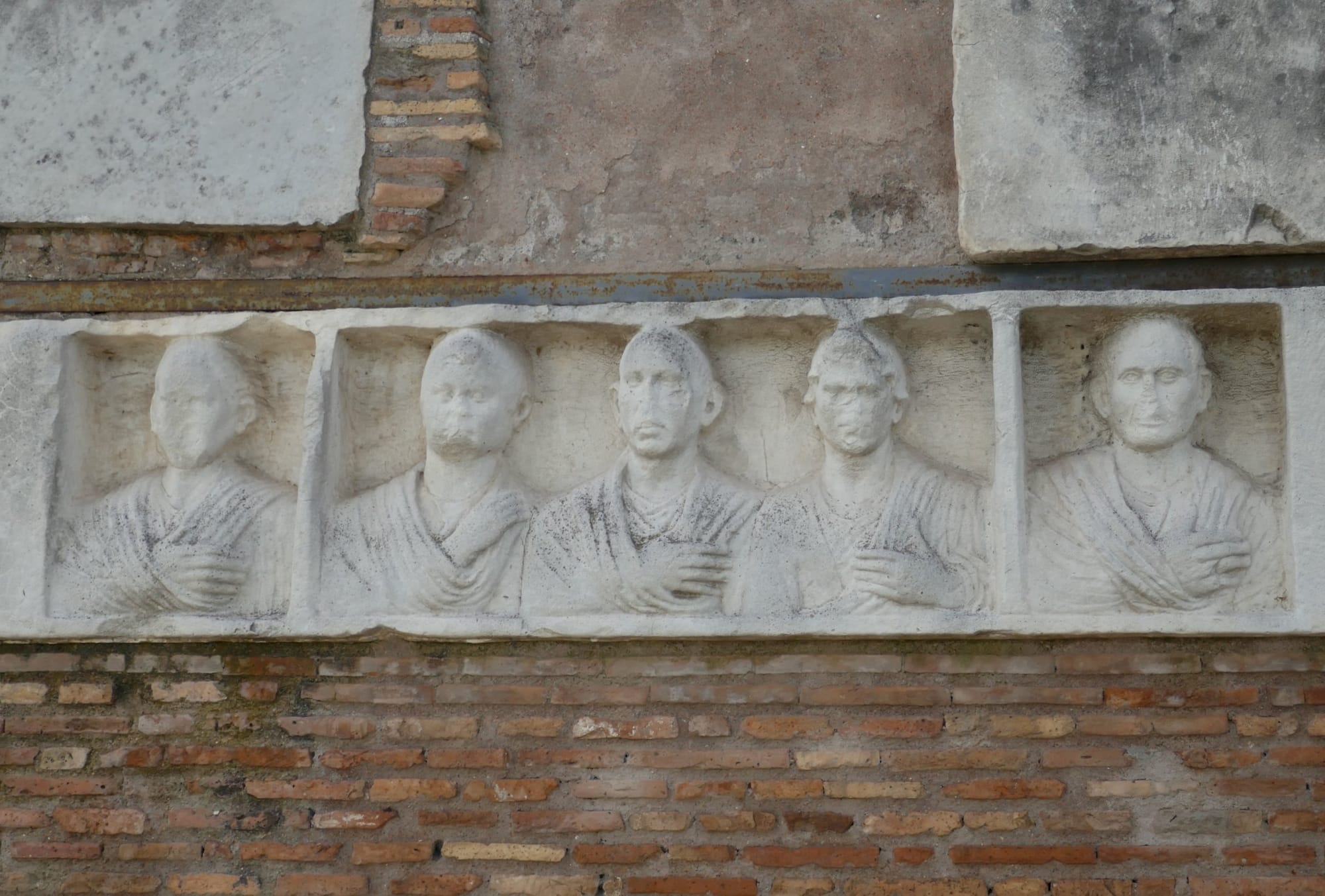
The first is the Tomb of Hilarus Fuscus, five kilometres from the gate: a relief with five portrait busts, a copy, because the original is in the National Roman Museum. Three hundred metres further on is the Tomb of the Rabirii, reconstructed, with the busts of the dead, among them a priestess of Isis: this too is a cast, and the original is at Palazzo Massimo. A little further on, the Tomb of the Garlands, with the frieze that gives it its name. If you look at only one, look at the Rabirii.
On the left, before these, is the tomb of the sons of Sextus Pompeius Justus, a freedman, with a long inscription in verse.
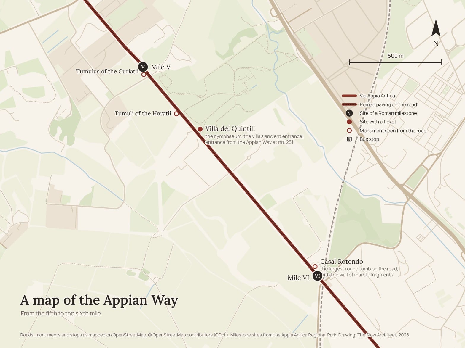
At the end of the stretch the road crosses Via di Tor Carbone. The fifth mile falls at the Tumulus of the Curiatii, on the right, six kilometres from the gate: it is where the road bends slightly to the left. If you started on foot from Caecilia Metella, this is where you turn round and walk back.
From the fifth to the sixth mile: the Quintili and Casal Rotondo (6.0–7.5 km)
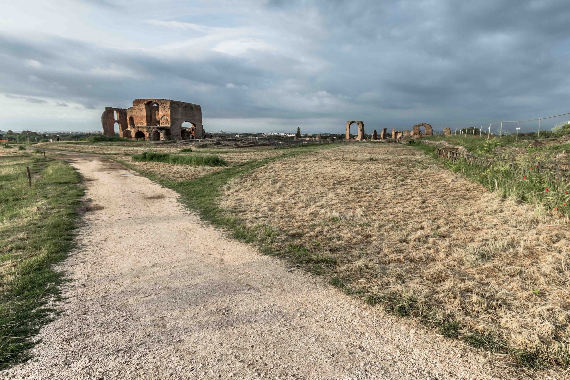
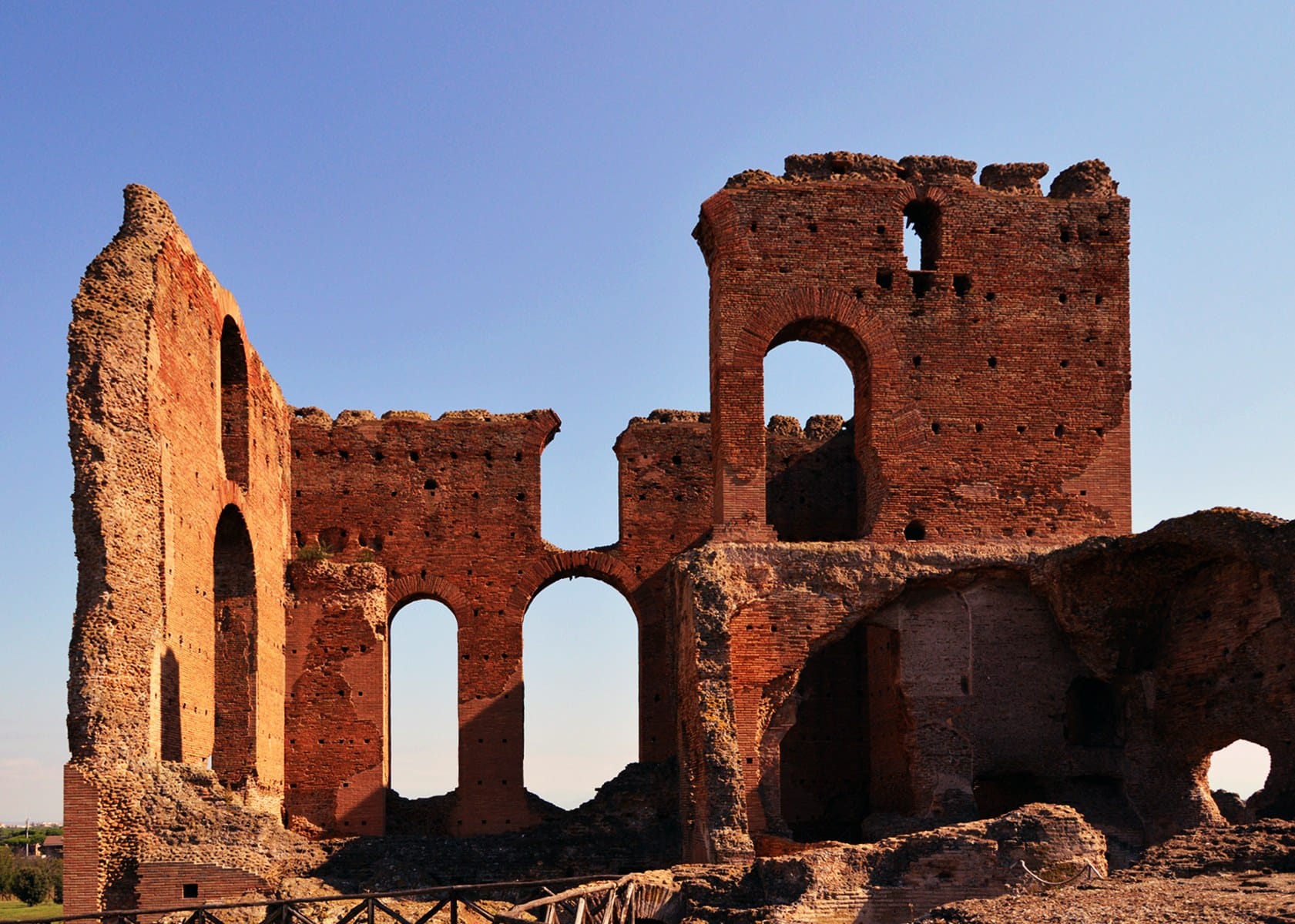
Three hundred metres after the Curiatii, on the right, are the tumuli of the Horatii: the names come from the legend of three brothers against three brothers, and the tombs are much later than the legend. Soon after, on the left, the Villa dei Quintili begins. The nymphaeum you see from the road, six and a half kilometres from the gate, was the villa's ancient entrance; today you can also go in from the Appian Way, at number 251, without going round by the Via Appia Nuova. The ticket costs 8 euros; if you are also seeing Caecilia Metella, buy the Park Ticket, 12 euros for both, valid for seven days. The ticket machines at the entrance take cards only, no cash. Inside there are vending machines and a refreshment area under the olive trees.
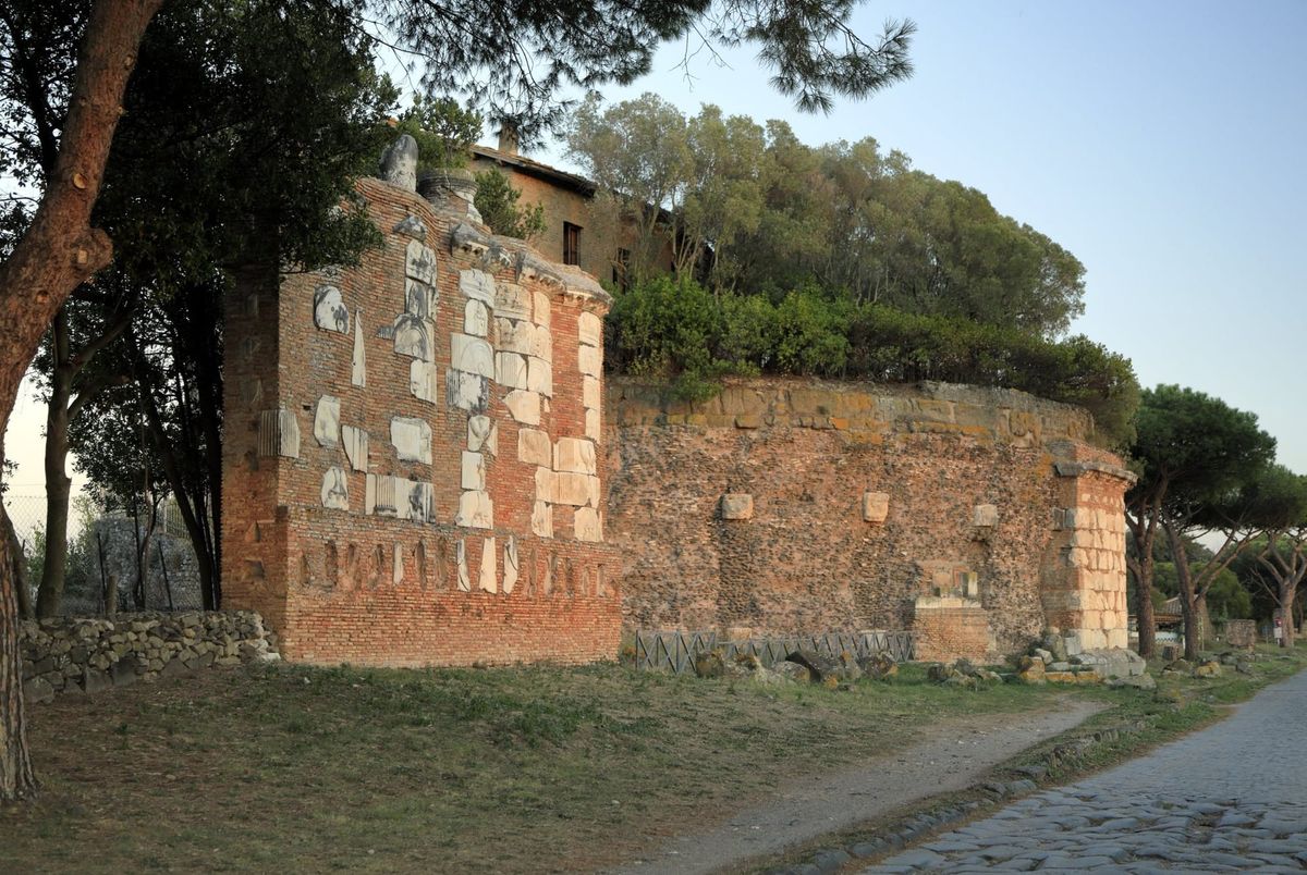
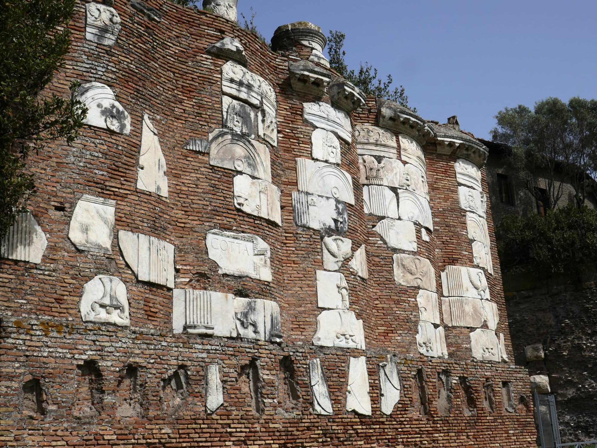
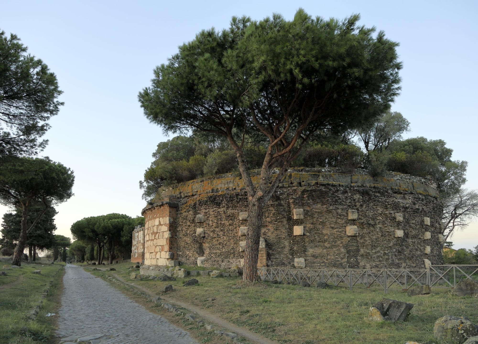
A kilometre further, about seven and a half kilometres from the gate, on the left, is Casal Rotondo, the largest round tomb on the Appian Way, with a farmhouse on top built on the base of a thirteenth-century tower. Next to it is the brick wall where, in the nineteenth century, Luigi Canina set the fragments found on the spot, which he believed came from the mausoleum. Just beyond stood the sixth milestone.
From the sixth to the seventh mile: the Torre Selce, and back (7.5–9.0 km)
The further you get from Rome, the quieter it is.
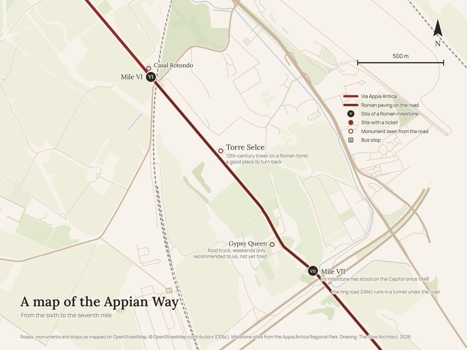
Six hundred metres after Casal Rotondo, a little over eight kilometres from the gate, on the left, is the Torre Selce: a twelfth-century tower built on the core of a round tomb of the early Empire, which must have looked like Caecilia Metella's. It was meant to be seen from far away, because it was used for signalling, and so it is. It is a good place to turn round.
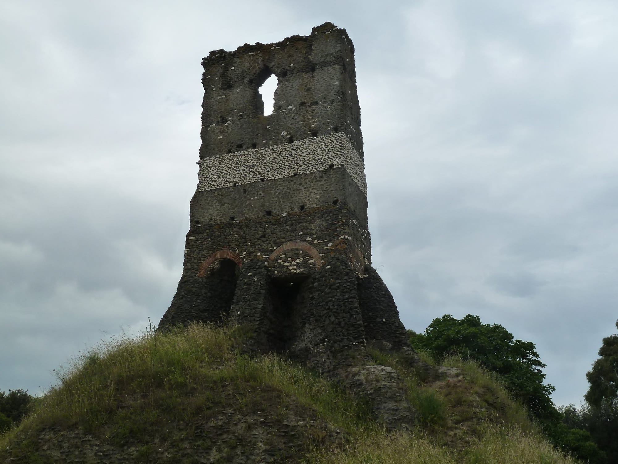
Or you carry on another six hundred metres, to the Gypsy Queen, on the right. I haven't been: it is a tip I was given, and I am passing it on. It is a food truck on the farm at number 300, next to the olive grove, and I am told it is nice, surrounded by greenery, handy for a short stop and something to drink before heading back. It opens on Saturdays and Sundays from 10am until sunset. I am also told to avoid lunchtime, when it is busiest.
A little further on stood the seventh milestone, which has been on the Capitol since 1848, and just after it, under your feet, the Grande Raccordo Anulare, Rome's ring road, runs through a tunnel: the ancient road passes over it. That is where this day ends.
If you are fit, or have an electric bike of your own, you can go further, as far as the Castelli Romani and the lakes. It becomes a long ride, with the last part uphill, and you come back by public transport. With a hired bike, though, you can't: the bike has to go back where it came from.
The catacombs on the Appian Way, if you want them
There are two on the Appian Way, and a third not far off. San Callisto and San Sebastiano are on the road, both on the right between the second and the third mile; Domitilla is in Via delle Sette Chiese, off the route. San Callisto and San Sebastiano cost 10 euros, 7 reduced, and can only be visited with a guide, for about forty minutes; at San Callisto groups set off every half hour.
San Callisto opens from 9am to 12 noon and from 2pm to 5pm, and is closed on Wednesdays and from 13 January to 10 February 2027. San Sebastiano opens from 9.15am to 5.15pm, is closed on Mondays and from 7 to 27 December 2026, and has the basilica above it. I think I saw one on another trip, but I can't remember which: that is why I won't tell you which to choose. The practical advice comes down to one thing. A catacomb costs you an hour, waiting and visiting, so decide beforehand whether it is a catacomb day or a road day; in winter you can't fit in both.
Eating and drinking
The road is not made for eating. Bring water and something in your backpack, and have a picnic on a low wall in the shade, which beyond Caecilia Metella is the rarest thing of the day. At the Villa dei Quintili there are vending machines and a refreshment area under the olive trees. There are bars and restaurants along the road, but this guide names only places I have tried, with one exception: the Gypsy Queen, beyond the Torre Selce, which I haven't tried but which was recommended to me, along with the advice to avoid lunchtime.
If you have a second day
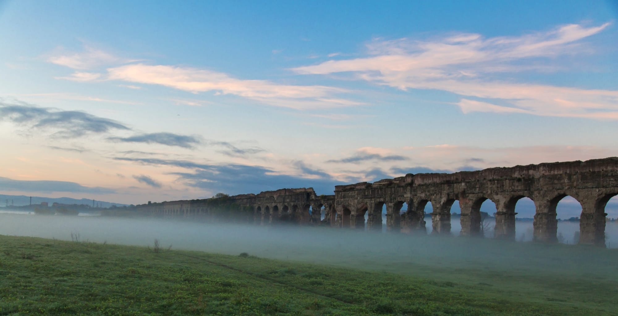
With an extra day, you have two choices. The first is the Parco degli Acquedotti, between the Via Appia Nuova and the Via Tuscolana, with the arches of the Claudian and Felice aqueducts in the middle of the meadows and a stretch of the paving of the Via Latina among the pines: you get there on metro line A, and from the Appian Way's Centro Servizi there is a bike ride of about twenty kilometres there and back. The second is the Appian Way beyond the ring road, as far as the eleventh mile, at Santa Maria delle Mole, where the old road rejoins the new one.
Mistakes to avoid
Going on a Monday. Going the day after a storm. Hiring a city bike. Arriving in winter in the early afternoon, when the Park's sites close at 4.30pm and the last entry to the Villa dei Quintili is 75 minutes before that. Looking for the private road through San Callisto on a Wednesday. Turning up at the ticket machines with cash. Stopping at every tomb between the fourth and the fifth mile. And thinking you can see the road, three sites and a catacomb in one day: you have to choose.