THE APPIAN WAY — THE ROAD ON TOP OF A VOLCANO
On the Appian Way you ride higher than the fields. It isn't an impression: you are on the back of a lava flow that stopped exactly where the tomb of Caecilia Metella stands.
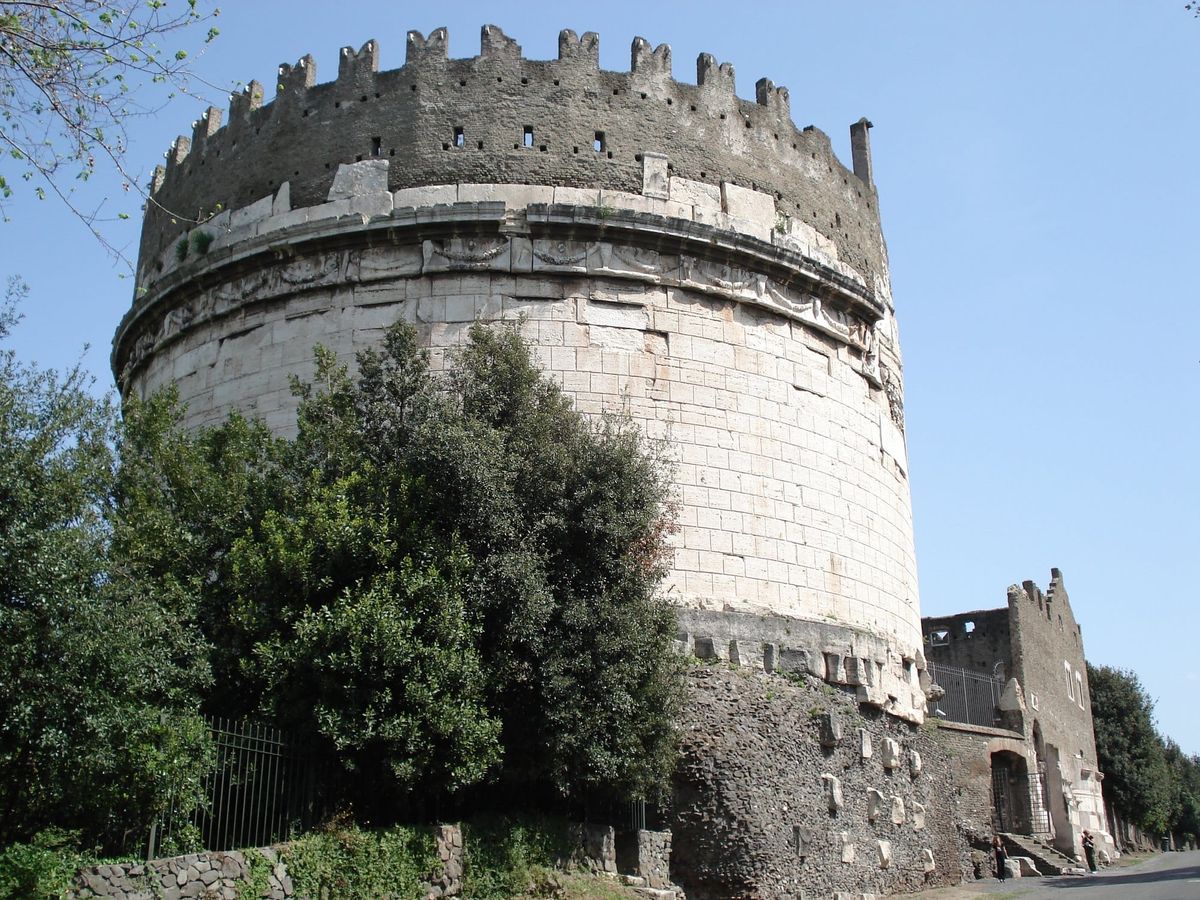
Under the Appian Way there is a lava flow that stopped exactly where the tomb of Caecilia Metella stands. The first part of a journey into the most famous road of the ancient world: what lies underneath it, and what it is made of.
This piece begins Strata, a series about a very Italian habit: not demolishing, but building on top, inside, beside. Each instalment reads a place like an excavation. The Appian Way gets two: this one, on the matter; the next, on the image.
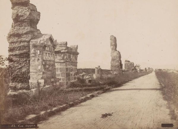
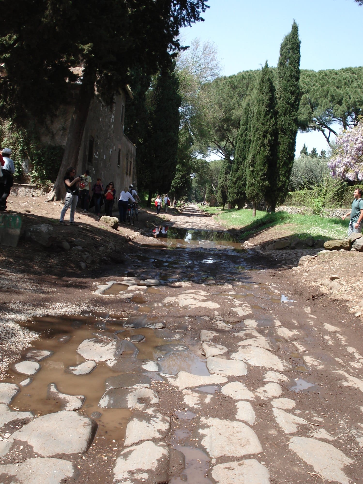
Anyone who has ridden the Appian Way on a bike knows a precise feeling: you travel higher than the countryside. Not by much, but enough to feel you are on an embankment, with the fields, the ruins and the villas a little below you, as if the road had been laid on top of the landscape rather than inside it. I felt it too, years ago, slaloming between the puddles on the Roman paving.
That feeling is real, and it is the oldest thing about the Appian Way. Older than the road, older than Rome. To understand it you have to go down below the paving stones, and then climb back up, one layer at a time, to the tomb that stands at the highest point of the road's first stretch.
The sleeping volcano
Under Rome, to the south-east, there is a volcano we don't see because we live on top of it.
Geologists call it the Alban Hills volcanic complex, the Colli Albani; it is often called the Vulcano Laziale, which is really the name of its oldest part. It began erupting about six hundred thousand years ago. Around three hundred and fifty-five thousand years ago a series of extremely violent explosions emptied its magma chamber, and the centre of the edifice collapsed into a caldera kilometres wide. Inside it two more volcanoes grew, the Tuscolano-Artemisio and the Faete, which at the Maschio delle Faete come close to a thousand metres. Over the last two hundred thousand years the activity changed again: no more lava flows and cones, but steam explosions, whenever the magma met groundwater. That is how the craters were born that now hold Lake Nemi and Lake Albano, which at about 170 metres is the deepest volcanic lake in Italy.
When the last eruption happened, nobody knows for certain. A 2016 study by INGV, Italy's national institute of geophysics and volcanology, places the end of the last eruptive cycle, at the Albano crater itself, around thirty-six thousand years ago; the Civil Protection department's fact sheet says about twenty thousand; some volcanic mud deposits suggest activity as recently as ten thousand years ago. For a volcano some twenty kilometres from Rome, tens of thousands of years of uncertainty are not a detail.
The same study says something else, and it matters more. The Alban Hills are not extinct: they are dormant. In six hundred thousand years they have had eleven eruptive cycles, separated on average by about forty thousand years. For twenty years satellites have been measuring a continuous uplift of the ground, two or three millimetres a year, in the area of the most recent craters, and the researchers attribute it to new magma collecting between five and ten kilometres down. No data point to an eruption in the short or medium term, and the risk today is not lava but gas: carbon dioxide and hydrogen sulphide rising through the fractures. Among the areas where it escapes, the Civil Protection lists Ciampino, Frattocchie, Marino, and a place called Cava dei Selci. The name already tells you what was quarried there: selce is what Romans call the lava stone.
The Romans knew this volcano well. According to Livy, around 398 BC, during the war with Veii, they dug a tunnel almost a kilometre and a half long beneath the rim of the Albano crater, more than a hundred metres below its edge, to drain the lake towards the plain and stop it overflowing. Tradition ties it to an oracle: Veii would fall only when the waters of the lake reached the sea. But the reason was hydraulic. Some scholars now think the tunnel we see is later, or that it replaced an older one; either way, it is a work built against the volcano.
And from the volcano the Romans took much of what they built with: the peperino of the Albano explosions, the tuffs, and the stone of the lava flows.
The tongue of fire
One of those flows came down towards Rome between two hundred and sixty and two hundred and eighty thousand years ago (the geologists' estimates vary): a leucitite lava, dark grey, extremely hard, about ten kilometres long. It followed a valley, cooled into a narrow, straight tongue of rock, higher than the ground around it, and stopped. It is called the Capo di Bove flow.
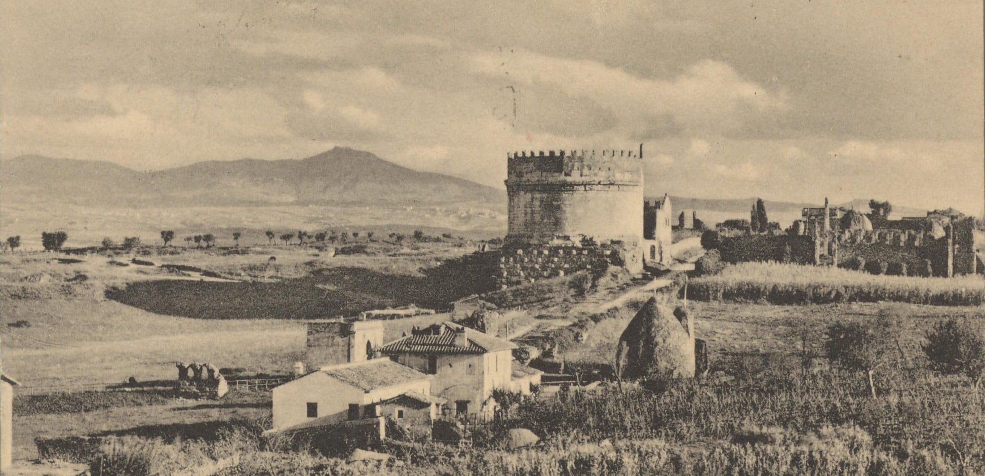
Where it stopped, we now know precisely. Between 1997 and 2000, excavations by the Soprintendenza, the state heritage authority, inside the palace of the medieval castle next to the tomb of Caecilia Metella uncovered the flow's terminal front: the face of the lava, the exact point where the tongue of fire stopped moving. Beyond that front the ground drops away towards the hollow of the Villa of Maxentius and San Sebastiano, with the catacombs dug beneath it. The tomb of Caecilia Metella was built right there, on the tip of the flow, at the highest point of the first stretch of the Appian Way.
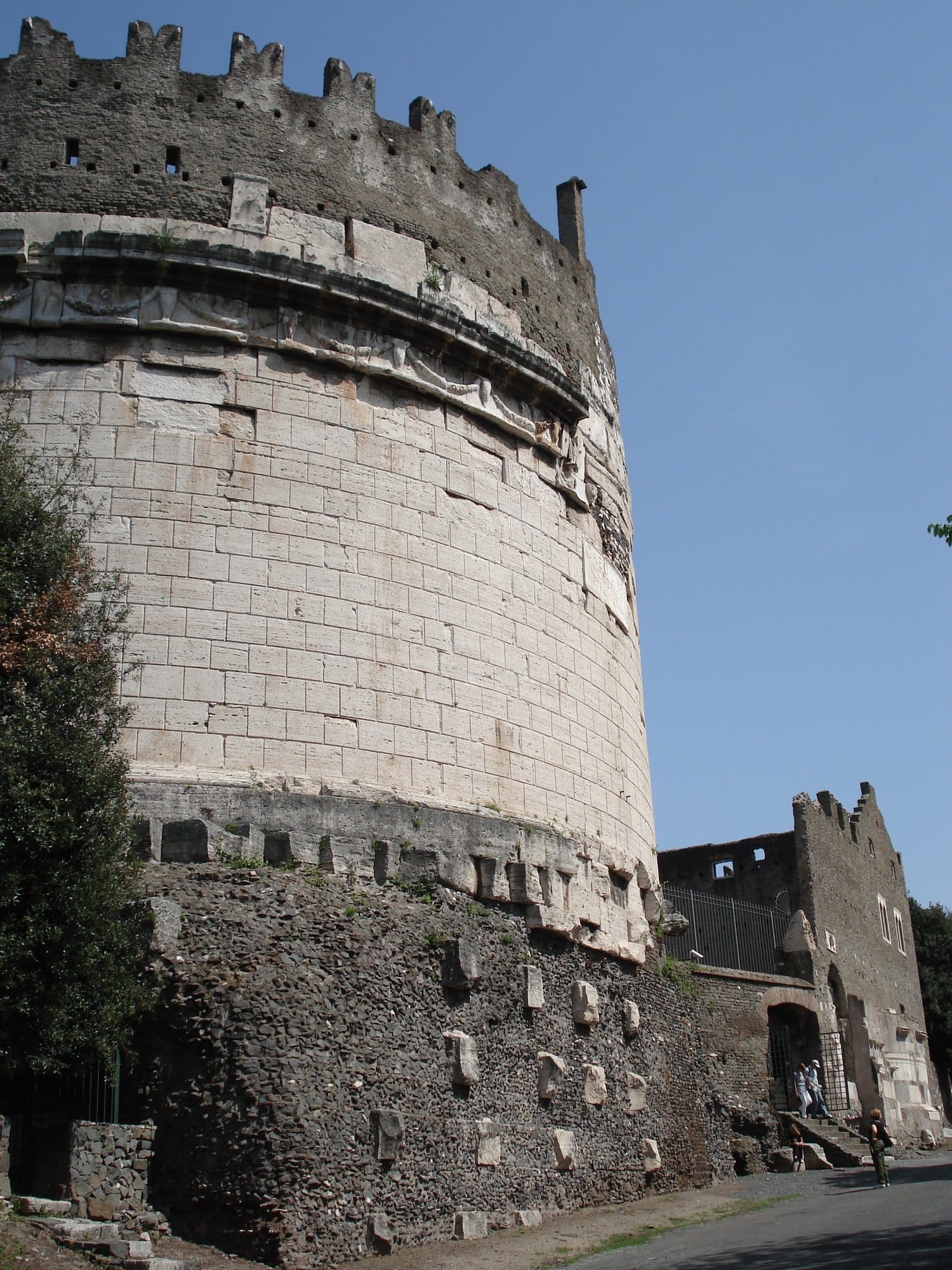
It is no accident that it can be seen from far away. And it is curious how often, over the centuries, that point has been used for measuring. In 1824 the astronomers Conti and Richbach climbed to the top of the tomb for a campaign of trigonometric survey, and the small pinnacle you see at the top, on the side facing the road, is modern and dates from that use. In the mid-nineteenth century the Jesuit astronomer Angelo Secchi, at Luigi Canina's request, chose the same point as one end of the geodetic baseline he measured for the study of the shape of the Earth. The point where a volcano had stopped more than two hundred thousand years before Rome existed became, for a few decades, a reference for measuring the planet.
A road older than its name
In 312 BC the censor Appius Claudius, one of the most inventive men of the Republic, began two works that carry his name: Rome's first aqueduct, the Aqua Appia, and a road to Capua to move the legions during the Samnite wars. It is the first time a Roman public work takes the name of the man who built it. In old age he went blind, and the Romans remembered him as Caecus.
But the road, in part, was already there. Livy himself, telling the story of a mutiny thirty years earlier, writes that the soldiers marched on Rome along the "road that is now called the Appia": an older route, which probably led to the Alban Hills. Before it was the road to Capua, the Appia was the road to the volcano.
And it wasn't paved. In the five years of his censorship Appius Claudius had time to lay out and build the road all the way to Capua with a rammed gravel bed. The paving stones came later, in stretches, and Livy records the first works less than twenty years on: first a path paved with squared blocks from the Porta Capena to the temple of Mars, then the road from the temple of Mars to Bovillae in silex, the lava stone. The picture we carry in our heads, the polygonal paving running straight between the tombs, is not Appius Claudius's. It belongs to his successors.
For the first stretch out of the city, though, nobody had to invent the route. The Capo di Bove flow offered a solid foundation, already raised, already straight. And it offered the material: quarries opened on the lava, and the paving stones were cut from the lava. The road is made of the same substance it rests on.
I like to think that the first designer of the Appian Way was the ground, and that the Romans' merit was to understand that it paid to go along with it. Anyone who works on building sites knows how rare that is: most of the problems I see arise on site come from designs that never read the ground, and then have to fight it.
How a Roman road is made
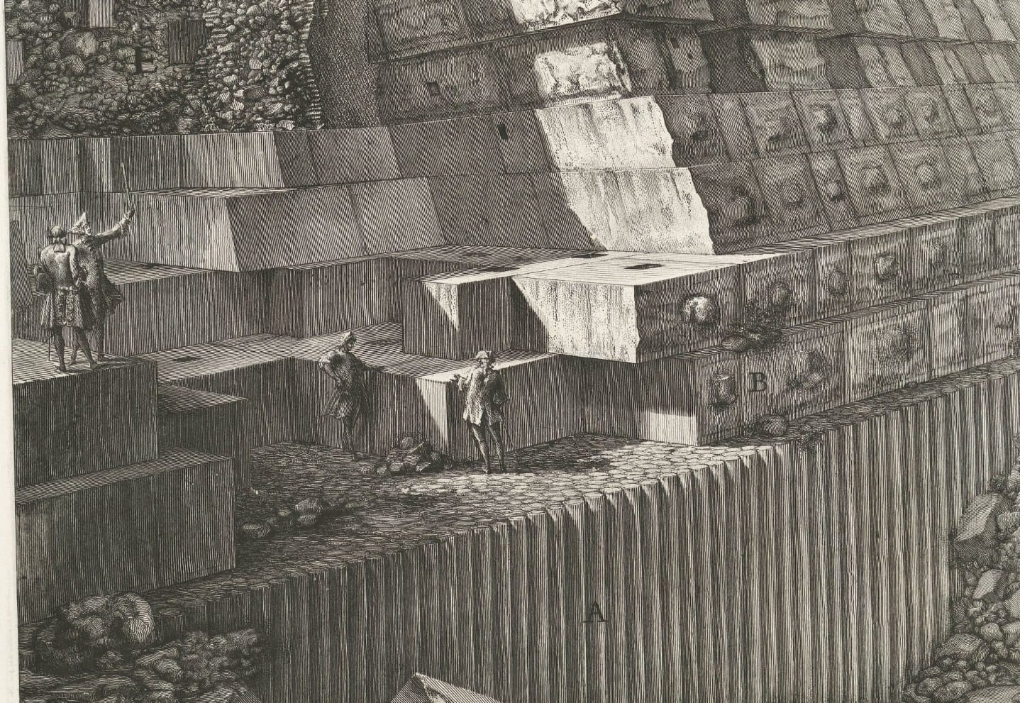
There is an etching by Giovanni Battista Piranesi, from 1756, that does exactly what on a building site we call a trial pit: it opens the road up and shows what lies underneath. It is the View of the ancient Appian Way in the third volume of his Antichità Romane, and its caption is a true stratigraphy.
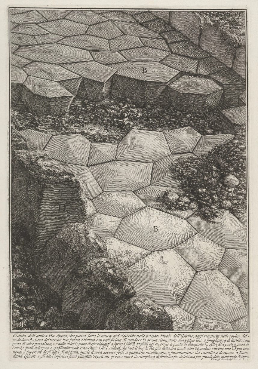
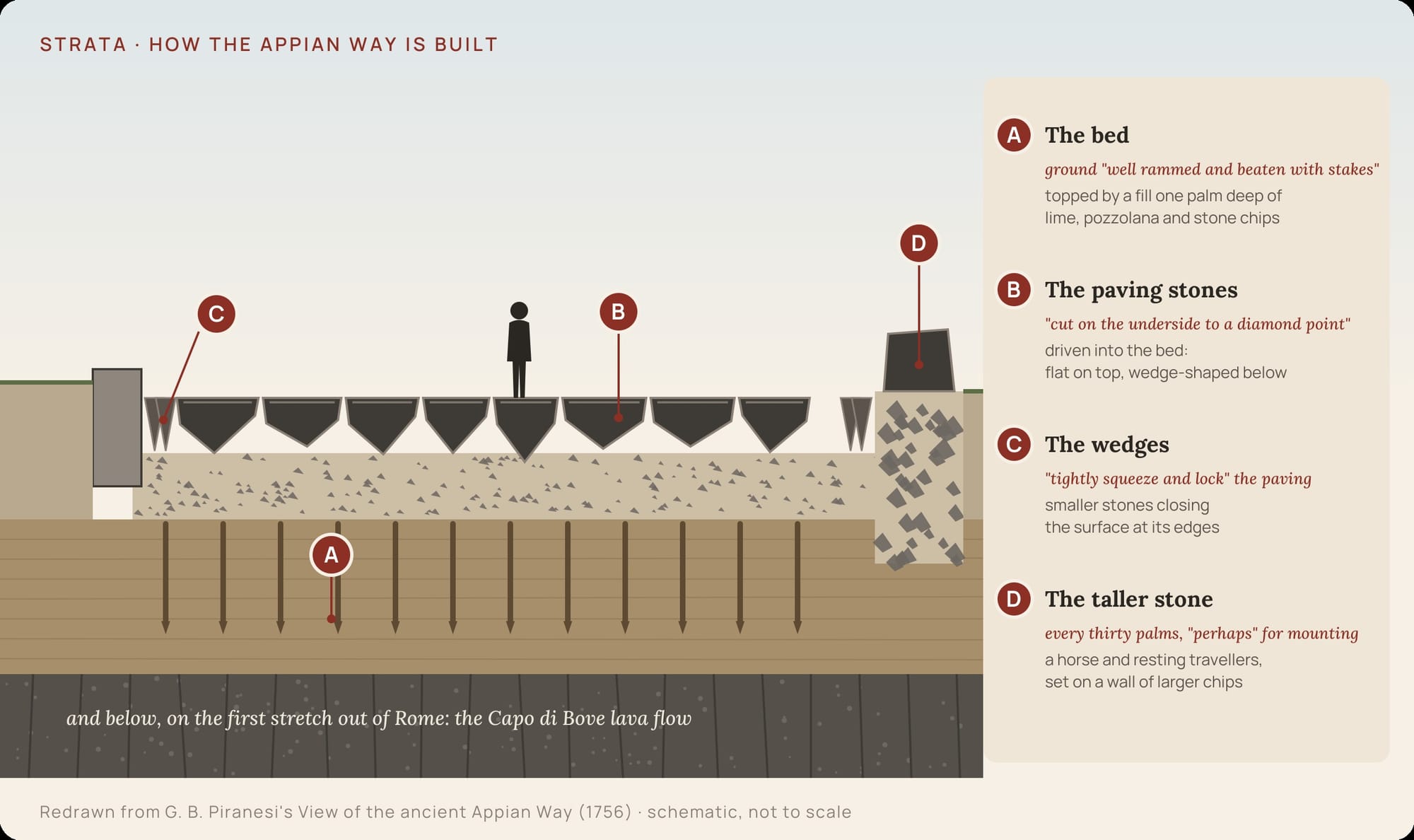
At the bottom, Piranesi writes, there is the bed of the ground, "well rammed and beaten with stakes". On top of it, "a thick fill one palm deep", a kind of screed "made of lime, pozzolana and stone chips". Into this bed the paving stones are "driven by force", "cut on the underside to a diamond point": the upper face flat, the lower one shaped like a wedge, like a tooth in its gum. Between the paving stones, other stones "set like wedges" squeeze them and lock them "mightily" together. And every thirty palms, at the edge, Piranesi sees a stone taller than the rest, which must have served, he writes, "perhaps" for those mounting and dismounting from their horses, and as a seat for travellers.
Not everything Piranesi draws is certain, and that "perhaps" is his own. But the principle is right, and it is the one that still holds up anyone cycling over it. A Roman road is not a floor laid on the ground. It is a system of layers, each with its own job: the compacted ground that carries the load, the bed of mortar and chips that spreads it, the paving stone wedged point-down so that it cannot move, the wedges that close the whole thing up.
More than eight centuries after Appius Claudius, in the sixth century, the historian Procopius of Caesarea, who followed Belisarius in the Gothic war, described the road with an admiration you can still feel. He wrote that the stones, polished and cut into polygons, had been fitted together without lime or anything else, yet so tightly that they did not look joined: they looked as though they had grown together. And that after so much time and so much traffic of carts and animals they had neither come apart nor worn away, nor even lost their polish. Procopius was convinced that Appius had brought that stone from far away. He was wrong. It was under his feet.
Today the original paving only comes to the surface here and there. In 1789, when the painter Carlo Labruzzi travelled the Appian Way with the Englishman Sir Richard Colt Hoare in the footsteps of Horace's journey, the leucitite paving stones of the first mile were already scattered, and the road was a cobbling of rounded lava chips bedded in mortar and pozzolana. Since the end of the nineteenth century that stretch has been surfaced with sampietrini, Rome's cobblestones. They are Alban Hills lava too, the leucitite that Romans still call selce, cut into cubes. The Roman who swears in his car today on the first mile of the Appian Way is driving, without knowing it, on the same volcano as the legionaries.
A tomb on the tip of the lava
If you travel raised up, you are also seen. And the Romans made this road into something else as well: an audience.
In Rome the dead were not buried inside the walls. Tombs were built outside, along the roads, and on the Appian Way the great families lined theirs up on display: whoever passed by saw them, read the name, remembered. The road became a gallery of memories kilometres long. And the best spot in the whole gallery was the one at the top, on the head of the flow.
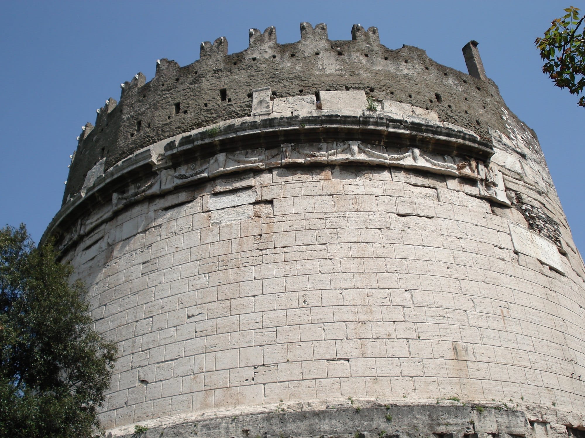
That is where the tomb of Caecilia Metella was built, in the age of Augustus: between 30 and 10 BC according to the most common datings, between 27 and 10 BC according to Rita Paris, who directed the excavations and restorations of the complex. A square base a hundred Roman feet on each side, about thirty metres, faced with travertine, and on top of it a cylindrical drum of the same diameter, a hundred feet, clad in travertine slabs. Around the top runs a frieze of bucrania, the fleshless skulls of oxen, holding up garlands of flowers and fruit. For centuries it was thought to be Pentelic marble, from Greece; examination of the fallen fragments found in the recent excavations showed it is marble from Luni. It was those bucrania that gave the area its name, Capo di Bove, "ox head", and from there the name passed to the lava flow: in Rome, the volcano and the tomb are called the same thing.
On the side facing the road, on a marble slab, is the dedication.
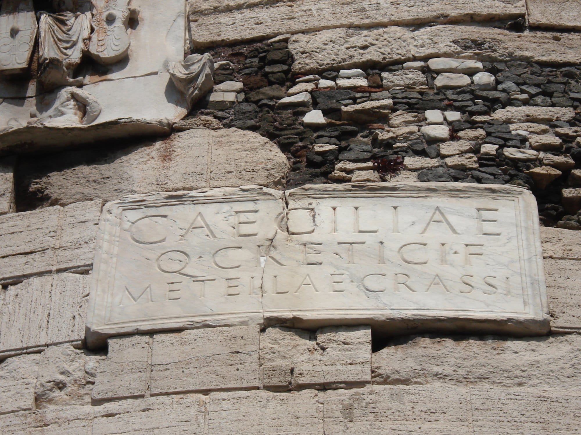
CAECILIAE · Q · CRETICI · F · METELLAE · CRASSI. To Caecilia Metella, daughter of Quintus Creticus, wife of Crassus. Her father was Quintus Caecilius Metellus Creticus, the consul who conquered Crete. Her husband was a Marcus Licinius Crassus, and scholars still argue whether he was the triumvir or his son. The tomb was probably built by her son, another Marcus Licinius Crassus, consul in 30 BC alongside Octavian, who won campaigns that earned him the title of imperator and other honours, which he could not take up so as not to overshadow the princeps. A tomb like this, on the most watched road in Rome, was also a way of reminding everyone who his family were.
And of Caecilia we know nothing else. She is, Rita Paris writes, a figure "not otherwise known": we know the father, the husband, the son. She is a name inside a genealogy of men. The most famous tomb on the most famous road of the ancient world keeps perfectly the memory it was asked to keep, the memory of a family, and almost nothing of the woman buried in it. Even the entrance to the burial chamber does not open onto the Appian Way but onto the south side, away from the traffic: the display was for the family, the silence was for her.
Inside, the chamber is circular, six and a half metres across at the base and more than twenty-two metres high, with an oculus at the top through which the light falls. The walls are brick, and they may be among the first brick facings of this quality in Rome.
There is a detail that makes the story stranger still. A century and a half later this whole area became part of the estates of Herodes Atticus, the immensely rich Athenian orator, tutor to Marcus Aurelius, married to the Roman noblewoman Annia Regilla. When she died in childbirth, in circumstances the sources leave unclear, Herodes turned the estate, the Triopion, into a great memorial landscape: woods, fields, sanctuaries, monuments scattered across it, in memory of his wife. Two women, two centuries, the same stretch of road. And in both cases a man building the memory of a woman, and building it his own way.
The second job
In medieval documents the tomb goes by strange names. A document from the monastery of Subiaco of 850 calls it ta canatricapita; a bull of Honorius III of 1217 calls it Prezatum, one of Nicholas IV of 1291 Peczutum, names that suggest a conical roof still standing. Soon afterwards the roof disappears.
In 1303 the family of Pope Boniface VIII, the Caetani, buy the Capo di Bove estate with the pope's help, together with all the buildings on it, and build a castle next to the tomb, the Castrum Caetani, with a palace and a church, San Nicola. The mausoleum becomes the keep. In place of the roof rises a wall of small stone blocks, the so-called opera saracinesca, about six and a half metres high, crowned with swallowtail battlements, the Ghibelline merlons, with a wall-walk behind them. The marble rings you can see between the battlements were used to hang wooden galleries. Inside, the chamber probably became a cistern. The tomb of an Augustan noblewoman now stands guard over the road.
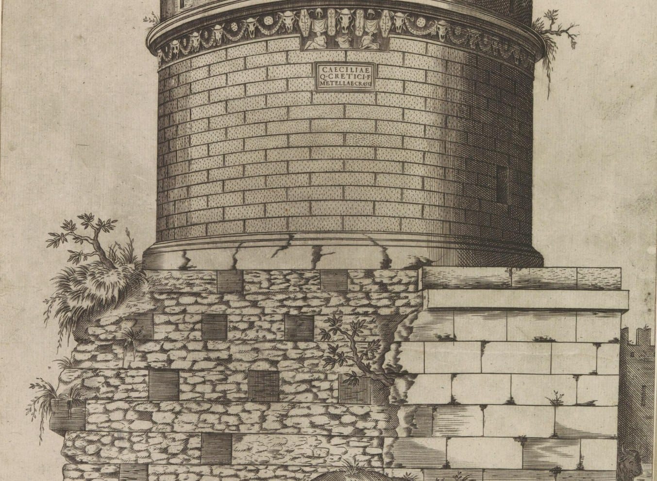
And here the most important thing in its history happens. Along the Appian Way a great many monuments disappeared over the centuries: marble and travertine were reused or ended up in the lime kilns, and the tomb of Caecilia Metella itself lost almost all the facing of its base in the sixteenth century; only the ends of the blocks remain, embedded in the concrete core. But the cylinder survived. In 1589 it even came close to disappearing altogether: Pope Sixtus V wanted to demolish it, and it was saved by the intervention of the conservator Paolo Lancellotti. The most convincing explanation for its survival, though, is not respect. It is usefulness. As long as the tower served a purpose, nobody was going to take it down.
Restoration theory put this truth in writing only in 1964. Article 5 of the Venice Charter says that "the conservation of monuments is always facilitated by making use of them for some socially useful purpose", and immediately sets the limit: such use is desirable, but "it must not change the lay-out or decoration of the building". The Caetani would have passed the first half of the exam and failed the second. They saved the tomb by changing its appearance for ever, and the battlements we photograph today as part of the monument are exactly the kind of alteration the Charter would forbid.
It is the knot that anyone who studies restoration runs into early and never quite unties. The buildings that reach us are almost never the ones we venerated: they are the ones we kept using. The Pantheon survived because in 609 it became a church, the Theatre of Marcellus because a palace was built on top of it. The use that saves is also the use that transforms, and the line between the two is not drawn by a rule. It is drawn, case by case, by someone who decides.
A theatre with a house on top
To see how normal this second job is in Rome, you only have to move a few kilometres, to the foot of the Capitol.
The Theatre of Marcellus is almost the same age as the tomb. Caesar began it, and Augustus completed it and dedicated it, between 13 and 11 BC, to his nephew Marcellus. In the Middle Ages its high position over the Tiber, next to the Ponte dei Quattro Capi, turns it into a fortress: first of the Pierleoni and the Fabi, then, from the thirteenth century, of the Savelli, who gave their name to the whole area, Monte Savello. Between 1523 and 1527 Baldassarre Peruzzi built a palace on top of the arches for the Savelli; in the eighteenth century it passed to the Orsini. Meanwhile shops, taverns and houses had squeezed themselves into the arches below.
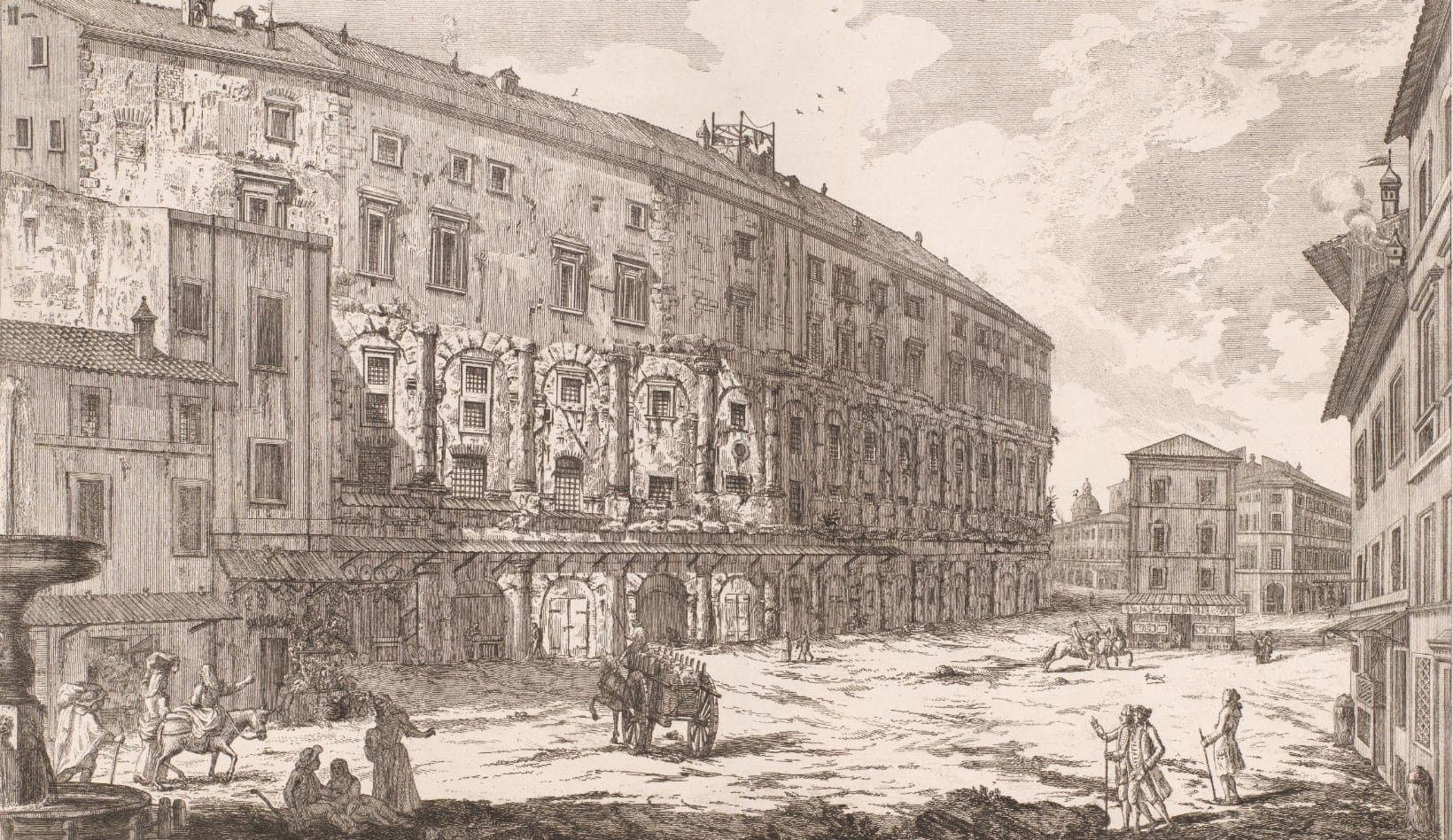
In the view attributed to Jean Barbault, from 1761, you can see Piazza Montanara with the theatre's arches taken over by shops and awnings, the palace above, carts and traders in front. In a postcard from the early twentieth century the arches have windows and iron grilles: someone is living inside Augustus's arches.
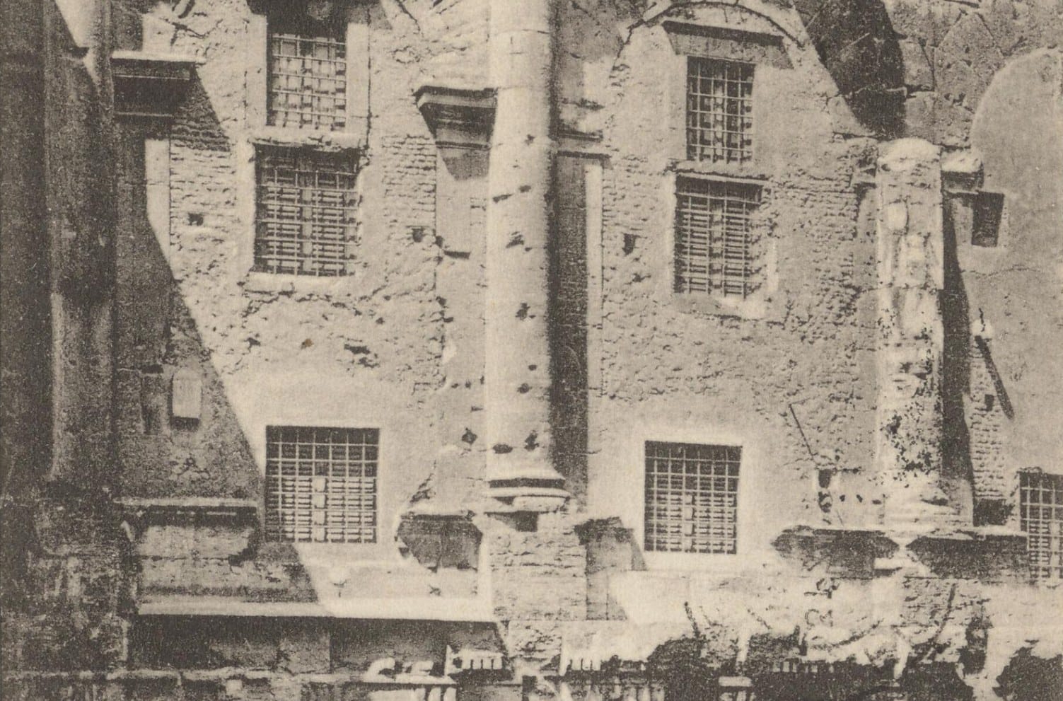
Then, on 21 April 1926, the Natale di Roma, the city's birthday, the "liberation" begins. A Latin inscription set into the theatre declares that the Senate and People of Rome, under Victor Emmanuel III and with Mussolini in government, have resolved to clear it of the squalid houses and ignoble taverns that occupied it and to give it back its ancient splendour. The works are run by the Istituto per le Case Popolari, the public housing institute, chaired by the architect Alberto Calza Bini. In the same campaign of demolitions, the one that opens up the Via del Mare, Piazza Montanara disappears, together with two churches and a puppet theatre.
And this is the point. The shops and the houses in the arches are removed, because they are an "ignoble" layer. Peruzzi's palace on top, on the other hand, stays, and people still live in it today; one wing houses the embassy of the Order of Malta to the Holy See. The liberation does not take the theatre back to what it was: it chooses which layers to keep. The Renaissance yes, because it is noble; the taverns no, because they are poor. The same criterion that left the Caetani battlements on Caecilia Metella, perhaps because by then they had become picturesque.
Every age decides which layers of the past deserve to stay, and it almost always decides on the basis of what it finds beautiful, not of what happened.
A difference in level
One thing remains that you can no longer see today, standing in front of the tomb.
In 1789 Labruzzi drew the tomb of Caecilia Metella. In his watercolour the Roman paving runs far below the monument, separated from it by a bank of lava, while the castle gate opens at a higher level, the level of the medieval ground, which had risen over the centuries. Anyone arriving from Rome faced a steep climb right under the tower. The road we travel at that point today is neither the Roman one nor the medieval one.
In 1823 someone decided to lower it. It was the first of a series of interventions that, in little more than a century, would build the Appian Way we carry in our heads: the solemn road lined with tombs and pines, which we think of as ancient and which was largely invented between the nineteenth and twentieth centuries. Who invented it, and why, is the second part of this story.
Further reading
Annarena Ambrogi and Rita Paris (eds), Il Museo della Via Appia Antica nel Mausoleo di Cecilia Metella – Castrum Caetani, L'Erma di Bretschneider, Rome 2020. The monograph on the complex: geology, mausoleum, castle, the 1997–2000 excavations and the catalogue of the sculptures. In Italian.
Carla De Stefanis, La Via Appia sotto le mura di Roma. Esperimenti di musealizzazione nell'Ottocento e oltre, Radboud University Press, 2025. Free to read online. Essential for the second part.
Fabrizio Vistoli, Saggio bibliografico sull'antica via Appia, Società Magna Grecia, Rome 2013. An annotated bibliography, with a historical and topographical note that puts the road's phases in order. In Italian.
Caterina Rossetti, "Sulla via Appia antica con Carlo Labruzzi", Lazio ieri e oggi, 2021. The first mile of the Appian Way compared with the drawings of 1789. In Italian.
Giovanni Battista Piranesi, Le Antichità Romane, 1756, third volume: the tombs and the road, plate by plate.
INGV, Il sonno dei Colli Albani (2016), and the Civil Protection fact sheet on the volcano. In Italian.
Translations of quotations from Italian are my own, except for the Venice Charter, which is quoted in its official English text.