ALL ROADS LEAD TO THE KING
Three avenues converge on the palace at Versailles, some thirty streets fan out from a tower at Karlsruhe, and a prefect cuts boulevards through Paris. Cities laid out for power, who paid the bill, and why Paris is still one of the best cities to walk in.
Utopian Cities, II · Versailles, St Petersburg, Karlsruhe and Haussmann's Paris: cities laid out so that power could be seen from far away and reach everywhere in a straight line. And today they are among the best cities to walk in.
At Pienza, a pope had a loggia built so that he could look at the valley. Two centuries later, kings wanted the opposite: cities built so that everyone would look at them.
Murray Bookchin describes the shift well in The Limits of the City, a book from 1974. In the Baroque capitals of the absolute monarchs, he writes, the size of a public building rose with the power behind it: urban space made no secret of its hierarchy, it turned authority into monuments, and it filled people with awe. In those same cities, the broad processional avenues that converge on the palaces of the Baroque districts run alongside the narrow, crooked streets of the medieval quarters. The first are built at a scale meant to overwhelm and intimidate; the second offer warmth, intimacy and community.
This chapter is the story of those avenues: who laid them out, why, and how they ended up.
Versailles
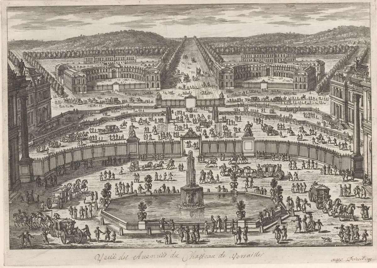
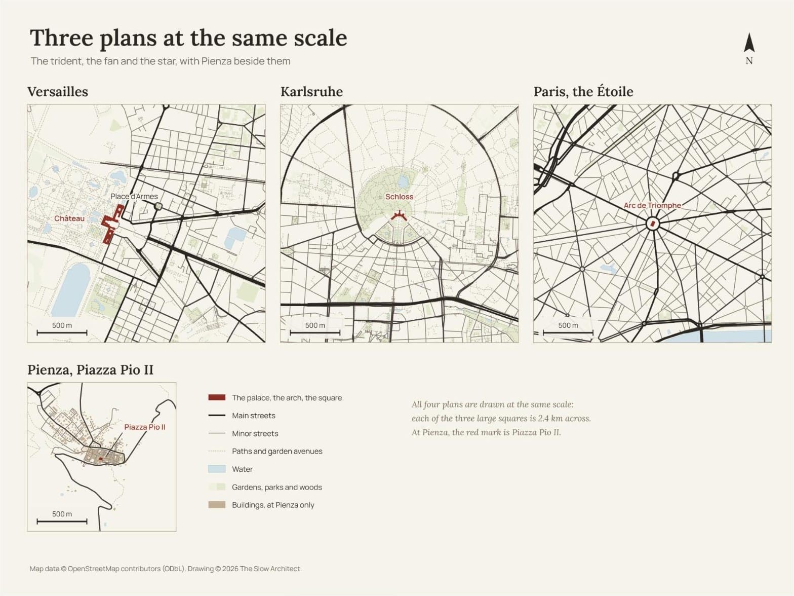
Versailles was a hunting lodge. Louis XIV turned it into an immense palace, and wanted a city around it. On 22 May 1671, from Dunkirk, he signed an order granting land to anyone who wished to build there, on one condition: that they respect "the state and symmetry of the buildings". The new quarter to the north of the palace was laid out by Louis Le Vau and his associate François d'Orbay. The three roads that converge on the Place d'Armes, and from there on the palace, the Avenue de Paris, the Avenue de Saint-Cloud and the Avenue de Sceaux, were already there in outline in a view Pierre Patel painted in 1668: the king found them, and made them into a trident. They don't lead to the church, or to the market. They lead to the palace. On 6 May 1682 the court and the government moved there.
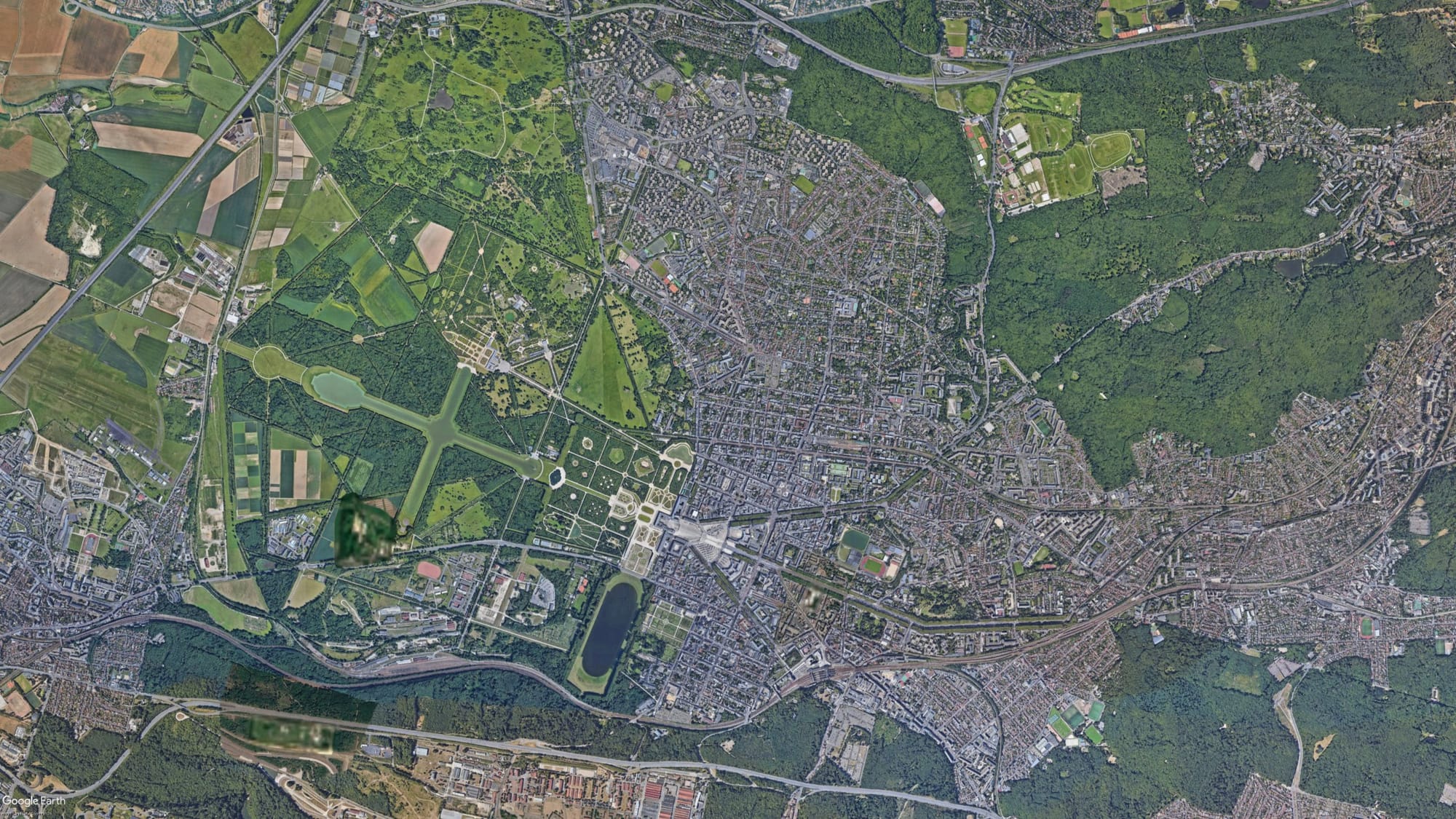
In 1789 Versailles had sixty thousand inhabitants. That October a crowd came out from Paris and took the royal family back with it, and by the early nineteenth century the population had dropped to twenty-five thousand. A city born for one man had lost the man and more than half its people. Today it has more than eighty thousand: it has outlived its king.
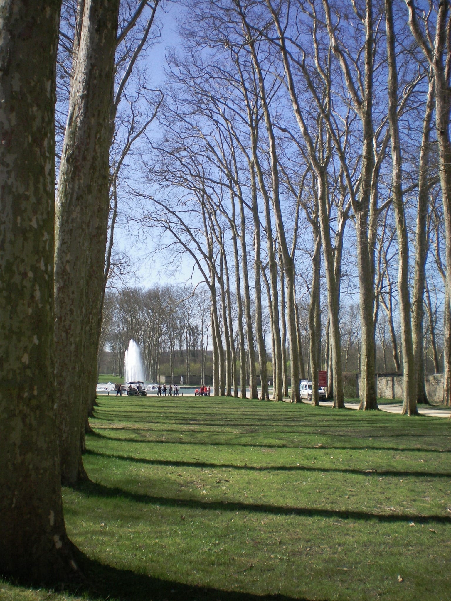
I went there on the first trip Kat and I made to Paris. We did all the museums; I took her to see the Villa Savoye, Perret's buildings and Le Corbusier's, and she followed me round with the patience of someone who goes along on another person's pilgrimage, to a saint who isn't hers. And we went to Versailles. It was April, but very cold, and spring hadn't come yet: in the gardens everything was dry, and the trees were bare. A garden in flower is one thing; a park in winter is another. We had just seen the royal palace at Caserta, and it has been a joke between us ever since: Versailles had looked like Caserta's annexe. When it comes to gardens, Versailles is a cut above, and they run on as far as the eye can see. For the staircases and the rooms, the sheer grandeur of the architecture, Caserta had made a better impression on me.
The comparison is not far-fetched. Caserta was born with one eye on Versailles: Charles of Bourbon laid its first stone on 20 January 1752, to a design by Luigi Vanvitelli, and the model was Louis XIV's palace. It has around twelve hundred rooms, and has been a World Heritage Site since 1997. The King of Naples treated Versailles the way Versailles had treated the rest of the world: as the measure to beat.
In the summer of 2026 we didn't go back to Versailles. The grandparents went; the three of us went to Disneyland, for Lea: the day was our present to her. I hate children's theme parks, and I did it only for her. Thinking back, though, that day the family had split between two cities built around a single gaze, the king's and Disney's. We'll meet the company again in the next chapter, in Florida.
St Petersburg: the premeditated city
Peter the Great went further. In May 1703 he laid the first stones of a fortress at the mouth of the Neva, in a marsh, and there he decided to build his capital. It was built by serfs sent there by force, tens of thousands of them every year. Nobody knows how many died: Russians say the city stands on a swamp of bones. In 1712 the capital was moved there from Moscow.
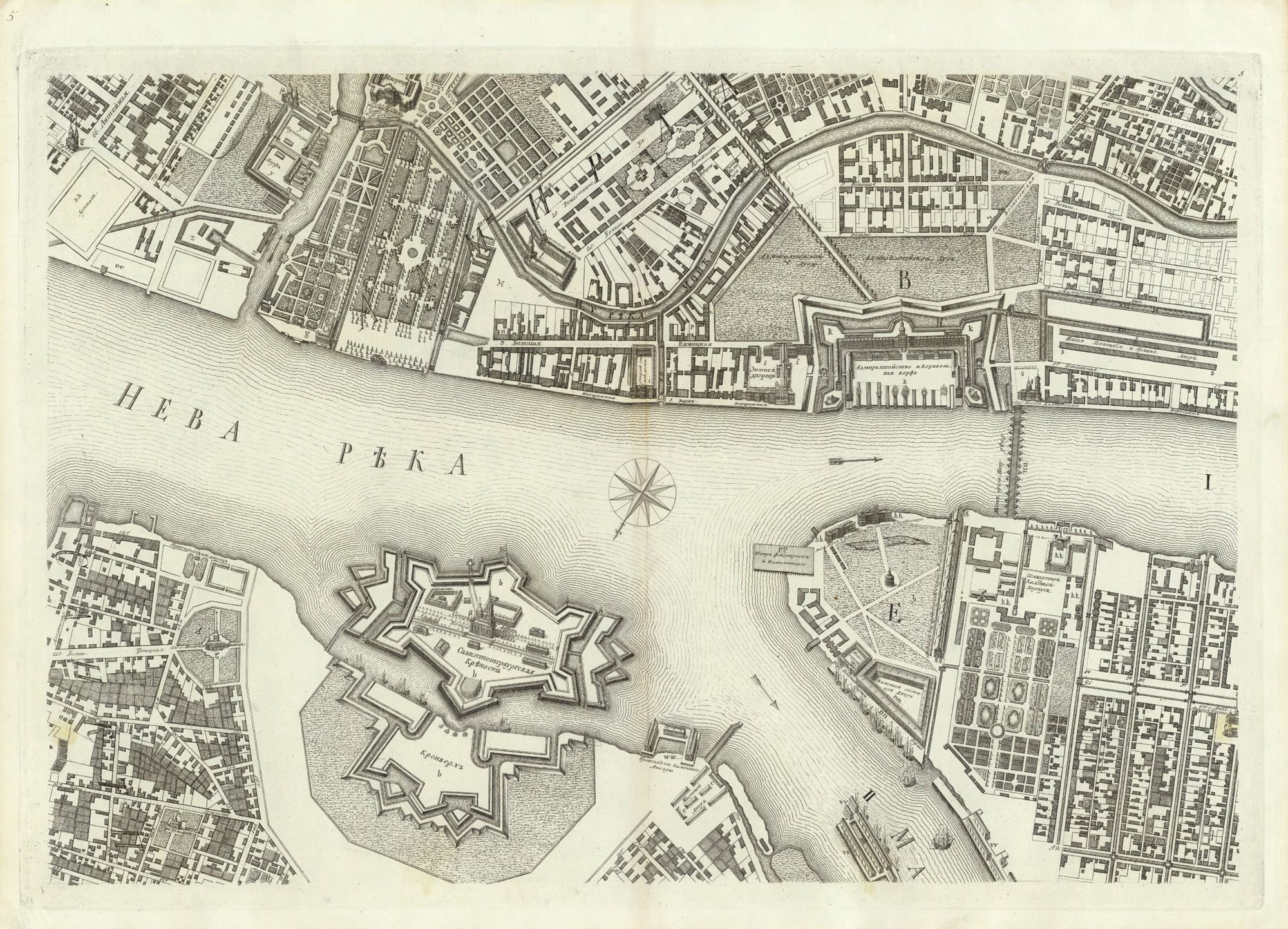
Dostoevsky called it the "most abstract and premeditated city in the world". The political scientist James C. Scott, in Seeing Like a State, sees it as the urban realisation of what a historian of Russia, Richard Stites, called the administrative utopianism of the tsars: schemes to fit their subjects into institutions built on hierarchy, discipline and geometric order. The plan, Scott writes, was a legible map of the society it was meant to produce: from each building's front, height and materials you could tell the class of the people inside.
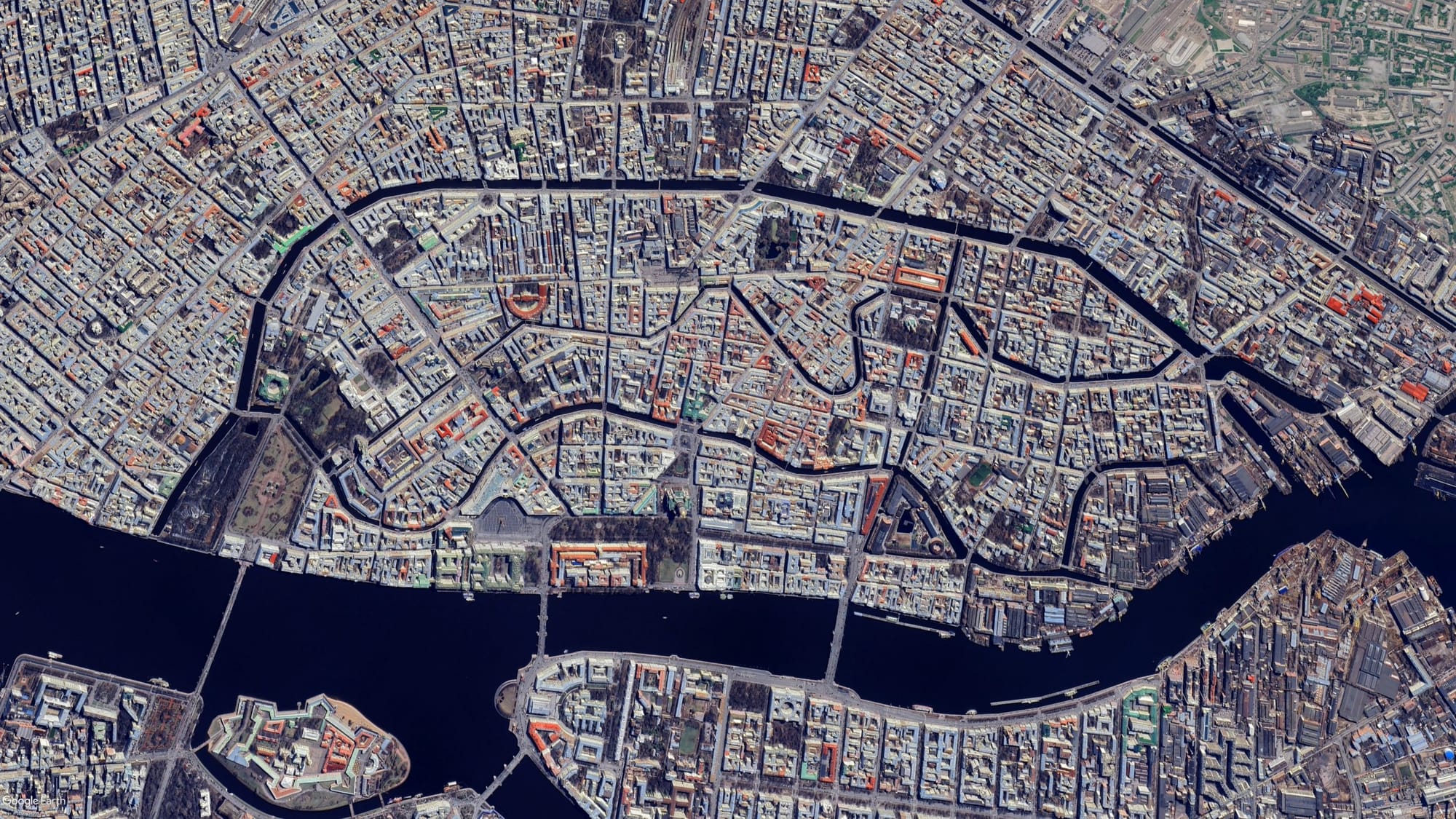
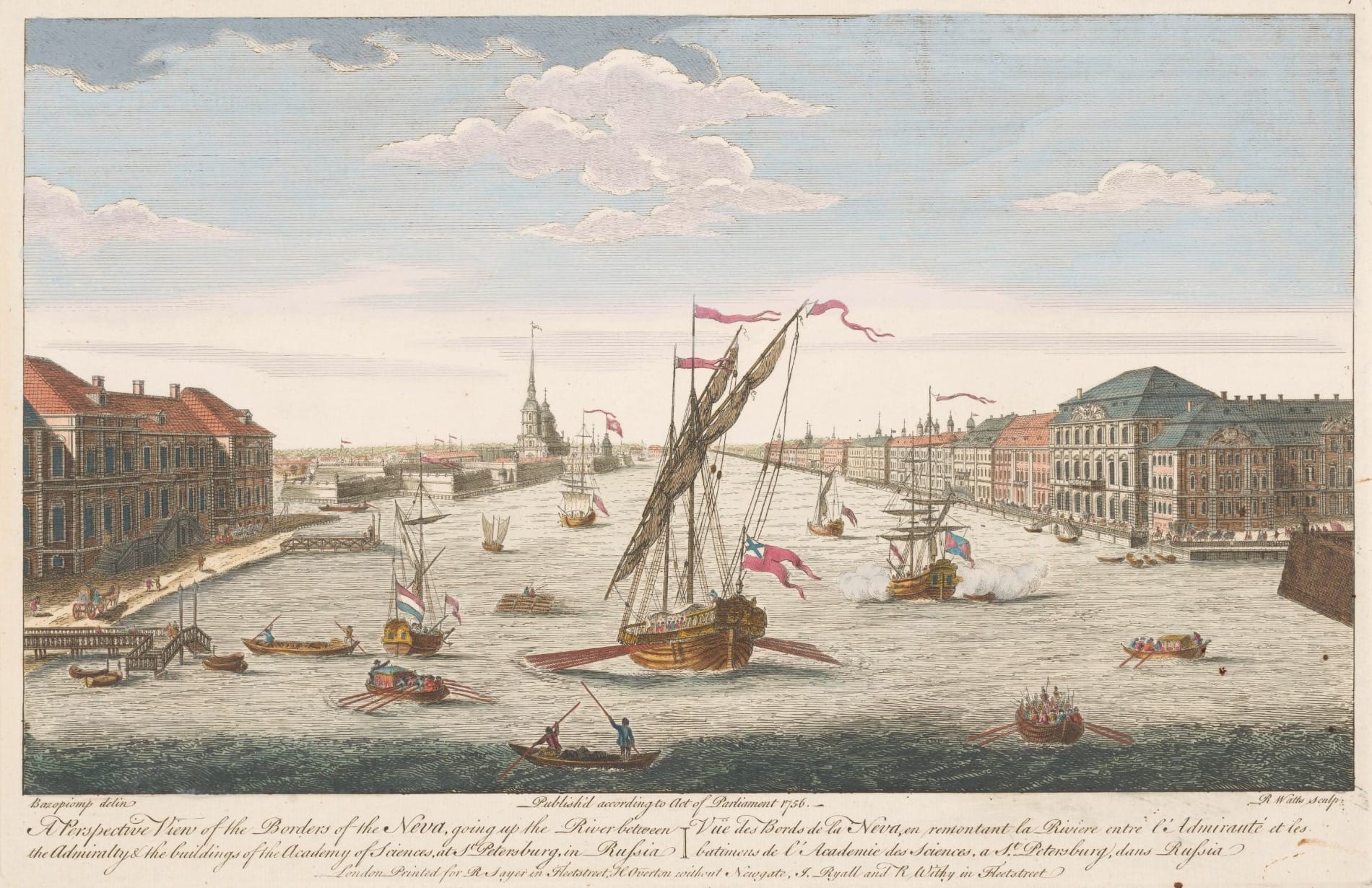
And it became one of the most beautiful cities in the world. That is the first uncomfortable point in this chapter: a city willed by one man and built by force can become a masterpiece, and remain one.
Karlsruhe: the fan
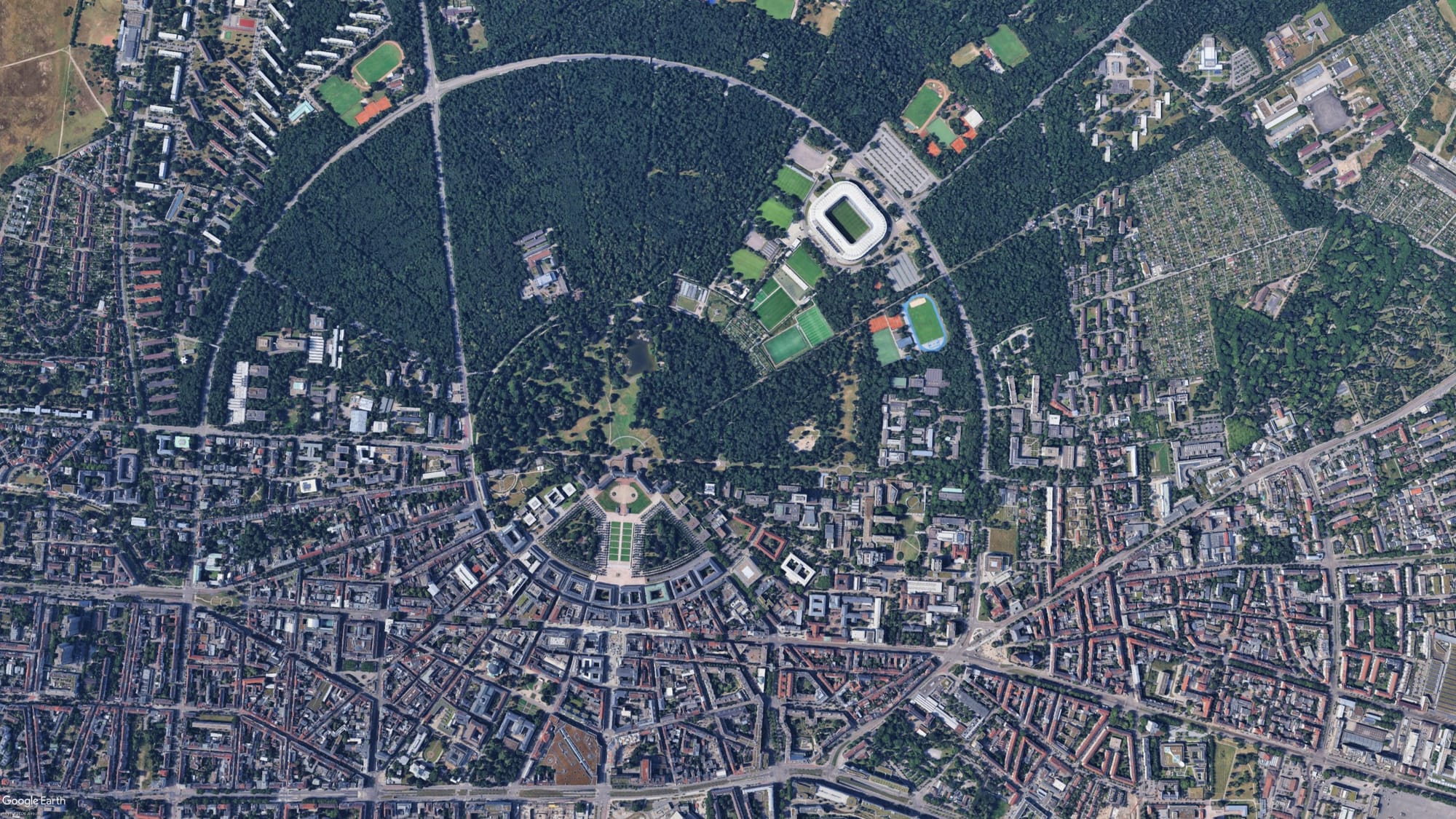
In 1715 the margrave Karl Wilhelm of Baden-Durlach, who had fallen out with the citizens of his old capital, founded a new one in a forest. Legend has it that he had dreamed it. At the centre he put the tower of his palace, and from the tower he had some thirty streets radiate outwards, like the ribs of an open fan. He called it Karlsruhe, Karl's rest. Today it is a German city of more than three hundred thousand people, and seen from above, the margrave's plan is still there in full. It is Versailles taken to its logical conclusion: every street leads to the prince, and the prince sees them all.
Seeing everything
What do a French king, a tsar and a margrave have in common? Scott has a word for it: legibility. A state, he writes, wants to see: to count, to measure, to reach. A medieval city that grew on its own is illegible to those who govern it, and the Baroque city puts that right. In Scott's account, the Baroque remaking of medieval cities, with its great buildings, its vistas, its squares and its eye for uniformity, existed to make the prince look great and fearsome; and appearances, he adds, often counted for more than the social order already in place and the everyday running of the city. Scott cites the historian Lewis Mumford, who found in the Italian military engineer, long before bulldozers existed, "a bulldozing habit of mind", born of a trade whose business was destruction: sweep the ground clean, then start again from geometry.
And there is a detail that takes us back to the first chapter. Alberti and Palladio, Scott reminds us, saw a city's main streets as military roads: straight and, for Palladio, the same all along, so that armies could march anywhere on them. Even the Renaissance of the ideal cities, where this series began, already had soldiers in mind.
The prefect
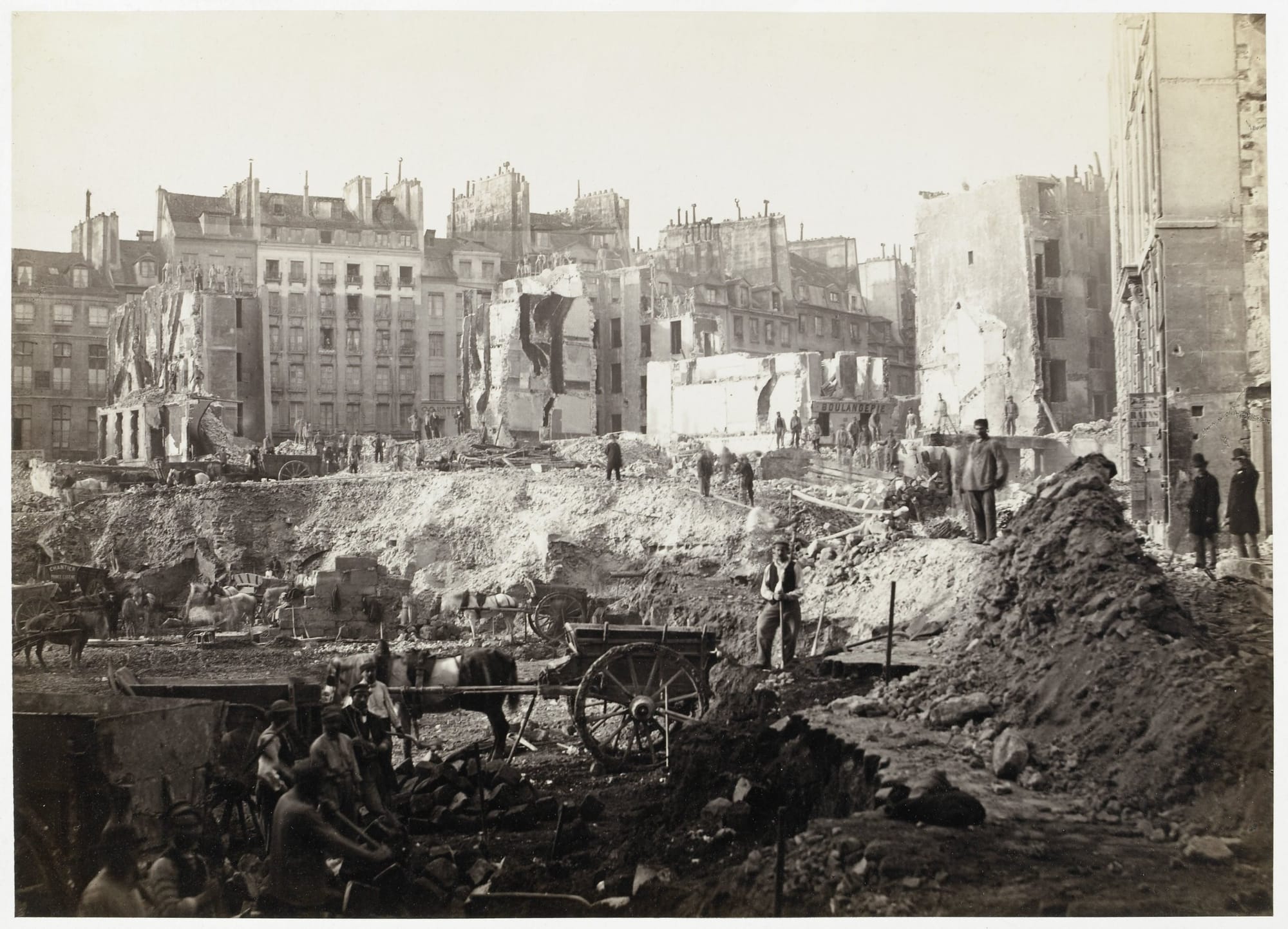
On 22 June 1853 Napoleon III made a forty-four-year-old official, Georges-Eugène Haussmann, prefect of the Seine. He was not an architect, and he did not draw up the new plan of Paris: at the start, Scott writes, the emperor handed him a map showing the central market, the Bois de Boulogne and many of the streets that were later built. Haussmann was the one who carried it out. In seventeen years Paris gained some sixty kilometres of new streets cut through the old city and, if you count every street opened in those years, between 175 and more than 200 kilometres, depending on the source; around twenty thousand buildings demolished and more than thirty thousand built; eighty thousand workers; and a cost of more than two billion francs.
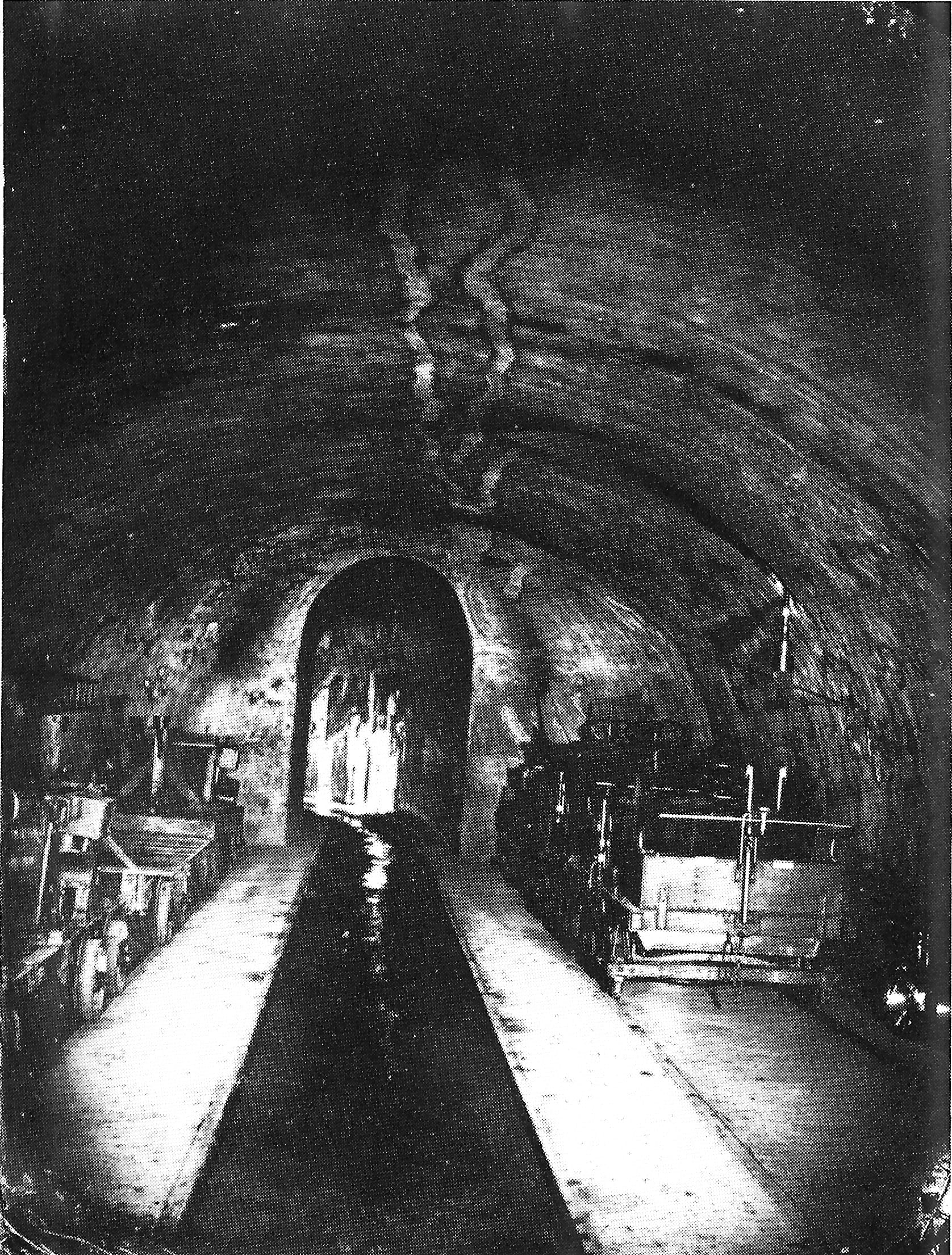
Nor was it all boulevards. Under the engineer Eugène Belgrand the sewers grew, from little more than a hundred kilometres to almost six hundred by 1878, and Belgrand also brought water into the city from distant springs, through two new aqueducts. Then came the Bois de Boulogne and the Buttes-Chaumont, a park made out of a gypsum quarry and opened on 1 April 1867, for the Exposition Universelle. On 1 January 1860 Paris annexed the communes around it: it went from twelve arrondissements to twenty, its area doubled, and its population grew by almost half a million.
And then the façades, which are what we now call Paris. This is where the guidebooks need correcting. The rule that ties the height of buildings to the width of the street was not Haussmann's invention: it went back to 1783 and 1784. The regulations of 1859 raised the cornice from 17.54 to 20 metres on streets more than 20 metres wide, with the roof kept inside a 45-degree line; the lines of the balconies and of the floors had to run on from one building to the next; the stone was Paris's own, Lutetian limestone. The continuous balconies on the second and fifth floors, which guidebooks put down to a decree, are a builders' habit: no decree on record calls for them.
Why
There were three reasons, and historians still argue about which weighed most.
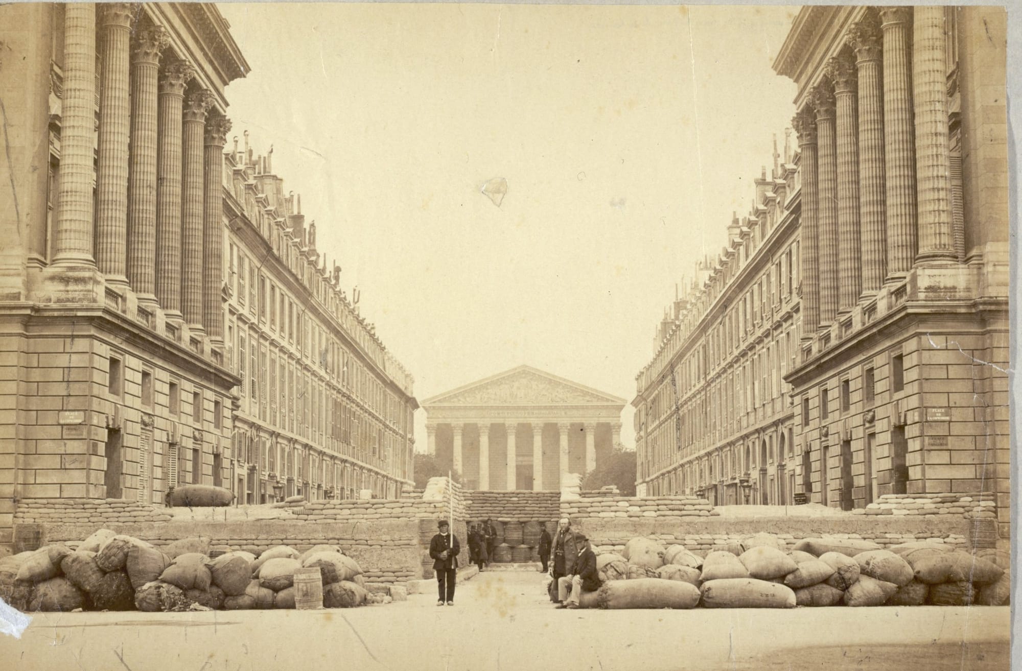
The first was public order. In the twenty-five years before 1851, barricades had gone up in Paris nine times. Making the case for a fifty-million-franc loan to get the work started, Léon Faucher, twice Minister of the Interior under the Second Republic, wrote that a broad cut had to be opened as soon as possible through "this district of barricades", for the sake of public order as much as of health. People at the time, Walter Benjamin tells us, called this embellissement stratégique: strategic embellishment.
The second was health. In 1832 cholera had killed more than eighteen thousand people in Paris, among them the prime minister, Casimir Perier. Old sewers, cesspits, a water supply nobody could count on: the city, Scott writes, was literally pestilential.
The third was business: traffic, the new railway stations, trade, the value of land. The architectural historian Pierre Pinon argues that the strategic explanation, apart from a couple of cases, has no foundation; others see the demolitions above all as an economic programme. Scott holds all three together: the works the hygienists called for in the name of health also made the city more efficient for the economy and safer for the army.
The bill
It was the poor who paid the bill. The demolitions drove tens of thousands of people from their homes, and the working people of the centre were pushed out to the faubourgs. The rules, Scott writes, looked almost only at the fronts of buildings; behind them, builders were free to pack people into airless tenements, and plenty of them did. The city became legible because it was sorted by class and by use: the bourgeois shopping district, the well-off residential quarter, the artisans' quarter, the industrial suburb. Belleville, to the north-east, had by 1856 become a town of sixty thousand people, many of them driven out of the centre.
Then it was Haussmann's turn to pay. In 1868 Jules Ferry gathered his articles attacking the prefecture's budgets into a pamphlet, with a title that played on E. T. A. Hoffmann's fantastic tales: Les Comptes fantastiques d'Haussmann, the fantastic accounts of Haussmann. The prefect had paid for the works with disguised loans. On 5 January 1870, under the liberal government of Émile Ollivier, he was dismissed. Two years later, in La Curée, Zola set his speculator, Saccard, on top of Montmartre, looking at a Paris slashed with sabre strokes, its veins open.
And in May 1871 it was the Commune that paid. The last Communards fell back on Belleville, and made their final stand at the Belleville town hall. Scott cites the historian John Merriman: the Versailles army could drive from the Place du Château-d'Eau to Belleville in one push, and it had Haussmann to thank for it. The army went by that name because the government sat there, at Versailles, in the king's city. That was the use Faucher had in mind for his cut, some twenty years earlier.
The continuous surface
And yet Paris is the best city in the world to walk in, or nearly. On that trip we didn't go into a single museum in Paris, or at least none of the ones everybody does, the ones we too had done the first time: we walked, and that was all. In the letter that came out of it I wrote that, seen that way, Paris was one continuous surface: a street that turns into another street, a bridge, a square, a façade that isn't in any guidebook. We did two long walks, and both were wonderful. The first started at the Place Dauphine, on the Île de la Cité, crossed the courtyards of the Louvre and the garden of the Palais-Royal, slipped into the covered passages, from the Galerie Vivienne to the Passage Jouffroy, and came out on Boulevard Haussmann, behind the Opéra; from there we kept climbing, all the way to Montmartre. The second started at the Tour Saint-Jacques and crossed the Marais to the Place des Vosges, with a sandwich on a bench at the Archives nationales and no hurry at all; then it turned back west, through the Tuileries and the Concorde, and up the Champs-Élysées to the Étoile. The second is long, but very satisfying: on foot it will easily take you half a day.
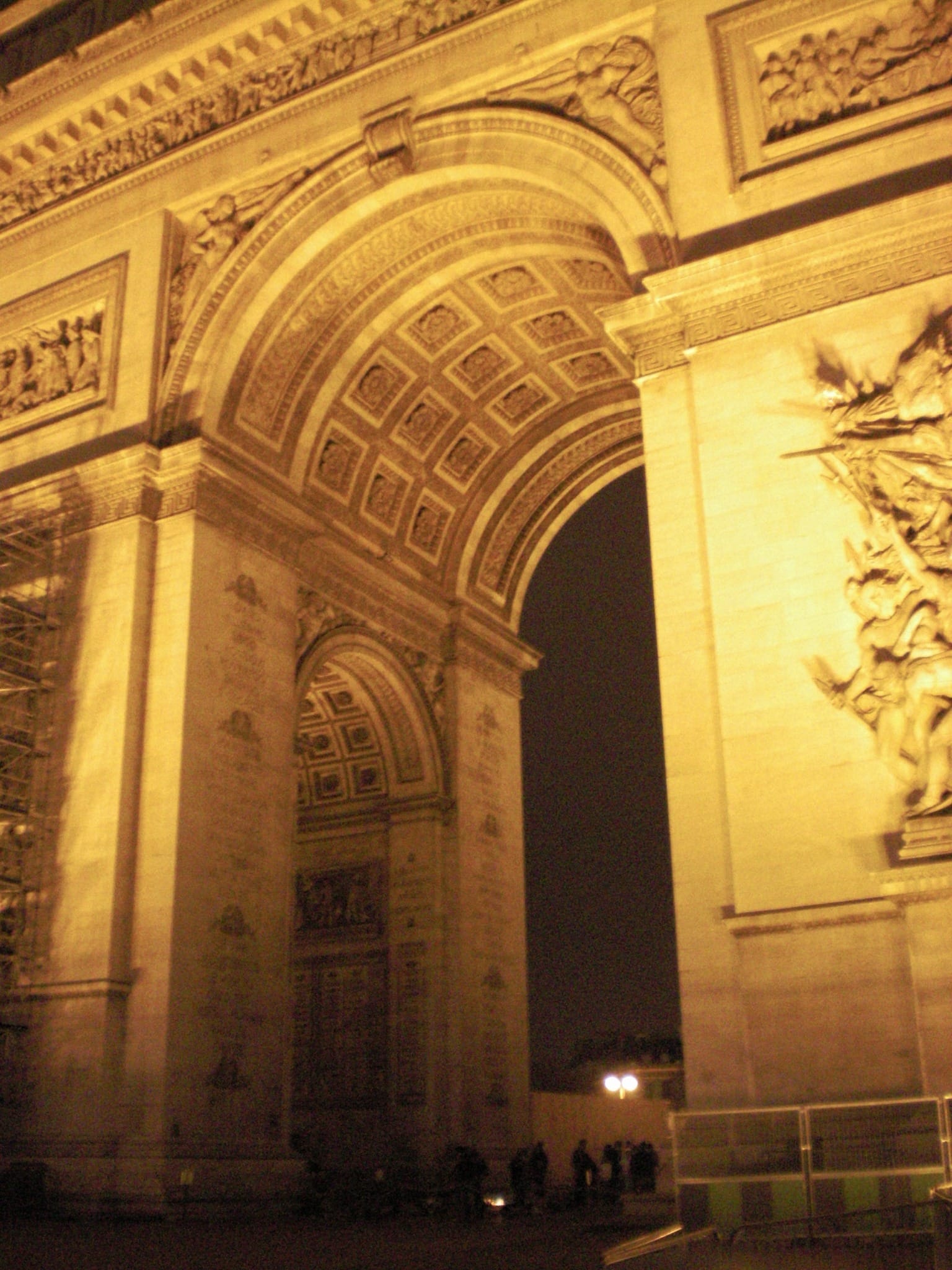
Going back over the two walks in my head, I realise that they cross from one Paris to another. The covered passages came before, in the first half of the nineteenth century, and the boulevards cut through or demolished a good many of them. Haussmann barely touched the Marais, which lay away from the great arteries, and in 1964 André Malraux made it one of France's first secteurs sauvegardés, its protected historic districts. Then you come out into the prefect's city. Napoleon had begun the Rue de Rivoli, but it was under Napoleon III and Haussmann that it reached the Hôtel de Ville. At the Étoile twelve avenues meet, in a square redesigned in the 1850s. And the boulevard that bears his name was begun in 1857 and finished only in 1926, when he had been dead for more than thirty years. As for Montmartre, when the prefect started it wasn't even Paris: it was a commune of its own, annexed on 1 January 1860. Eleven years later, on 18 March 1871, the Commune began right there, when Thiers's soldiers went up to take the cannon on the hill. Read again with all this in mind, that continuous surface turns out to be largely Haussmann's. The façades that were meant to display the greatness of the empire have become the even backdrop against which everything else stands out: the café, the tree, the people.
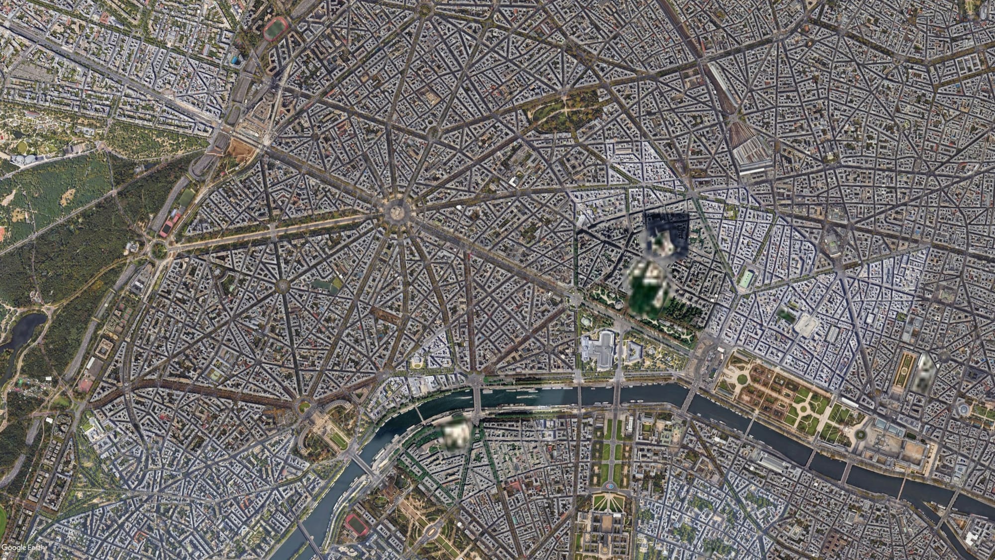
Bookchin sets Haussmann apart: along with L'Enfant's plan for Washington, his remaking of Paris is one of the few attempts before the late nineteenth century to plan a whole city at once, for better or for worse. And earlier in the book he says something that holds for all the kings in this chapter. Their power was at least the power of a person: someone you could see, weigh up, put to the test and, when it came to it, unseat. At Versailles, that is how it began: in October 1789 a crowd that had come out from Paris took the king away.
The next chapter has a new prince. The king makes way for the boss, and the city is built by the company.
Further reading
James C. Scott, Seeing Like a State: How Certain Schemes to Improve the Human Condition Have Failed (Yale University Press, 1998). Chapter 2, "Cities, People, and Language", for the Baroque city and Haussmann's Paris; St Petersburg is at the start of chapter 6, "Soviet Collectivization, Capitalist Dreams".
Murray Bookchin, The Limits of the City (Harper & Row, 1974). Chapter 3, "The Limits of the Bourgeois City", on Baroque avenues and the monuments of power; chapter 4, "Community and City Planning", for Haussmann and L'Enfant.
Émile Zola, La Curée (1872). The Paris of the demolitions, seen from the side of the people who speculated on it.