CIVITA DI BAGNOREGIO — THE CITY THAT IS DYING
Everyone crosses the bridge to photograph the dying city. Almost nobody asks the real question: why do we keep building bridges to reach a place that is disappearing?
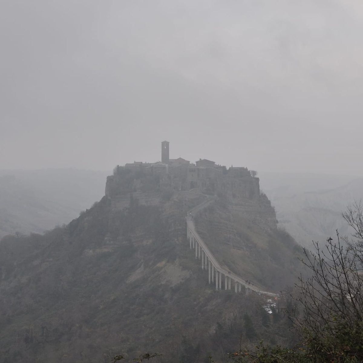
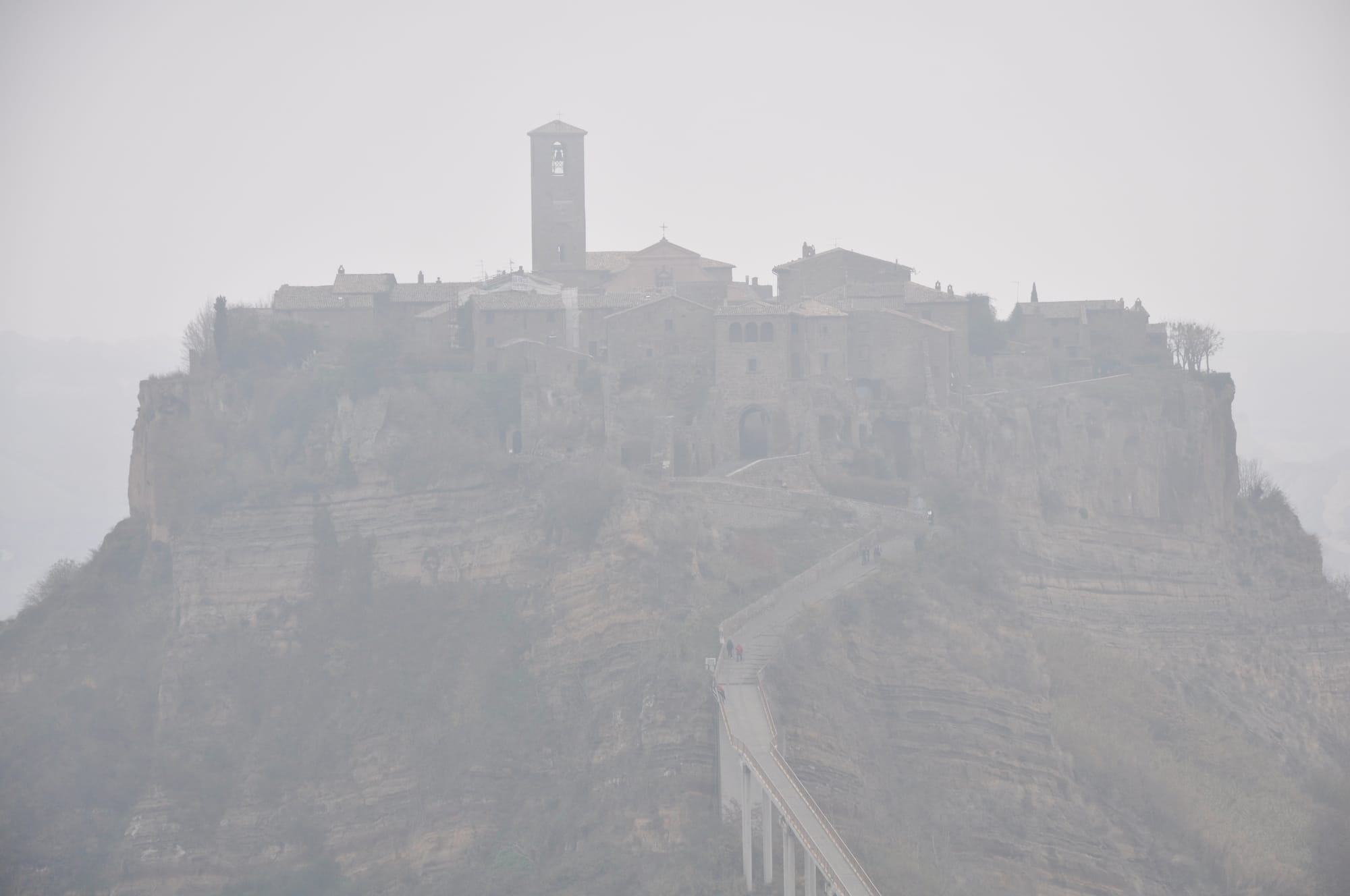
The wind on the bridge comes up from the valley, not along it. Three hundred metres of concrete, wide enough for two people abreast, and the whole way across you are leaning slightly into something arriving from below — from a place where there is nothing left to lean on.
I crossed it under a leaden sky. The calanchi had dissolved into mist on both sides, and Civita stood ahead with no visible base, the cliff going down into grey and not coming out anywhere. The bridge seems to drop first, then climb — steeply, at the end, steeply enough that you feel it. And somewhere in that climb it occurred to me that the thing under my feet was the only object in sight that did not belong: grey, straight, poured in 1965, laid across a valley that has never held a straight line in its life.
So here is the question nobody asks while crossing: why do we keep building bridges to reach a city that is disappearing?
This is not a rhetorical question. It is the most honest question you can ask in front of one of the most extraordinary landscapes in Italy — and the answer says something important about how human beings relate to what they are losing.
The Geology First
To understand Civita you need to understand what is beneath your feet. Not metaphorically — physically.
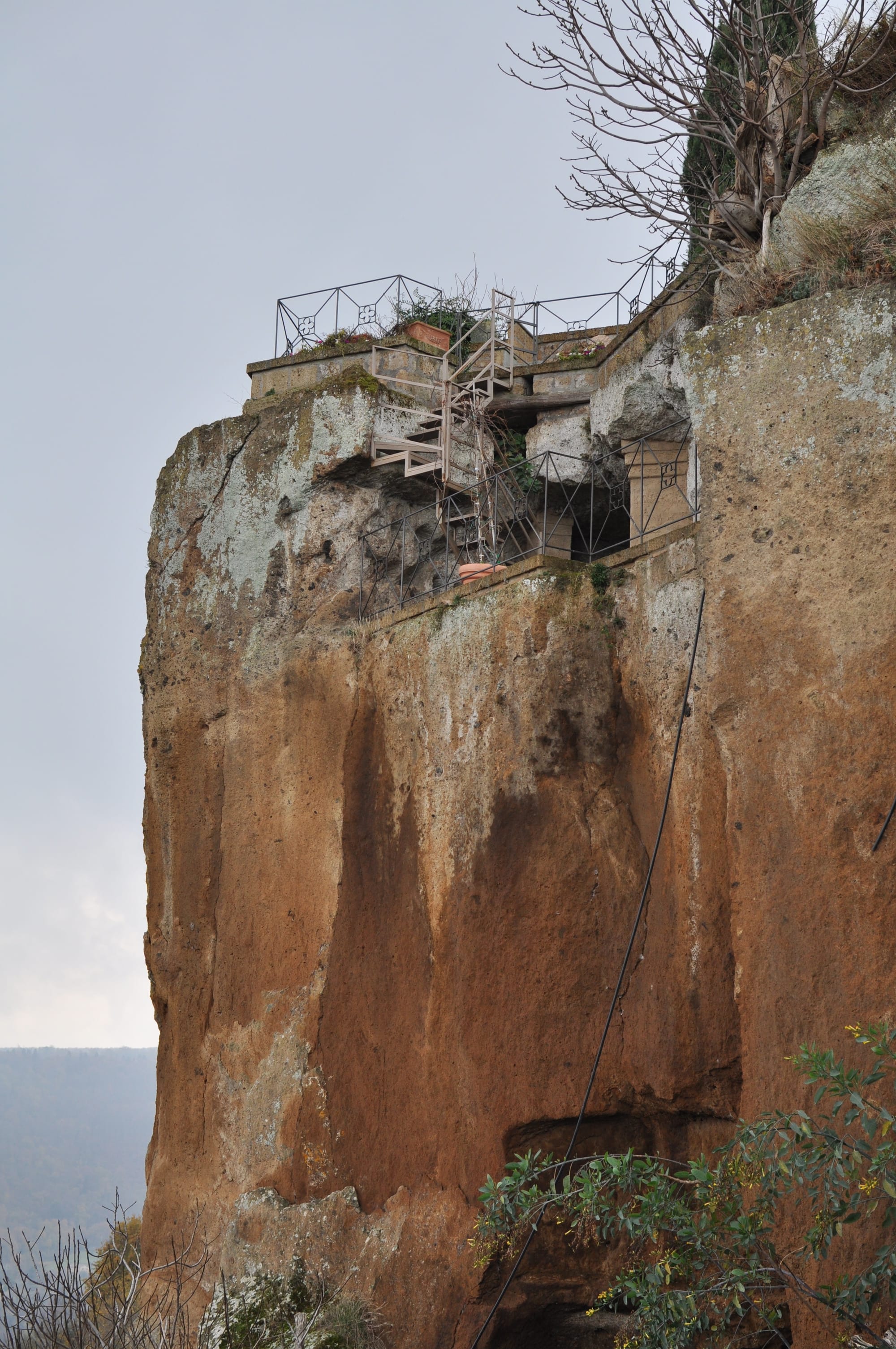
The block on which the village stands is formed by two superimposed geological layers, profoundly different from each other. The lower one is Pliocene marine clay — the same clay we already encountered beneath the tufa cliff of Orvieto, deposited on the floor of an ancient sea before the volcanic activity of the Alban Hills and the Vulsini Mountains lifted the territory. Clay is impermeable, plastic, subject to flow: it absorbs water and deforms, swells with rain and contracts with drought, slides slowly but inexorably downward.
Above the clay, volcanic tufa — a harder, more resistant material, but with no cohesion of its own. Tufa doesn't bond to clay: it rests on top of it. When the clay gives way, the tufa falls.
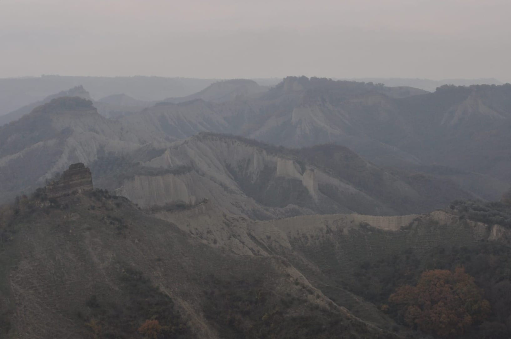
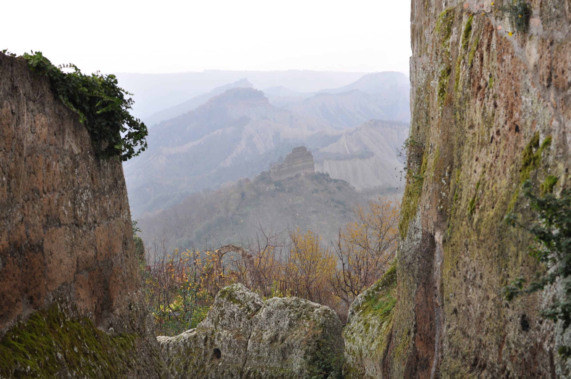
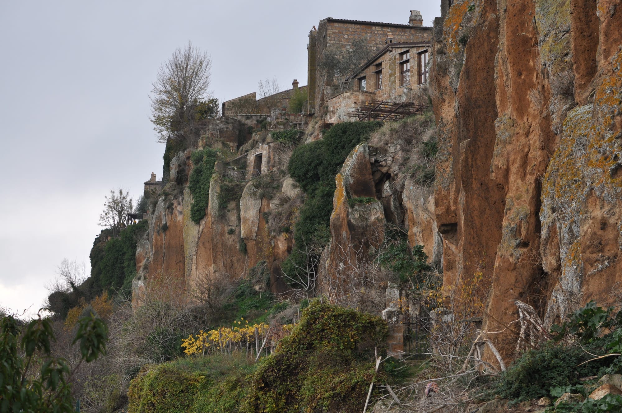
The two rivers that surround the village — the Torbido to the north and the Chiaro to the south — have carved two parallel valleys over millennia, eroding first the clay and then progressively undermining the base of the tufa block. The result is what we see: an island of rock growing narrower, surrounded by calanchi — those clay formations eroded by water into ridges and gullies that give the valley its lunar landscape.
The average rate of erosion is approximately seven centimetres per year. The road that led to Bagnoregio has dropped twenty-five metres since the mid-nineteenth century. This is not a stable phenomenon — it is a process accelerated by the abandonment of vegetation and the concreting of slopes, which have increased surface runoff and reduced water absorption in the soil.
Civita is dying of natural causes, but surviving through human ones. This distinction defines the value of the modern building site: the engineering of consolidation — the drainage wells, micropiles and steel tendons inserted into the rock — does not accelerate the process, but fights a slow, methodical battle against geology to delay the inevitable.
The mechanics of erosion are worth clarifying, because the seven centimetres per year is an average figure that can mislead. Clay erosion does not proceed in a linear, constant way, as if the cliff were being smoothed down millimetre by millimetre each day. It proceeds through catastrophic localised collapses: the wall remains immobile for years, accumulating geometric tension while the clay beneath is slowly undermined, until an entire block of tufa detaches at once and falls into the valley. Weeks of silence, then ten metres of cliff face disappearing in a few seconds. The seven centimetres are the average of decades of silences and collapses.
Two Thousand Five Hundred Years of History on a Block of Clay
The Etruscans founded this city approximately two thousand five hundred years ago on one of the oldest roads in Italy, the one connecting Lake Bolsena to the Tiber. We don't know the original Etruscan name — Civita is a generic medieval term meaning simply "city," used to indicate the oldest urban nucleus of a territory.
The choice of site follows the same defensive logic we have already seen at Orvieto, at Matera, at every Etruscan city of the Tuscia: the cliff as natural fortress, isolation as protection, difficulty of access as military advantage. The Etruscans made Civita a flourishing city, favoured by its strategic position for trade and its proximity to the communication routes of the time.
But the most extraordinary trace they left behind is not defensive — it is underground.
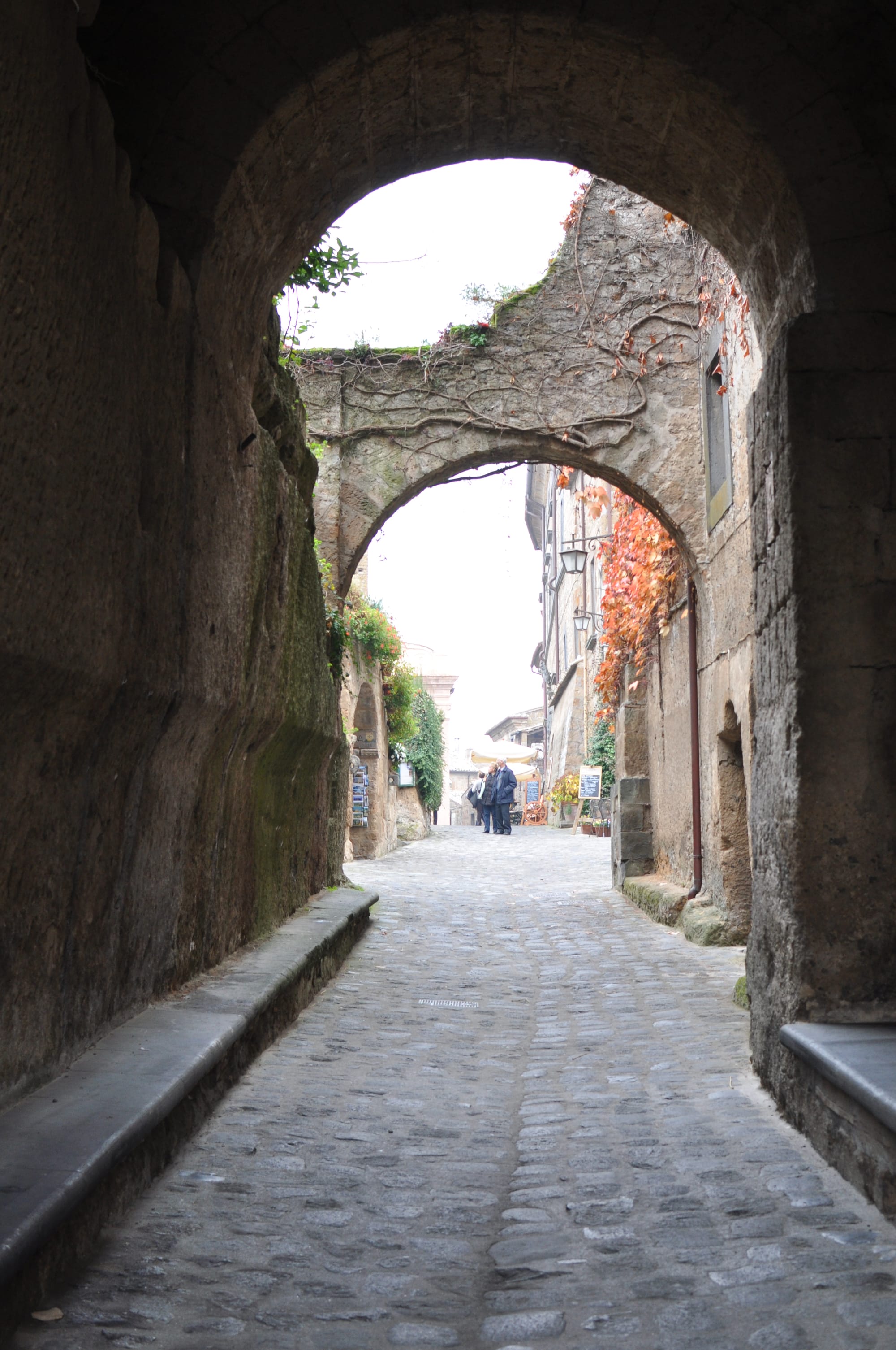
The current street layout is the result of an adaptive medieval fabric that developed above the voids of the Etruscan hypogea — a network continuously mutilated at its terminals by the peripheral collapses of the cliff. Not a rigid grid that survived intact, but an organic system that lost its margins over the centuries and reorganised itself around what remained. The streets of Civita do not tell the story of Etruscan planning — they tell the story of medieval resistance to erosion.
Beneath the village, in the tufa, the material traces of that presence remain: the small necropolis in the cliff below the San Francesco area, the cellars carved into the rock that were originally chamber tombs, and above all the Bucaione — a deep tunnel that passes through the base of the clay and tufa spur with an outlet onto the Valle dei Calanchi, probably originally an Etruscan water channel, later adapted as a secondary access to the village.
The cave of San Bonaventura — where tradition holds that Saint Francis visited and healed the young Giovanni Fidanza, who would become one of the greatest theologians of the Middle Ages — is in reality an Etruscan chamber tomb. The continuity of eras at Civita is material, not merely historical: tombs become caves, caves become places of worship, places of worship become tourist attractions. Same space, successive functions.
The Urban Fabric
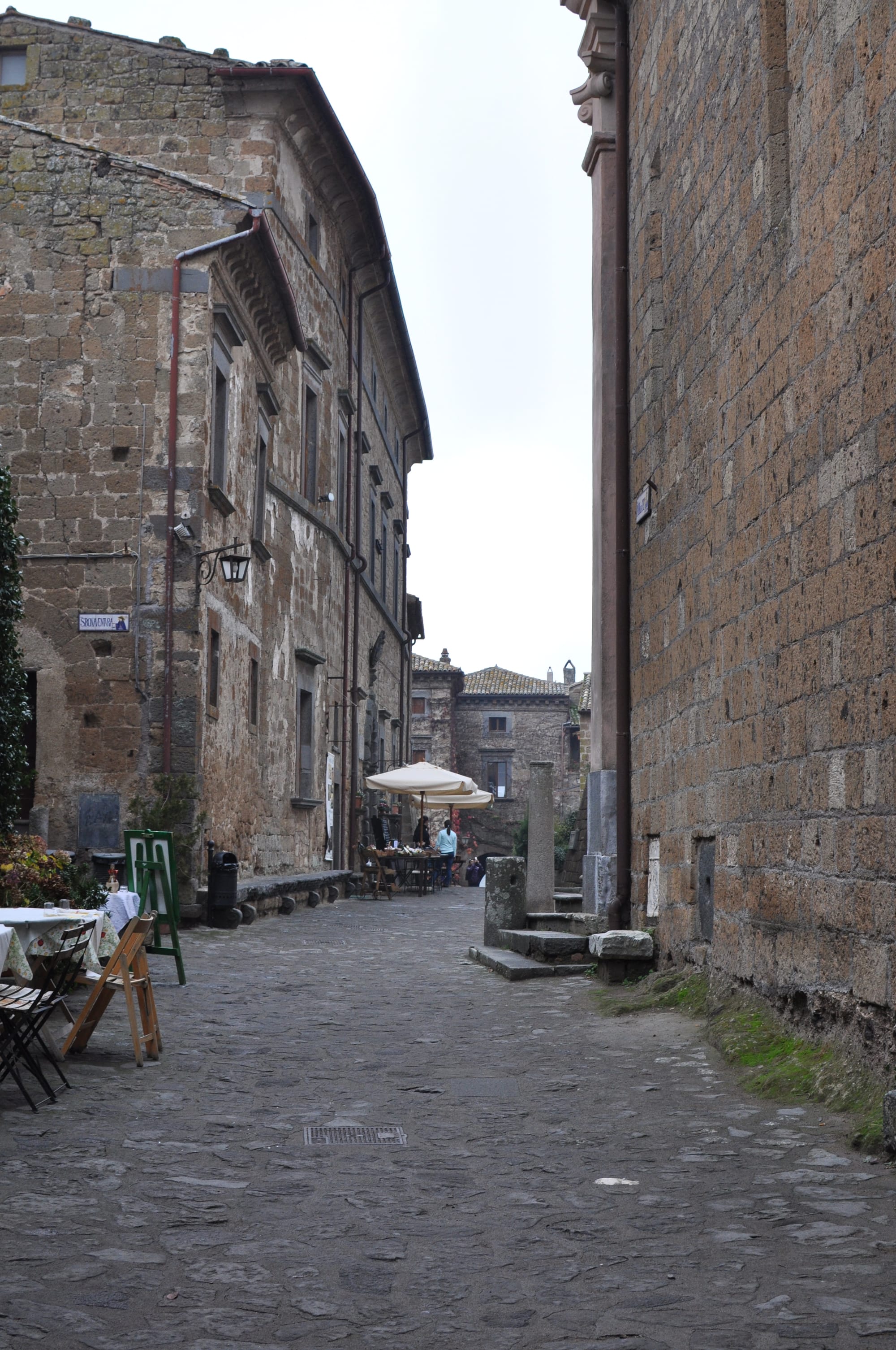
An architect entering Civita immediately notices the contradiction between the scale of the city and its historical density. It is a tiny village — the main piazza, the church, a handful of streets — but every element tells different centuries simultaneously.
The apparent geometric regularity perceptible at the centre of the village is the result of the Roman overlay and successive medieval regularisations around the piazza space. This area, though mutilated by landslides, has maintained its function as the barycentre of public space, where the few surviving street axes converge.
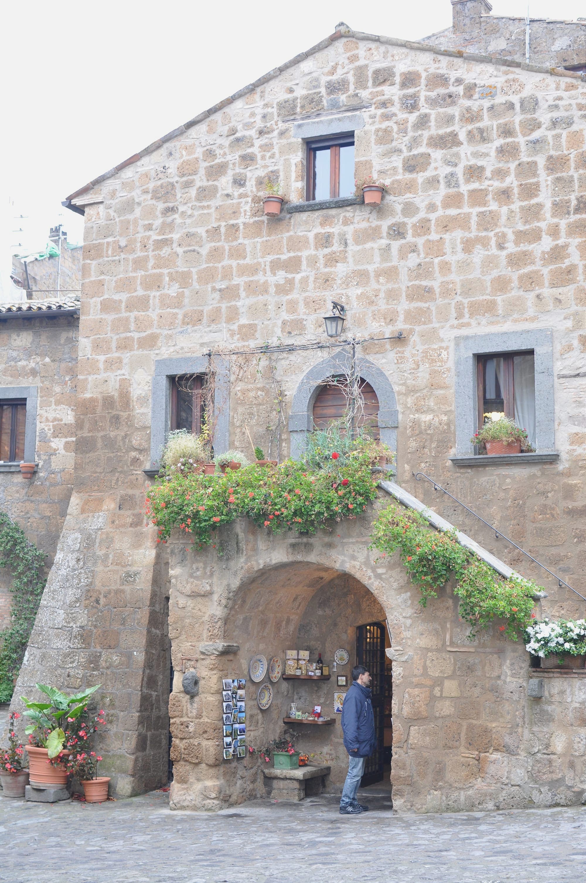
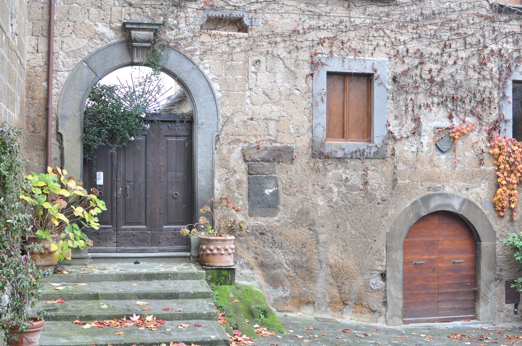
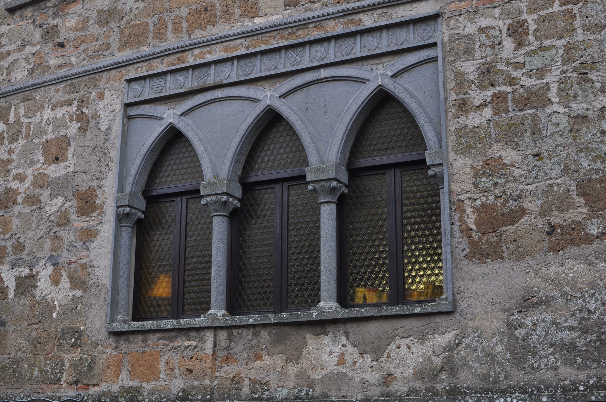
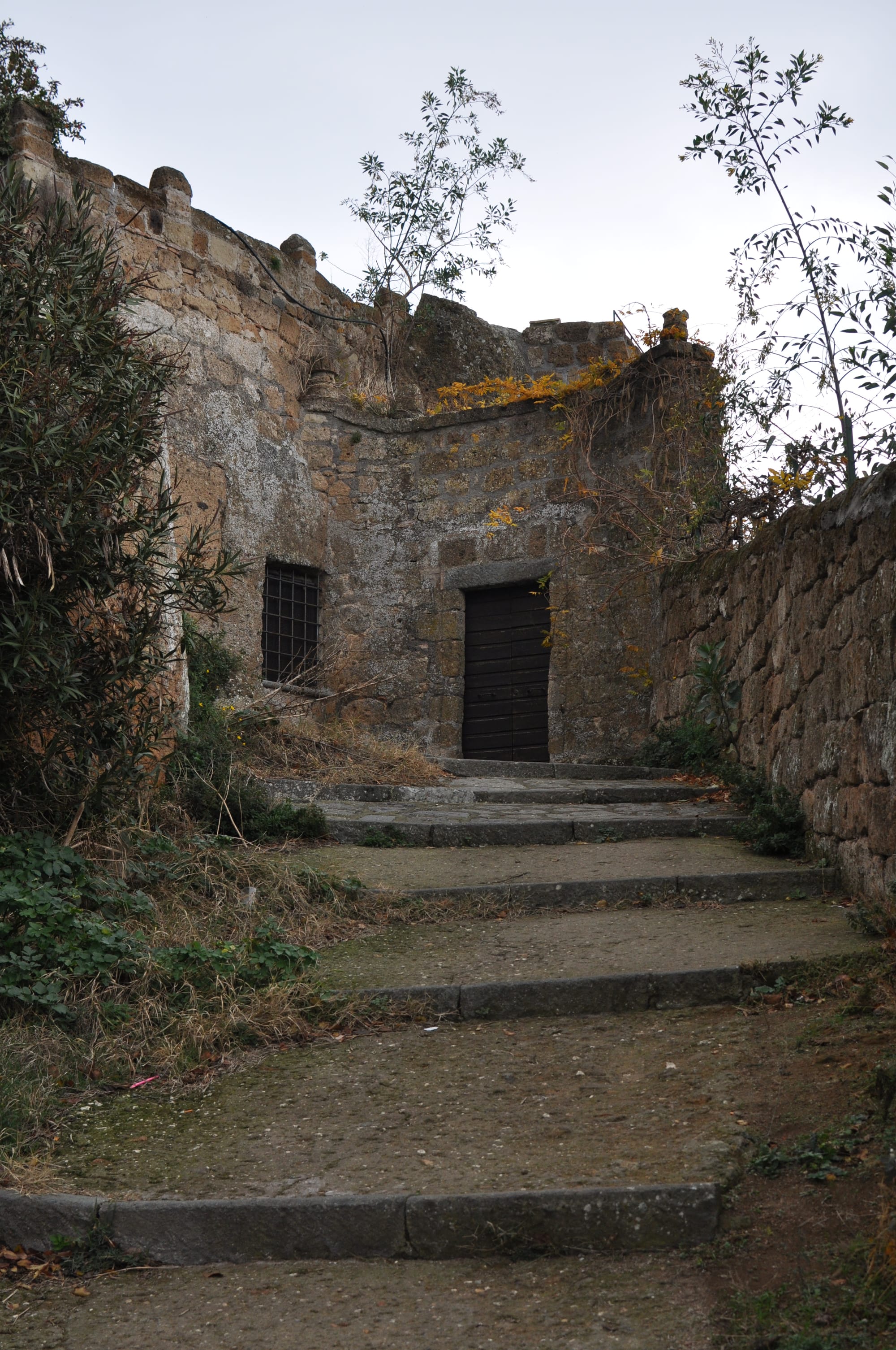
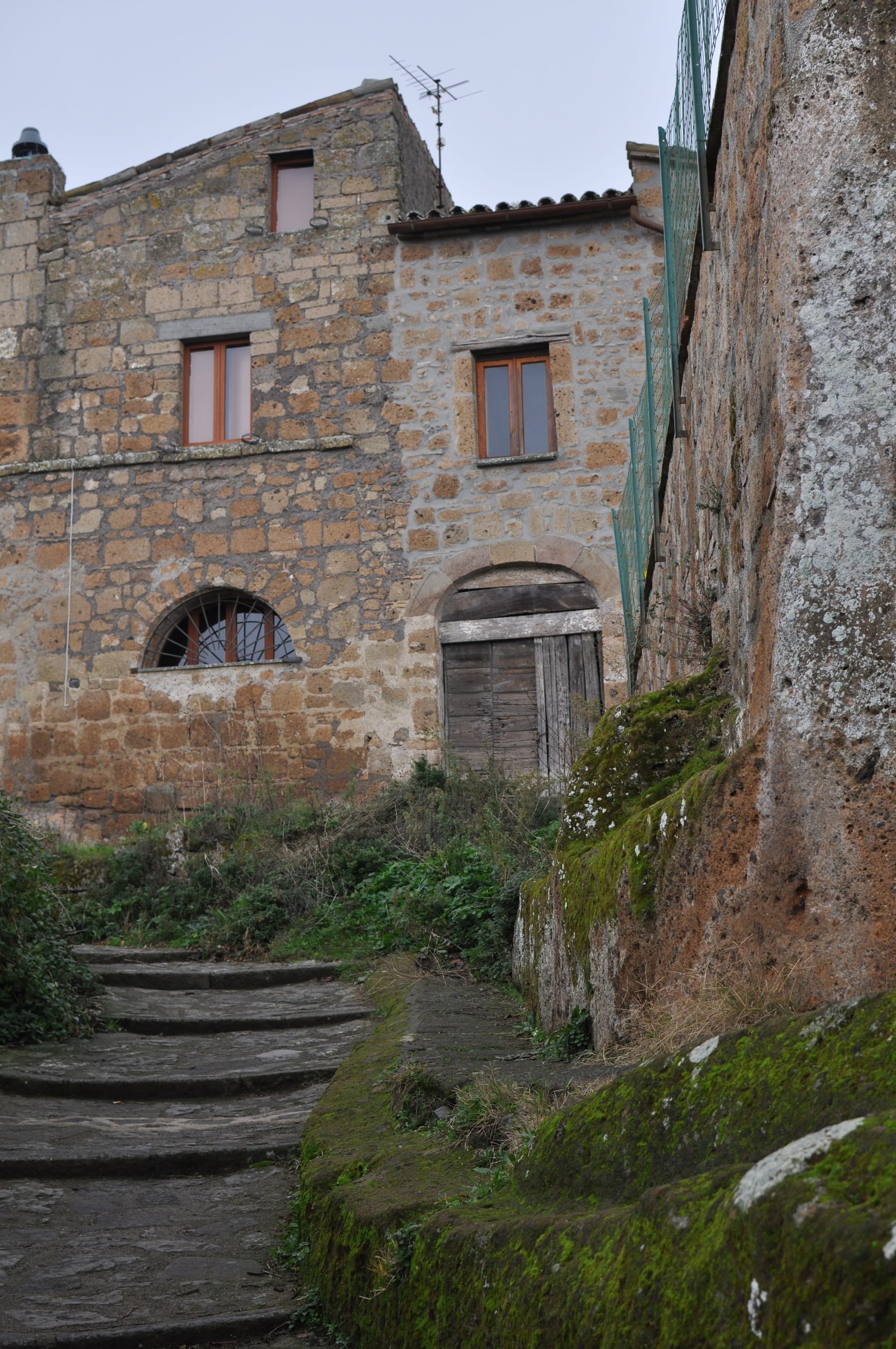
Above this structure, the Middle Ages built in tufa. The houses of Civita are mostly medieval and Renaissance constructions in peperino and local tufa blocks, with portals in black basalt recalling the Etruscan and Roman construction tradition. Some preserve loggias, double-arched windows, heraldic emblems. The most important palaces belonged to the families that alternated in control of the village — the Monaldeschi of Orvieto, against whom the inhabitants of Civita fought with sufficient ferocity to carve two lions clawing human heads above the Porta Santa Maria, as a monument to their victory of 1494.
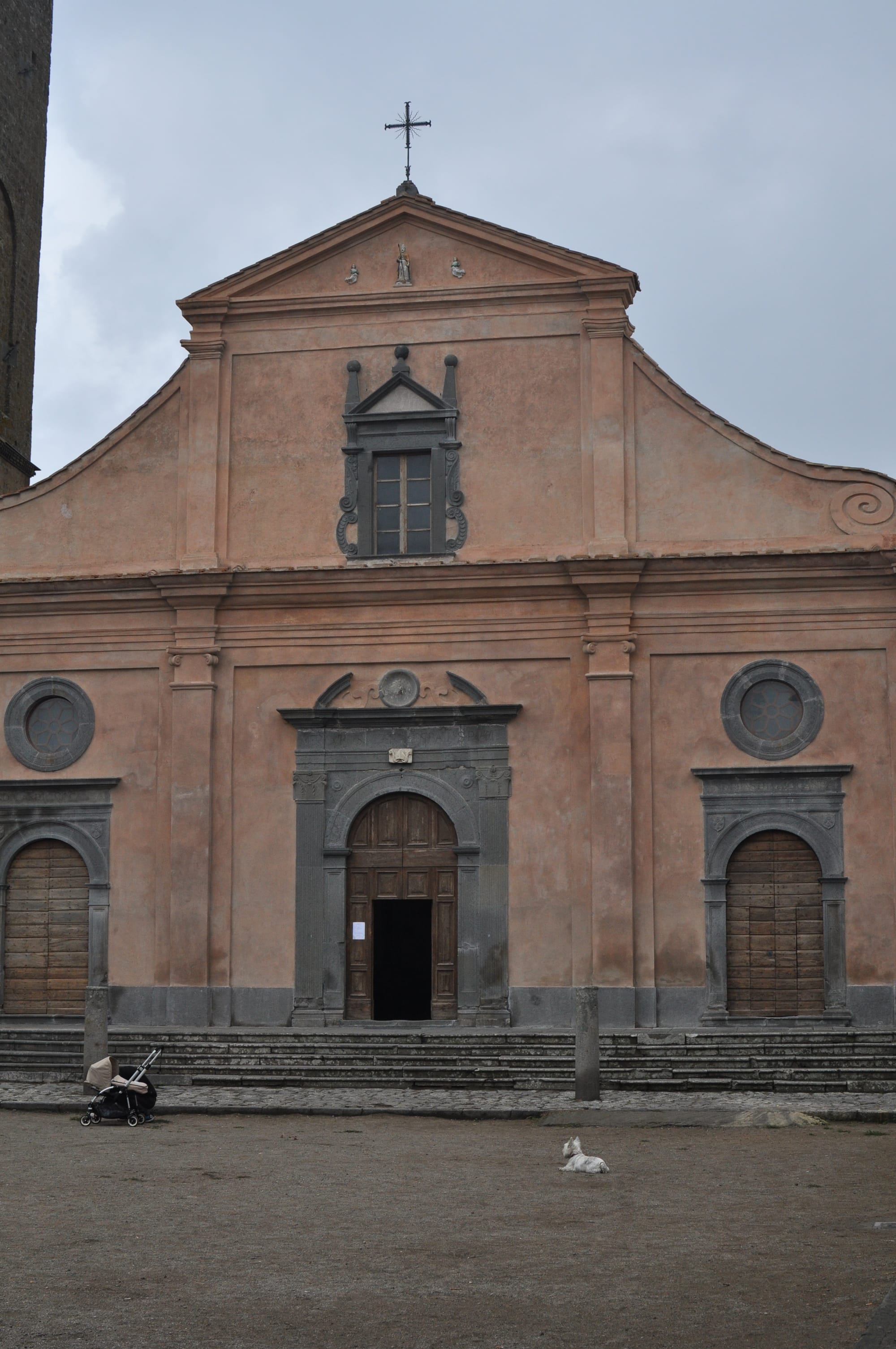
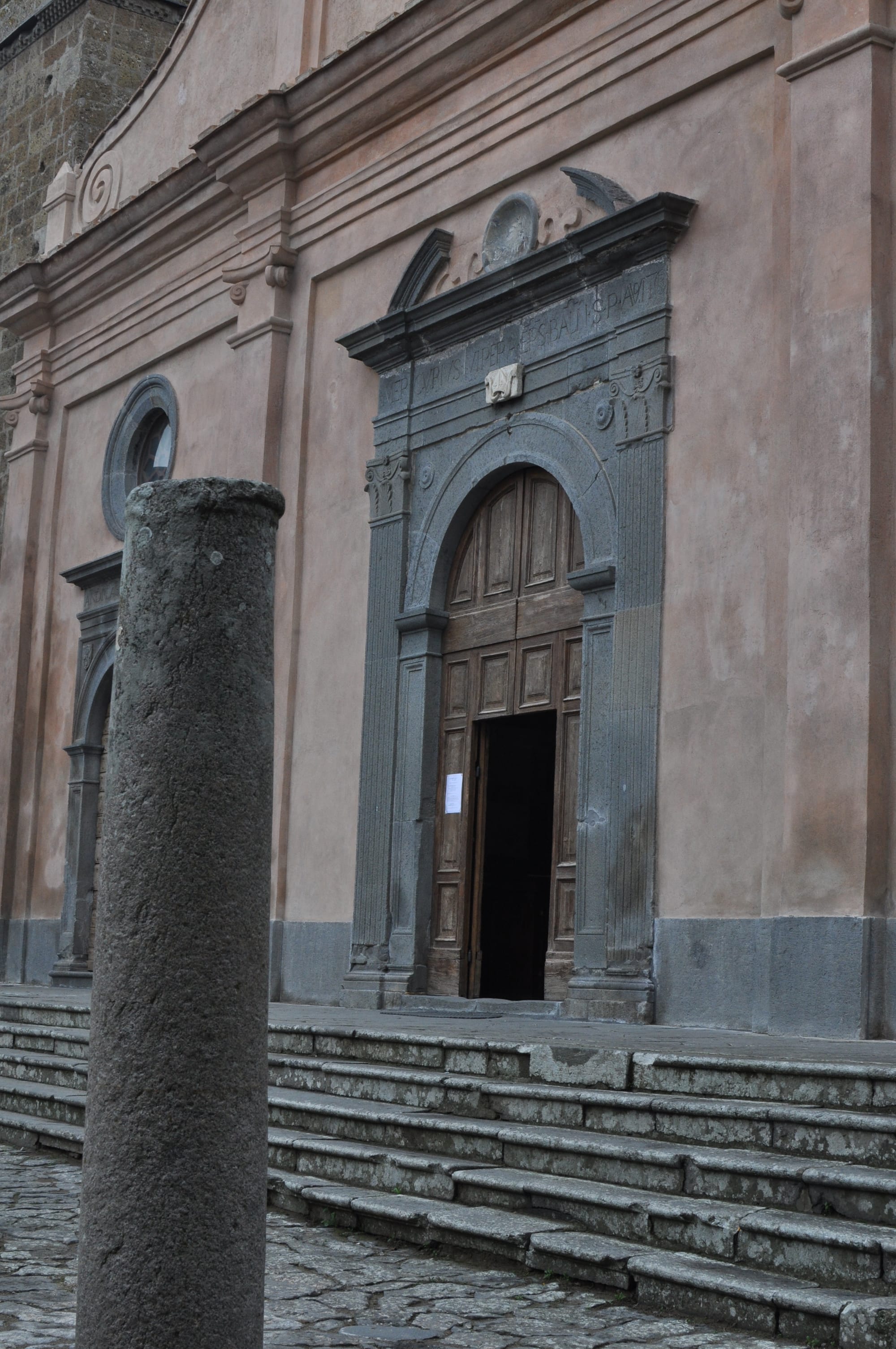
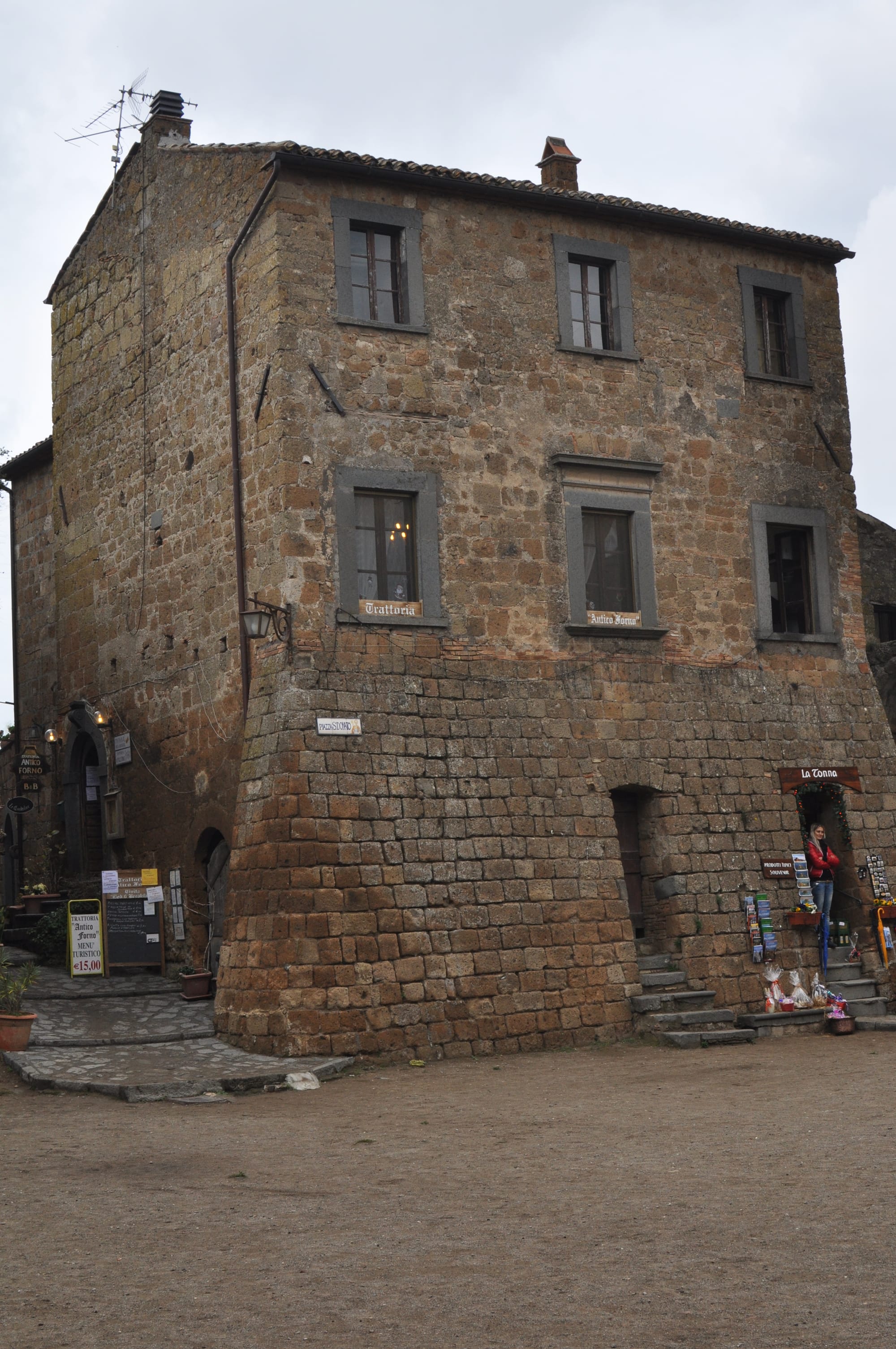
The church of San Donato occupies the centre of the main piazza — built in the fifth century, probably on a pre-existing Roman or pagan temple, later remodelled in Romanesque style and further modified in the Renaissance. The interior preserves a celebrated fifteenth-century wooden crucifix and some partially legible medieval frescoes in the apse, while the relics of the patron saint Bonaventura followed the transfer of the episcopal see to the new Bagnoregio after the earthquake of 1695. It is one of the most layered religious buildings in the Tuscia: five centuries of successive interventions on a palaeochristian plan above probable Roman foundations above Etruscan soil.
This superimposition — Etruscan, Roman, medieval, Renaissance — in a space of a few hundred square metres is what makes Civita unique. It is not a monument. It is a palimpsest.
The Earthquake That Split a City in Two
For centuries Civita was the mother city — the original nucleus on which the surrounding settlements depended. Bagnoregio did not exist as an autonomous entity: it was the Rota district, the village of farmers and labourers that orbited around the Civita of nobles and the bishop.
On 10 June 1695, at twenty past two in the morning, a violent earthquake struck the entire area. In the zone of maximum damage, corresponding to the diocese of Bagnoregio — inhabited by eleven thousand people — there were only a few dozen deaths. Not because the earthquake was mild — it was devastating — but because three hours earlier a strong foreshock had induced almost everyone to abandon their houses and sleep outside.
The earthquake opened the void that definitively separated Civita from Rota. The edge of the cliff gave way, creating the gap that is today crossed by the bridge. The city split — not metaphorically, physically: the western side of the village fell into the valley, the eastern side remained. That night Civita lost half its territory.
After the earthquake the episcopal see was transferred to Bagnoregio, with the construction of a new cathedral dedicated to San Nicola. The nobles followed the bishop. The merchants followed the nobles. Civita was left with the elderly, with those who lacked the strength to move, with those who had decided to die among the rubble rather than emigrate.
A second earthquake in 1794 completed the emptying. What had been the political, economic and religious centre of the entire area became a hamlet of a few souls in Bagnoregio — the daughter city that had surpassed the mother.
The name "the dying city" comes from the writer Bonaventura Tecchi, born in Bagnoregio in 1896, who used it for the first time in a text from the 1940s. It is not a geological diagnosis — it is a literary metaphor that became more successful than the reality it described.
The Architecture of Fragility
There is something that strikes you immediately when you enter Civita: the absence of anything that is not strictly necessary.
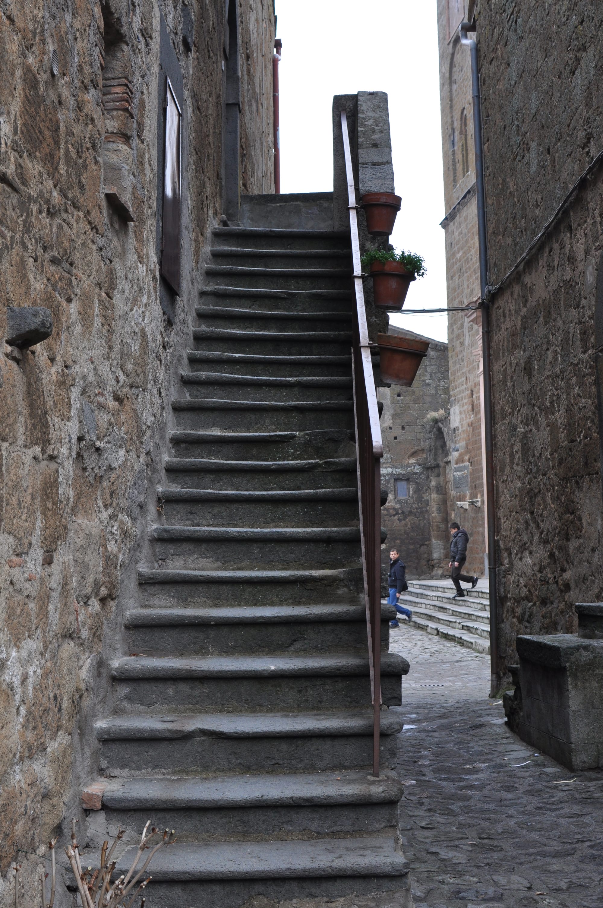
There are no wide streets — there are alleys. There are no open piazzas — there is a piazza. There are no tall buildings — everything is low, compact, pressed together. The city contracted on itself over the centuries, losing first the peripheral neighbourhoods to landslides, then the most vulnerable houses to earthquakes, then the abandoned palaces to the collapse of their perimeter walls. What remains is the hard core — what geology and history could not destroy.
This process of contraction produced, paradoxically, one of the densest and most coherent urban environments in the Tuscia. Every building still standing in Civita is standing because someone built it well, because the rock beneath held, because the walls were thick enough to resist the shocks. This is not random — it is Darwinian selection of architecture. The strong survive.
The cellars carved into the tufa are the most fascinating element from an architectural perspective. Every house has its own cellar below, carved directly into the rock, accessible from an internal staircase or a door in the alley. Many of these cellars are in reality adapted Etruscan tombs — funerary spaces transformed into storage spaces, then into shelters for livestock, then into wine cellars. The hypogean architecture of Civita is an archive of the place's history written in tufa.
The rock itself changes in appearance as you descend from the surface toward the bottom. Above it is compact tufa, yellowish, easy to work but resistant. Below, where the tufa meets the clay, it becomes darker, more friable, threaded with veins of moisture. That is where the city crumbles — at the boundary between the two materials, where their different responses to weathering create tensions that no wall can absorb.
The Bridge — and the Question We Don't Ask
The pedestrian bridge connecting Bagnoregio to Civita was built in 1965 in reinforced concrete, replacing the temporary walkways erected after the destruction of the old masonry bridge from the 1920s, blown up by the retreating German army in 1944. Those temporary walkways — in wood and metal — were continuously swept away by cliff collapses. The 1965 bridge was the first stable connection after twenty years of intermittent isolation. It is three hundred metres long, wide enough for two people side by side, and the only means of access to the village.
Walking the bridge is already an architectural experience. The wind comes up from the valley with a force that always surprises. The landscape on either side — the calanchi, the clay eroded into ridges and gullies, the colours that change with the light — is one of the most unusual in central Italy. And at the far end, Porta Santa Maria with its stone lions: the first built element you encounter, Etruscan in its structure, medieval in its iconography.
But the bridge poses a question nobody asks explicitly: what are we preserving?
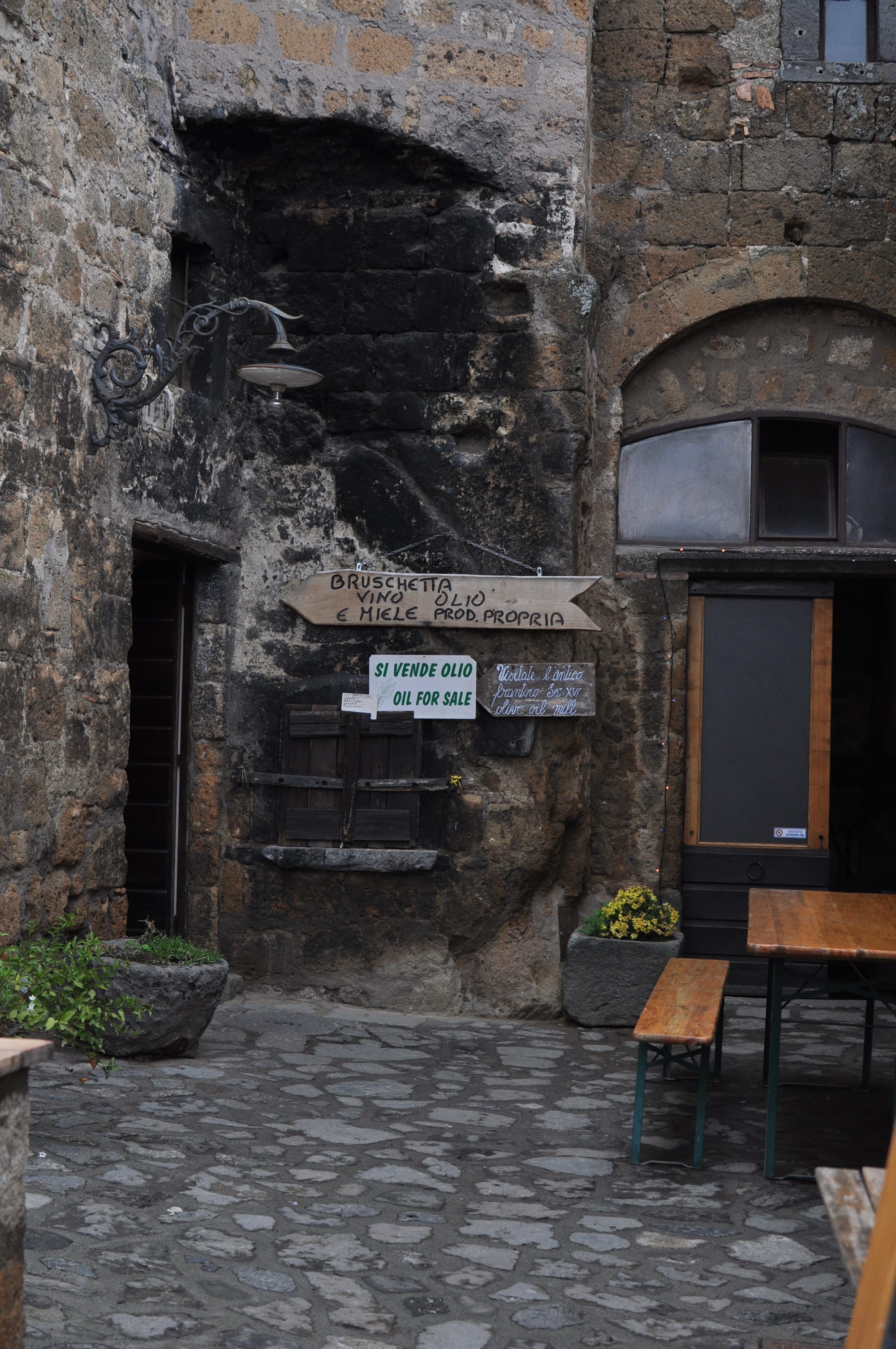
Civita is permanently inhabited by fewer than ten people. In summer the holiday homeowners arrive, a few agriturismi, the restaurant staff. In winter a handful of elderly residents remain. The village functions as an open-air museum — you pay an entrance ticket, walk the streets, buy souvenirs, return to the car park.
This transformation into a tourist product has physically saved Civita — the ticket revenue funds the cliff consolidation works — but it has also completed the process that the 1695 earthquake began: the emptying of urban life. Civita is preserved but not lived. Restored but not inhabited. Beautiful and empty.
The question is not whether it was worth saving. It was. The question is: what does it mean to preserve a city without preserving its inhabitants?
The Paradox of Salvation
There is a brutal irony in the recent history of Civita. The city was disappearing — through abandonment, erosion, lack of resources. Tourism saved it. And tourism is destroying it.
Not physically — the weight of visitors does not erode tufa faster than rain. But socially: Civita today is a stage set, not a city. Visitors arrive by the thousand each summer day, cross the bridge, photograph the houses, eat at the trattoria in the piazza, leave. The permanent residents have become custodians of a museum. The houses have become holiday rentals for foreigners seeking "the authentic Italian experience" in a village that ceased to be authentic the moment it became a destination.
This is the paradox of conservation: to save a city you must transform it into something that is no longer a city.
I have no solution. Nobody does — not the municipality of Bagnoregio, not the FAI which has included Civita among its places of the heart, not the architects who designed the consolidation works. The erosion continues at seven centimetres per year. The bridge is rebuilt every ten years. The entrance ticket increases. The residents decrease.
What I can say is that Civita, seen under the leaden sky I described at the opening, with the wind cutting across the valley and the calanchi dissolving into the grey horizon, is one of the most honest places in Italy. It does not lie about its condition. It does not hide its fragility under fresh plaster. It shows exactly what it is: a beautiful city that is disappearing, that knows it is disappearing, and that has decided to do so with dignity.
What to See in the Village
The village is small — you can visit it in an hour and a half, two hours at a leisurely pace. But the density of historical layers per square metre is among the highest in the Tuscia.
Porta Santa Maria — the only one of the original five gates still standing. The arch is Etruscan in structure, medieval in its modifications. The two stone lions clawing human heads on the lintel commemorate the 1494 victory over the Monaldeschi of Orvieto — a monument to the rivalry between neighbouring cities that in the Middle Ages was a matter of life and death.
The church of San Donato — at the centre of the piazza, built in the fifth century on probable Roman foundations. The Romanesque structure of the original building is visible in the columns and arches. The interior preserves a celebrated fifteenth-century wooden crucifix and some partially legible medieval frescoes in the apse. The relics of San Bonaventura are at the Concathedral of San Nicola in Bagnoregio — where they were transferred with the episcopal see after the 1695 earthquake.
The Bucaione — the Etruscan tunnel in the rock that descends toward the Valle dei Calanchi. Dark, cool, narrow, silent. Walk to the end and turn around: you see Civita from above through the opening of the tunnel, framed by the rock. It is one of the most unusual views in the village.
The cellars — some are open to the public, some private. The open ones show the geology-history sequence: bare rock at the bottom, worked tufa on the walls, medieval amphorae, wine presses. Every cellar is a vertical core sample through the history of the place.
The belvedere over the Valle dei Calanchi — on the north side of the village, beyond the church. The view is the one that justifies everything else: the calanchi dissolving toward the Tiber, the clay ridges eroded into forms that seem drawn, and the silence — real silence, not the silence of a historic town but the silence of an ancient landscape.
The Landscape as Architecture
One thing travel blogs never say about Civita: the village is the least interesting part of the place.
The landscape around it is what stays. The calanchi of the Valle dei Calanchi are geological formations of an alien beauty: clay ridges eroded by water into pinnacles, gullies, natural amphitheatres that change shape with the light and the season. In spring they are green at the edges and grey at the centre. In summer they turn almost white under the sun. In autumn they take on ochre and rust. Under the grey and heavy sky — that leaden sky that gives the valley an almost lunar quality — they become something difficult to communicate in words.
The calanchi landscape is a geological landscape — formed by processes that have nothing to do with human beings and that continue indifferent to human presence. It is one of the few places in Italy where you feel clearly that nature does not need us to carry on.
This is the ultimate contrast of Civita: the human being who builds on terrain that does not want to be built on, who insists on making a city where geology has decided there will be no city, who crosses a bridge every morning to reach a place that is crumbling underfoot. And the landscape around, indifferent, continuing its ten-thousand-year work.
The City That Cinema Cannot Stop Filming
There is something in Civita that directors understand immediately and that is difficult to explain in words: the place already looks like a film set. Not because it is fake — the opposite — but because its reality is so intense, so free of contemporary elements, so suspended in an unidentifiable time, that the camera finds it already ready.
The first to understand this was Federico Fellini. In 1954, for La Strada — the film that would win the Silver Lion at Venice and the Oscar for Best Foreign Film in 1956 — he chose Bagnoregio as the main location, thanks to his production manager Luigi Giacosi, a local. What Fellini was looking for was a poor, rural Italy, suspended between the postwar period and a future that wouldn't arrive — and he found it here, in the Tuscia countryside, in the tufa streets, in the faces of the inhabitants. The landscape of Bagnoregio and Civita is not a backdrop — it is a character.
In the 1960s came Totò. In I due colonnelli (1962) directed by Steno, Civita becomes a Macedonian village — its medieval timelessness works as a set for any poor Mediterranean town. In 1970 Alberto Sordi filmed La contestazione generale by Luigi Comencini here.
But the most extraordinary relationship between Civita and cinema is with a director who never came here.
Hayao Miyazaki, the master of Japanese animation, drew on the isolated structure of Civita di Bagnoregio to shape the early drafts of Laputa: Castle in the Sky (1986), the masterpiece in which a floating city suspended in the void severs its connections with the mainland. The correspondence is not formally documented — no interview, no production note from Miyazaki himself confirms it — but it is a claim repeated so consistently across decades of Italian and Japanese commentary that it has become accepted fact. What is documented is Miyazaki's 1984 trip to Wales, which shaped the mining architecture of the film explicitly. Civita remains, at most, an unconfirmed visual echo — though one persuasive enough that thousands of Japanese visitors make the pilgrimage every year.
More recently, Alice Rohrwacher filmed the entire first part of Lazzaro felice (2018) here — the film that won the Palme d'Or for Best Screenplay at Cannes. The village of Civita and the hamlet of Vetriolo become, in Rohrwacher's universe, a world outside of time, separated from modernity as if by an invisible barrier. The director said she chose this place because "time here behaves differently from other places." This is not a metaphor. It is a precise technical description of what happens when you walk through the streets of Civita — the sensation that the present is elsewhere, and that here you are visiting something irrecoverable.
San Bonaventura and the Etruscan Cave
Civita gave birth, in 1221, to Giovanni Fidanza — who would become Saint Bonaventura, one of the greatest theologians of the Middle Ages and a Doctor of the Church. Minister General of the Franciscans, philosopher, theologian, cardinal. He is the patron of Bagnoregio.
Legend holds that the young Giovanni, still a child, was gravely ill and that Saint Francis himself visited and healed him, exclaiming "O buona ventura!" — from which the name. The cave where the miracle occurred is still visitable in Civita.
But the cave, like almost everything in Civita, tells more than one story. It is in reality an Etruscan chamber tomb — a funerary space two thousand five hundred years old, transformed into a Christian place of worship in the Middle Ages, then associated with the Franciscan miracle, then become a pilgrimage destination for the devotees of San Bonaventura. Same rock, four different eras.
There is something profoundly civitano in this stratification: a space born for death becomes a place of miracle and life. It is the same logic that governs the entire village — continuity not as conservation but as perpetual transformation of the same material.
Bonaventura Tecchi and the Name That Changed Everything
The name "the dying city" does not come from a geologist or an urban planner. It comes from a writer.
Bonaventura Tecchi was born in Bagnoregio in 1896. He was a novelist, Germanist, translator of Goethe and Thomas Mann, university professor, president of the National Academy of Dramatic Art. In 1948 he published a text in which he used for the first time the expression "la città che muore" — the dying city — referring to Civita. The expression was taken up by a 1950 documentary by director Marino Girolami, which carried the name beyond local boundaries. From that moment Civita was no longer just a village in the Tuscia — it was a condition, a symbol, a metaphor for the fragility of everything beautiful.
The name did more for Civita than any tourism campaign. It transformed a geological problem into an existential theme. It made the village interesting not despite its imminent disappearance, but precisely because of it. Mortality became its main attraction.
There is something paradoxical in this: Tecchi saved Civita by giving it a name that announced its end. The dying city does not die — it survives thanks to the fact that it is dying.
Before You Leave
Civita is best in the early morning, before the tourist flow fills the bridge. Or out of season — in November, in February, when the village is almost deserted and the Valle dei Calanchi is wrapped in fog.
One thing no guide ever says: Civita is completely pedestrian. No cars, no mopeds, no traffic of any kind. Children can run freely through the alleys, explore the portals, lean over the belvedere railings, disappear around a corner and find themselves alone in a medieval alley without anyone needing to worry. It is one of the few places in Italy where parents can look at the architecture while children look at the world — and both are doing exactly the right thing.
The calanchi trail from the valley is one of the least frequented and most beautiful walks in the entire Tuscia. You descend from Bagnoregio toward the valley floor, walk between the clay ridges, and climb back up toward Civita from below. Approximately two hours, low difficulty, extraordinary landscape. You see the cliff from below — the only perspective that truly shows how high it is and how narrow the base on which it rests.
Bagnoregio — the modern town on the hill — deserves twenty minutes. The historic centre of Rota, which became Bagnoregio after the 1695 earthquake, is an intact medieval village almost ignored by visitors who come only for Civita. The cathedral of San Nicola, the main piazza, the narrow streets — everything Civita was before it emptied.
Practical Notes
Getting there: By car from Rome approximately 1 hour 30 minutes on the A1 toward Florence, exit Orvieto, then approximately 30 minutes toward Bagnoregio. No practical direct rail connection.
Parking: In Bagnoregio, in the signposted car parks near the bridge. Entrance ticket to Civita: €5 adults (may vary by season — verify).
The bridge: 300 metres on foot, not suitable for pushchairs or those with significant mobility difficulties. The wind can be strong — keep your hands free.
When to go: Avoid spring and summer weekends, when the visitor flow makes the experience difficult. Weekdays in September and October are ideal. Winter is beautiful and almost solitary.
The calanchi trail: Departs from Bagnoregio toward the valley. Signage present but not always updated. Comfortable shoes, water. Not suitable after heavy rain — the clay becomes slippery.